


Acadiana's first shot of some real fall temperatures are on the way for later this week.

In the near term, expect near seasonable lows mostly in the mid-upper 50s tonight under fair skies accompanied by possibly some patchy fog toward daybreak, with sunshine and temperatures rebounding into the lower 80s tomorrow.

Acadiana's strong front arrives after dark Tuesday evening with scattered showers and a few thunderstorms possible (at 70%). No severe weather is expected.

Do not expect much rainfall but a few spots may pick up an additional 1/4-1/2" of rain or less.

Rains end around midnight, followed by breezy and sharply cooler cooler conditions Tuesday night into Wednesday.

The chilliest of temperatures arrive Wednesday and Thursday with lows dropping into the 40s and highs barely making the mid-60s!
See the KATC 10 Day Forecast for the latest.
It looks to stay dry with some slight moderation in temperatures, but remaining seasonably cool into all of next week...we've been waiting months for this!
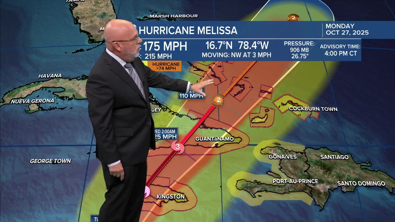
Meanwhile in the tropics, it's all about Major Hurricane and Category 5 Hurricane Melissa which is poised to bring catastrophic conditions to Jamaica and then on to the northeast with time.
Here's the latest as of 4pm Monday:
