


After another pleasant morning in Acadiana Tuesday, look for temperatures to get back closer to the lower 90s for the afternoon, and mid-90s later this week.

Lows Tuesday morning will range from the upper 50s for our northern parishes and the lower 60s to the south. The coolest since the first couple of weeks of May!
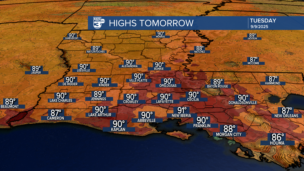
Plenty of sun brings our temperatures back toward the lower 90s for Tuesday afternoon.
Our high resolution models this afternoon we're showing a low end chance for isolated showers toward Eastern Louisiana Tuesday afternoon, with the very slight chance of one or two of those
showers drifting westward for late in the day...rain chance locally will be 10-20% or less, and favors mostly St Martin, Iberia and St Mary parishes.

It won't be nearly as refreshing, but still nice for Tuesday night into Wednesday morning with lows some 6-9° milder than the previous day.

Thereafter, and at least through the next 7-9 days, it looks hot and dry for the area with highs pushing well into the mid-90s, minimal rain chances are anticipated, but fortunately with humidity that stays mostly in check courtesy of persistent northeasterly surface winds.
See the KATC 10 Day forecast for the latest.
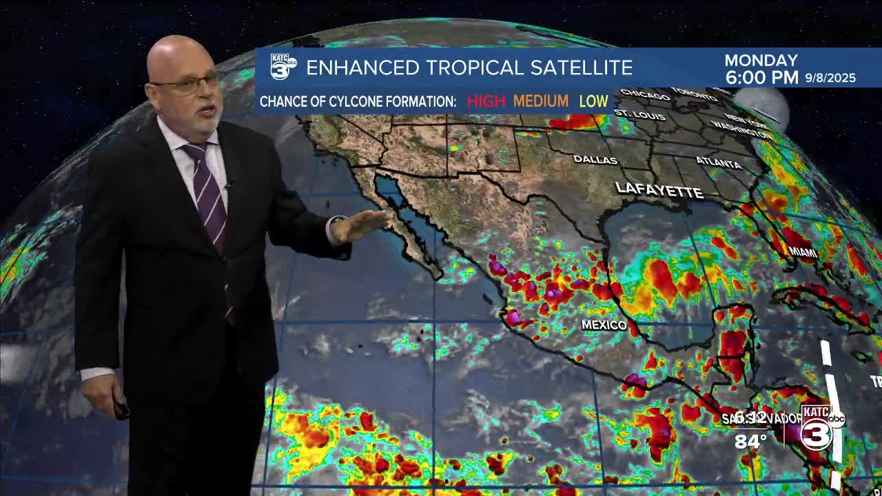
Meanwhile, in the peak week of the Atlantic hurricane season, there are currently no suspect areas for the next week!

See the full Atlantic tropical update and the latest on Hurricane Kiko near Hawaii below:
