


A weak cold front will cross the region early this morning with a few showers. Temperatures ahead of the front are fairly mild, with morning temperatures in the 50s. Skies will gradually clear today as the front moves eastward.

Expect mostly sunny skies by the afternoon. Depending on how long we get the sun, will be the end result in our high temperatures. Right now, it looks like low to mid 60s will be a good bet. A jacket will still be needed though, as winds will be picking up out of the northwest up to 20mph.

High pressure will build in behind the front. Fortunately, the air mass behind this from is of Pacific origin, so we're not expecting frigid temperatures like we did last week. But, as winds calm down during the overnight hours, temperatures will be allowed to fall below normal.

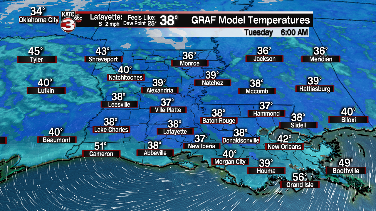
In late February, we should be in the low to mid 40s at night, but we can expect mid to upper 30s as we roll into Tuesday morning.
Sunny skies are expected to return for Tuesday. The February sun is surprisingly strong as the angle has been higher, and the length of day longer. Most areas will be able to rebound back into the upper 60s by Tuesday afternoon. More sunshine is expected Wednesday. Highs will hover near 70 degrees. The return flow will set up by Thursday with another chance for showers. A front is expected to stall late in the week, keeping on and off rain chances into the weekend.
