


Acadiana will see it's coolest temperatures of the fall season Monday morning, but readings will slowly moderate as the week wears on.
Look for Monday morning lows to drop into the mid-upper 30s north of the I-10 Parishes to lower 40s most everywhere else, except on the immediate coast.

Most, if not all of Acadiana looks to stay above the frost zone for this one.

Typically Acadiana's first frost comes in the mid-latter part of November and/or early December depending on your local latitude below:

Temperatures look to gradually warm up later this week with plenty of sun and likely no clouds through Tuesday.
Mostly sunny to partly cloudy skies with highs in the upper 70s are expected later this week, with daytime highs pushing back into the 80s Saturday ahead of our next front that arrives Sunday.

See the KATC 10 Day Forecast for the latest.

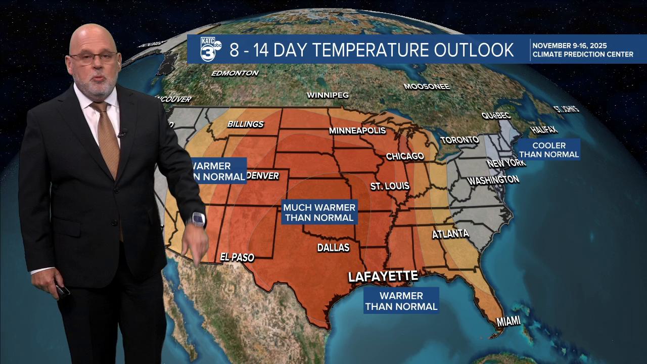
Meanwhile, the extended outlook per the Climate Prediction Center calls for mostly above normal temperatures for the Gulf South, with no signals either way for precipitation.

The precipitation outlook could mask a rather dry pattern going into and at the beginning of the 8-14 day outlook, but there might be a spell of wetter weather at the end of that 14 day outlook...ie in two weekends...but that certainly could change.

Finally with the time change, sunset times are now in the latter part of the afternoon and at 5:20pm for Sunday and Monday!
