


A chill start to Acadiana as forecast yesterday with a nice and steady NE flow of cold air staying in the region, reinforcing those chilly temperatures. You'll want to have a nice jacket as you walk out of the door this morning.

With that directional component of the wind the National Weather Service reissued a Low Water Advisory with levels so low they cite that there may be possible hazardous navigation for marine interests in these areas.

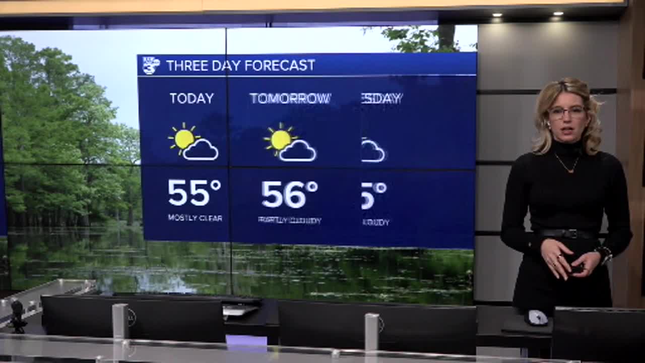
As for what you can expect for the rest of your Monday, other than the below average tempatures, the weather remains calm and mild. We keep some cloud cover, but the mostly sunny skies will allow us to warm up to the mid-to-upper 50s for our afternoon high with winds remaining mild as well.
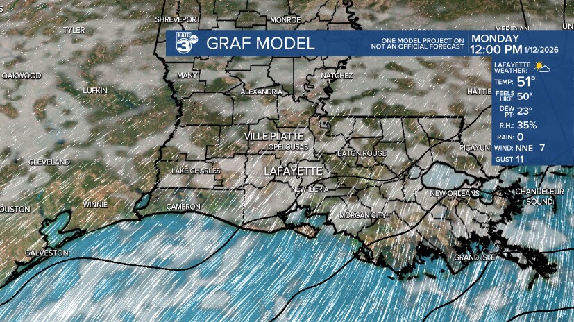
The GRAF is alleging some showers near Cameron Parish tomorrow, but we shouldn't see much, if any, even sprinkles in area. The GRAF model has been interesting lately, but I do believe the idea of increased cloud coverage is believable as we warm up much more into Wednesday ahead of a dry cold front Wednesday evening.

Here is what you can expect as we head through the beginning half of the work week.

Temperatures will begin to drop towards the end of the week as cooler than average temperatures are reinforced by Wednesday evenings dry cold front.
