


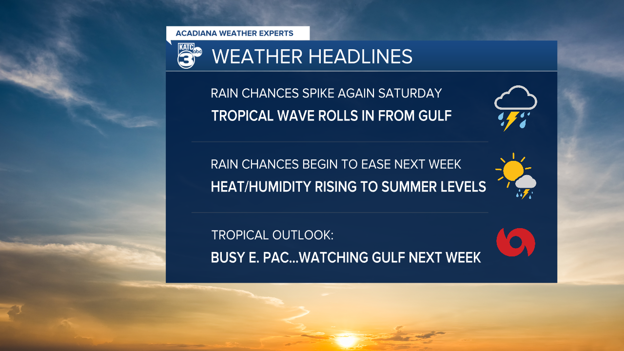
While the chance of showers and thunderstorms will ease a little for Acadiana's Friday, it will likely peak again Saturday thanks to an approaching tropical wave.
In the near term, look for shower and thunderstorm activity to diminish a little sooner this evening as compared with the last couple of days...lows will be near a cooler 70°.
Friday will bring some partly sunny skies and warmer temperatures along with the chance of scattered afternoon showers and a few thunderstorms, but rain chances should be lower, in the 40-50% range.
Temperatures Friday will top out in the mid-upper 80s with the requisite humidity making it feel hotter.
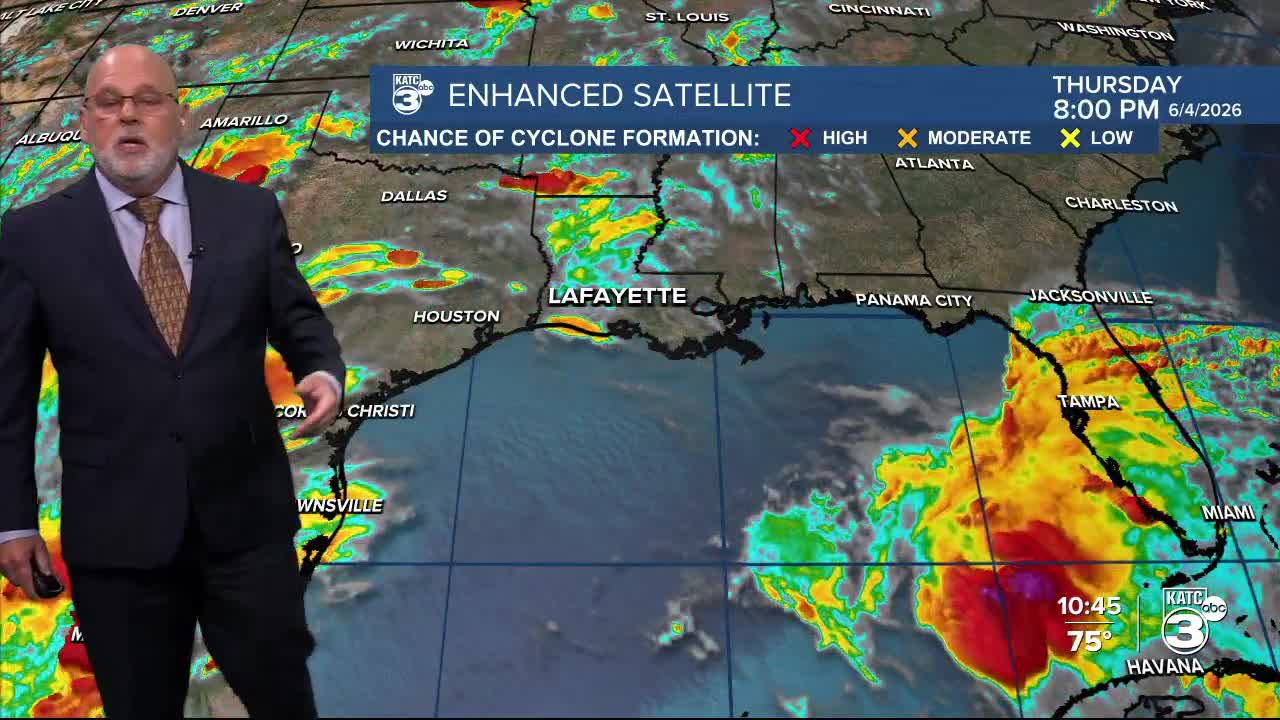
By Saturday, a very weak low currently in the Gulf will become an open tropical wave/trough and will be moving into Southern Louisiana.

This system will likely lead to a spike in our rain chances, with the risk of locally heavy tropical downpours possible...but whether those downpours manifest in Acadiana or farther to the east, is yet to be determined.

Thereafter, rain chances may start to ease beginning Sunday, but even more so into next week, when rain chances should drop to the 20-40% range.
That means next week will be hotter with highs near 90° while heat index values may start to push the lower 100s...it's that time of year.
And speaking of that time of year, the medium range Euro deterministic model has been trending toward developing some sort of tropical system in the Gulf toward the end of next week into the following weekend.

So far it's a mixed signal on whether something may actually develop in the Eastern Pacific emanating from the Central American Gyre (CAG) where it's already active, or the CAG slings something into the Gulf.
It remains too early to assess, but at this time a depression/lower end tropical storm may be possible...we'll monitor the trends over the next several days.
Some sort of Louisiana impacts may also be possible, but no worries for now as more than a week out is an eternity for any kind of weather specifics...and model forecasts will change.
Meanwhile, see the KATC 10 Day Forecast and Power Doppler 3 page for the latest.
