


Breezy and warmer conditions are expected for Acadiana in the days ahead, with some showers and a few storms possible with a weak frontal trough that arrives late Thursday night.

In the near term, with high pressure to our southeast and low pressure troughing in the Plains States will translate to breezy southerly winds overnight resulting in milder temperatures holding in the low-mid 50s through daybreak Wednesday.
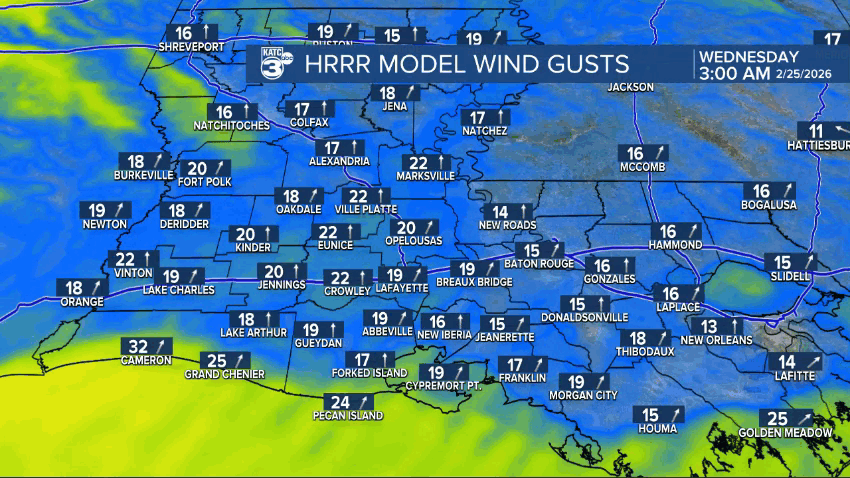
A Wind Advisory is in effect for Acadiana Wednesday as southwesterly winds increase to 15-25 mph with gusts reaching as high as 30-35 mph.
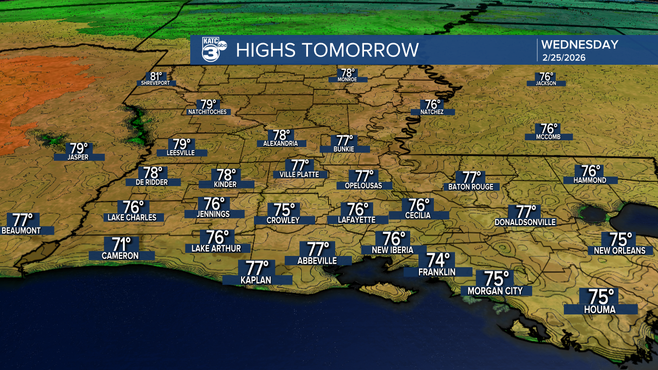
Temperatures will soar into the mid-70s under partly to at times mostly cloudy skies.

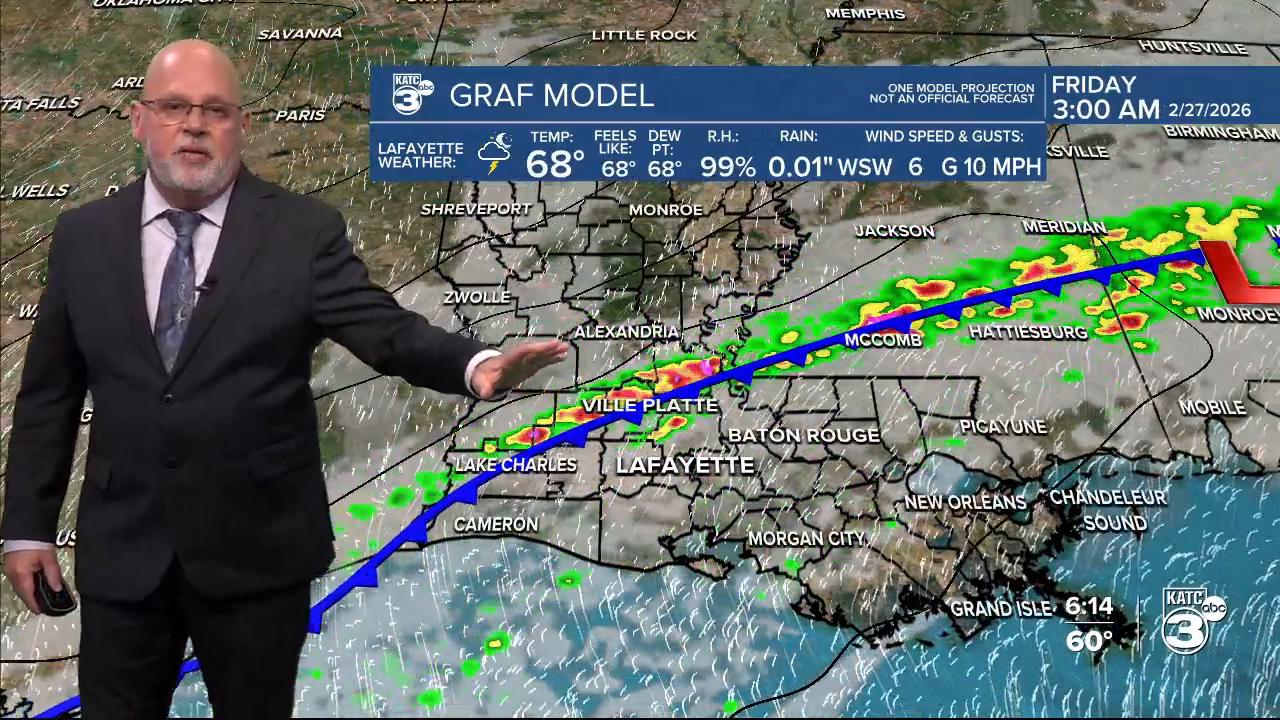
More of the same is expected into Thursday but a weakening frontal trough is expected to traverse the region during the pre-dawn hour Friday which should result in a 60% chance of scattered showers and non-severe thunderstorms. Rain totals look to be near 1/4 to 1/2" or less.
Temperatures behind the frontal trough will not change much with spring-like conditions likely into the first days of Meteorological Spring, which starts March 1st.

The next weather-maker could bring more substantial rain chances toward the end of next week...see the KATC 10 Day Forecast for the latest.
