

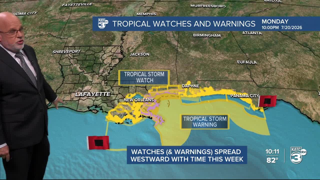


Acadiana will see it's hottest temperatures so far this summer in the next couple of days, while we continue to monitor a struggling tropical system that will skirt our coast Wednesday into Thursday with what now appears to be with minimal impacts on our area.

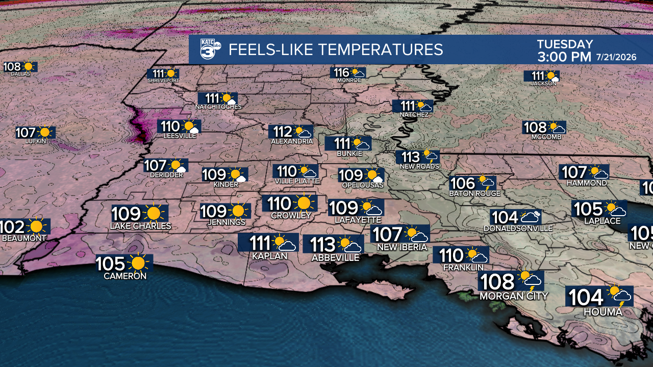
In the near term, a Heat Advisory is in effect for Tuesday for highs in the mid-upper 90s accompanied by heat Index values near 108°-112°, and it could be even hotter Wednesday with heat index values reaching near 115°!
Of course we continue to watch Tropical Depression #2 which as of Tuesday afternoon still struggling with upper shear and some dry air entrainment.

The latest NHC Forecast guidance has indicated much the same, and have limited the potential maximum intensity down to a mid-range tropical storm in the 45-50 mph range.

TD #2 is still expected to become Tropical Storm Bertha by Tuesday impacting Eastern Louisiana with mostly some wind and elevated tides Wednesday.
While the system moves westward near the Louisiana Coast into Thursday it will be fighting dry, dusty high pressure to the north and increased upper wind shear from the northeast.

This will result in a weakening, lop-sided storm/depression with most of the big rains and squalls staying on the south side of the circulation and well offshore as it passes by.

A few scattered showers and storms will be possible inland across Acadiana in the days ahead, but rain chances will be 20-40% range at most through Friday.
Overall, based on today's data and trends, there will be minimal impacts of this system on Acadiana other than a hot northerly breeze developing into Wednesday.
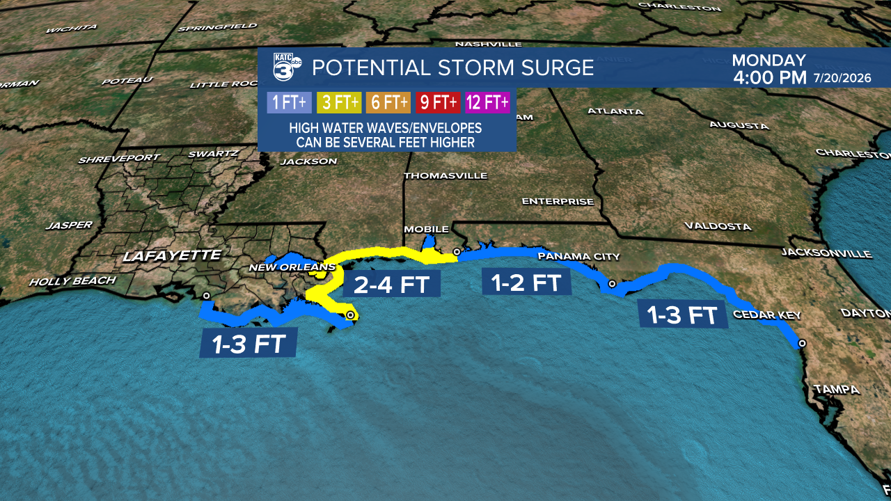
Conditions on the Acadiana Coast will be breezier and there could be an increase in tides by 1-2 feet after the circulation passes west Thursday into Friday, but that may be it.

It is entirely possible that this system could degenerate to a tropical wave before reaching the Texas Coast Friday/Saturday.
Overall, the 10 Day Forecast looks like a typical summer forecast with very little if any real impacts from the tropical system anticipated...but as always, conditions could change, but the overall trend is heading toward a rather forgettable event...we hope, and we'll see!
Stay with KATC for updates should conditions change.
