

There were plenty of natural fireworks for the 4th of July as scattered showers and thunderstorms covered more ground. Wednesday looks to bring additional storms with some isolated heavy rains possible.
The ridge of high pressure that has dominated the region for several weeks, bringing the intense heat, is finally starting to show signs of breaking down a bit. Or at least more of a weakness over the central Gulf Coast. With better lift, we'll see showers and storms developing over the Gulf waters before dawn, will gradually shift inland.
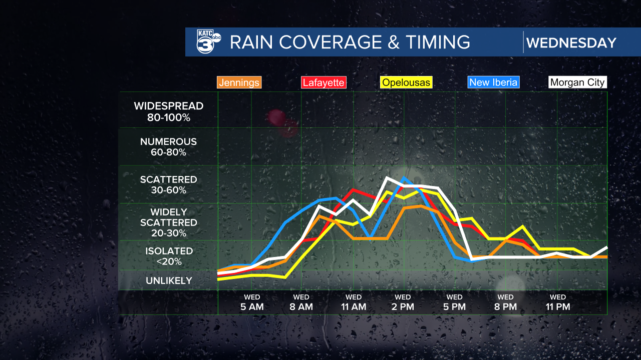
Rains will cover more ground as we get into the afternoon. Temperatures will climb into the upper 80s for our coastal parishes where rains will begin earlier in the day. Highs are expected to reach the lower 90s for the I-10 and inland parishes as storms will get going a little later. Some of the storms will be efficient rain producers, so some local areas could get a quick one or two inches of rain in a short period of time. Don't be surprised to see a few tropical funnel clouds closer to the coast.
More of the same for Thursday, although the coverage of rain will be more widespread. Not only will we see plenty of moisture flowing in and pooling across local area, a trough northwest of the area will also help squeeze out the rains and concentrate them over southern Louisiana. Rain chances will be highest Thursday along with some decent rainfall totals. Good news as much of the region has been very dry from this oppressive heat wave we've been dealing with since last month. Expect highs around 90 with upper 80s along the coast.

Friday conditions will remain unsettled with scattered showers and storms, more likely as we head into the afternoon. Highs will climb into the lower 90s.
Over the weekend, a ridge will build in from the west. Some scattered storms, typical of a summer day in Louisiana, will be popping up on Saturday with highs in the low 90s. Sunday and much of next week will bring more stable conditions and less rain. Temperatures will be climbing once again, and we could be knocking on the door of 100 degrees again later next week.

Tropical weather remains quiet. The National Hurricane Center isn't expecting any tropical development over the next week.
