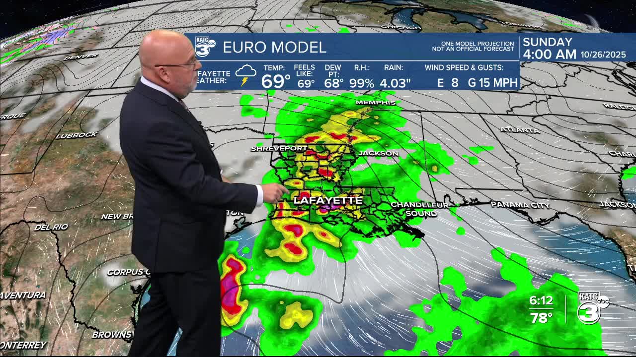


After a nice stretch of weather for Acadiana to finish the week, a storm system will likely produce showers and thunderstorms with activity developing Saturday and continuing overnight ending Sunday morning.
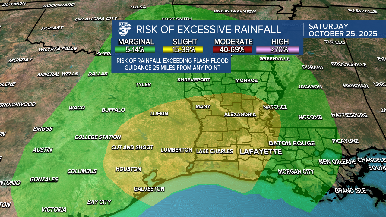
The Weather Prediction Center (WPC) has a good part of Acadiana hatched in for a slight risk (level 2/4) for excessive rainfall.
Hopefully it doesn't come all at once as the dry ground needs some "priming" to not have immediate run-off/localized flood issues.

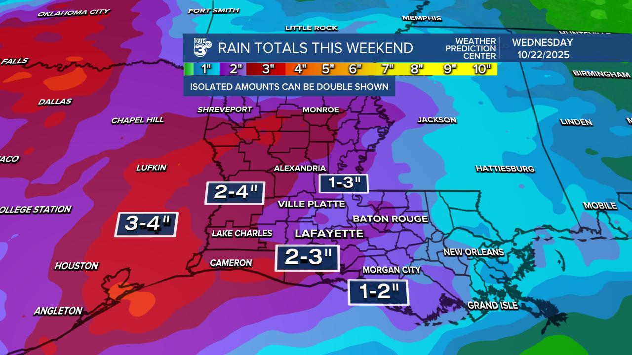
The WPC has most of the area hatched in for roughly 2-3" but latest Euro and GFS are coming in with higher totals approaching the 3-5"+ range in some areas.

Nonetheless, beneficial rains to help put a dent in our recent drought.

Although the Storm Prediction Center has not outlined the risk of severe storms for this particular event, we'll probably see a marginal risk outlook for the area issues at some point for the low end chance that some storms could produce damaging winds, and perhaps an isolated tornado. At this point strongest storm dynamics look to arrive Saturday evening/night.
Activity should end by Sunday afternoon, if not, sooner than later.
In the near term, expect a nice and cool Thursday morning with temperatures ranging from the mid-upper 40s to lower 50s.

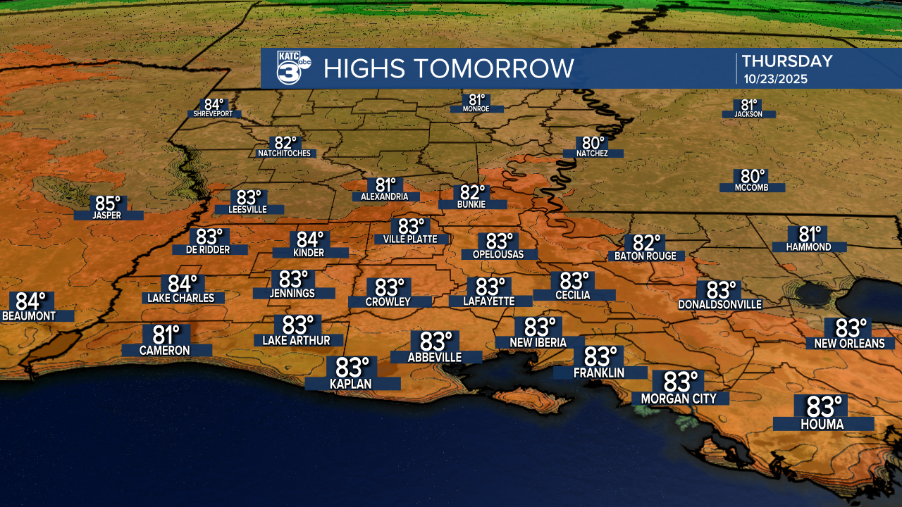
Plenty of sun is expected through Friday with highs in the lower 80s Thursday and mid-80s Friday as southeasterly winds begin to usher in higher atmospheric moisture and humidity ahead of our weekend weather-maker.
More fall-like weather and temperatures are expected to follow or next week insuring a nice and chilly Halloween.
See the KATC 10 Day Forecast for the latest.
Meanwhile in the tropics, Tropical Storm Melissa is now forecast to become a major category 4 hurricane in the Caribbean Sea.
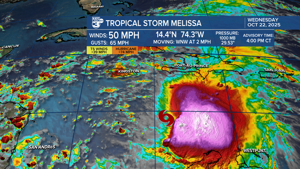
And per the the latest tropical hurricane models the storm could does have category 5 potential.

And after the Day 5 (Monday) Forecast, the models indicate the storm should turn back to the northeast putting Jamaica potentially in a dire threat for a significant/extremely damaging storm.
