


After gray skies and fog this weekend, we're starting the week with lots of clouds. A weak, slow moving cold front will continue moving southeastward. Warm and breezy conditions are forecast for today.
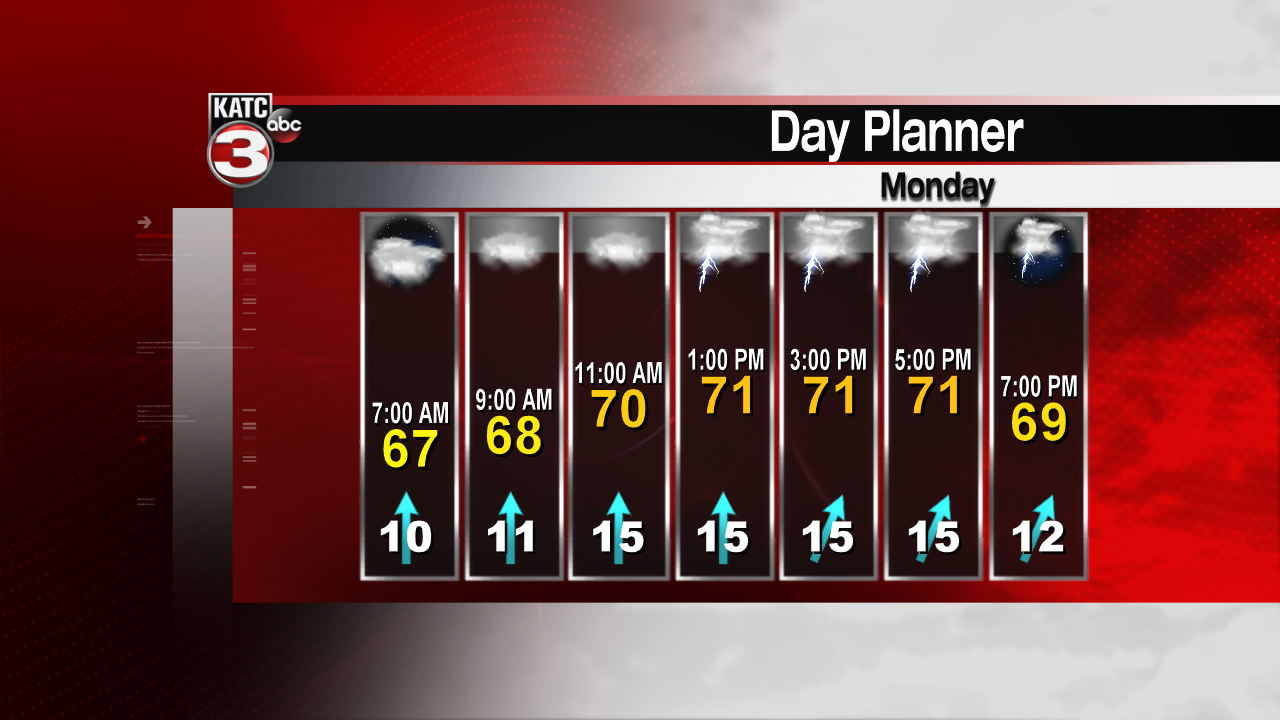
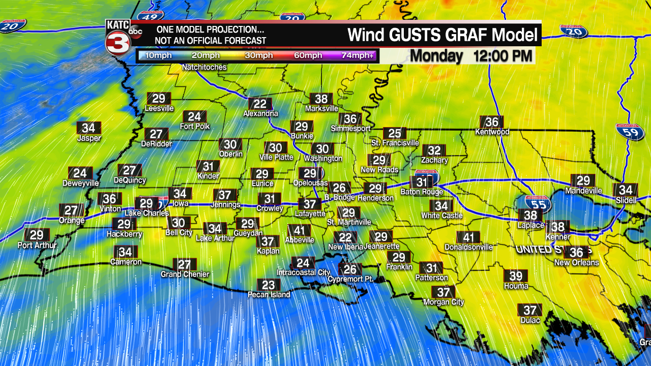
Some light showers will be around this morning, but a better chance for rain exists this afternoon. Winds will be out of the south from 20-25mph, with gusts at times over 30mph. Highs will reach the lower 70s.
The front is forecast to move very slowly and only make it to the coast overnight tonight before stalling. Clouds will hang on, temperatures will be slightly cooler, as we dip into the upper 50s to near 60 degrees. Winds will lighten up.
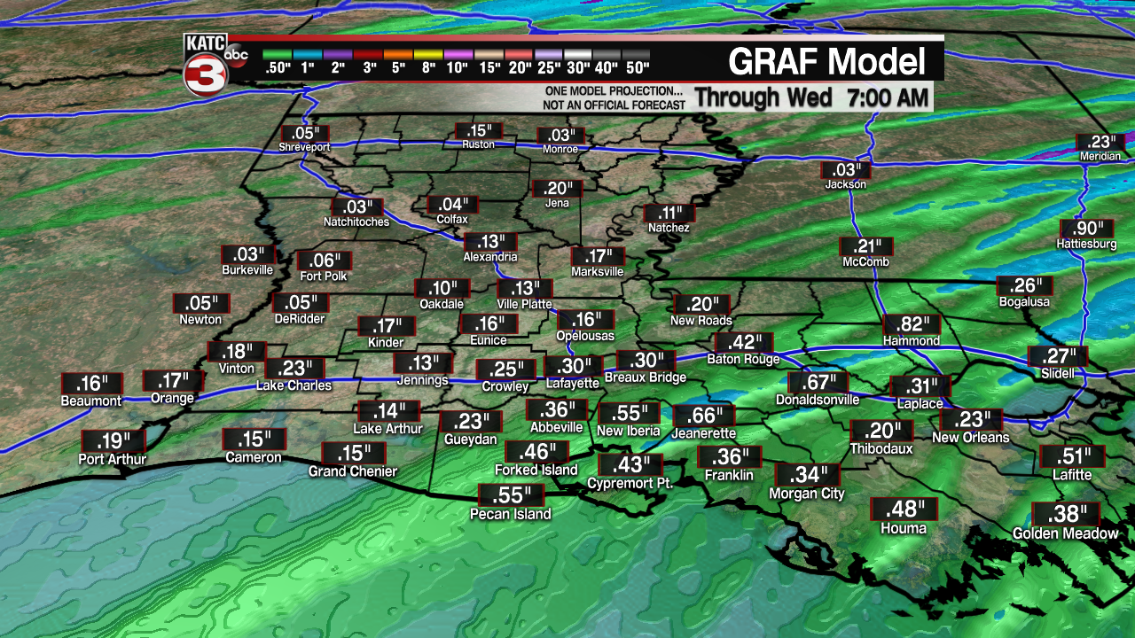
The front will still be lingering with occasional rain showers again on Tuesday. Highs will be in the upper 60s.

A stronger push of colder air will slide in for the mid week. Another chance for showers on Wednesday, before we finally catch some decent sunshine on Thursday and Friday. Temperatures will end the week on a chilly note.
