


After a frosty start Tuesday, look for milder temperatures into the afternoon, with clouds advancing into the region ahead of a couple of weak disturbances Wednesday and Thursday.
Look for temperatures to again go below freezing tonight, but with much less wind, and sub-freezing readings lasting a few hours less in many spots as compared with last night/this morning.

Most of Acadiana was below freezing for 10-14 hours through Monday morning, and tonight it will range gnerally from 1-4 hours across Southern Acadiana, to a more substantial 6-12 hours to the north.
With light winds and temperatures meeting up with dew points in the upper 20s and a moist east-southeast flow at the surface, look for widespread frost Tuesday morning, with the best frosting across the northern Acadiana parishes and out in more rural locations.
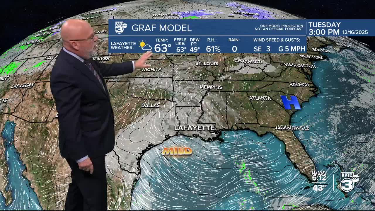
Surface southeasterly winds will help the area warm-up nicely Tuesday as upper clouds move in from the southwest during the afternoon.
Highs will top out in the upper 50s to lower 60s Tuesday.

As milder Gulf air continues to "advect" into the region, look for more clouds and patchy light rain, sprinkles, drizzle and or mist to develop toward Wednesday morning with lingering light rain shower activity in the "KATC" forecast through Wednesday afternoon.

Rain chances should be in the 40% range.
Temperatures will moderate into the 70s Thursday ahead of a weak front that arrives Thursday evening, with a few showers possible when the aforementioned front arrives.
Thereafter, the pattern looks rather quiet into next week with minimal (or low) rain chances and temperatures remaining in the mid-upper 70s much of Christmas week and beyond.
See the KATC 10 Day Forecast for the latest.
Looking farther down the road...

The Climate Prediction Center's forecast for December 23-29 looks warmer than normal for most of the country.

A wet and snowy pattern looks to shape up for the Western U.S. while the Gulf Coast looks fairly dry.
