


After another chilly morning in the mid-upper 30s for Acadiana Wednesday, look for temperatures to rebound to near 70° for the afternoon, with a warming and drier than normal trend expected to continue for the foreseeable future.

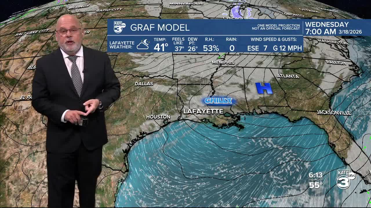
In the near term, it will be seasonably cold through Wednesday morning, but not as cold as this morning with lows ranging from the mid-upper 30s.
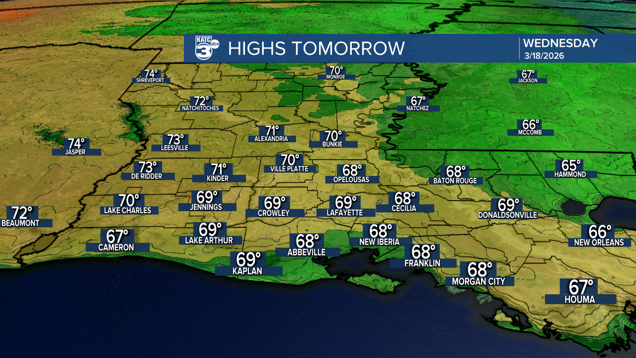
Wednesday will bring partly sunny skies with a fair bit of high cirrus clouds as temperatures moderate into the upper 60s to near 70°.

The warming trend will continue with generally mostly sunny skies Thursday into the weekend with highs ion the mid-upper 70s Thursday and approaching the lower 80s Friday into the weekend.
There looks to be little change for Acadiana into next week, with warmer than normal spring temperatures, and rain chances staying near zero, perhaps through the end of the month!
See the KATC 10 Day Forecast for the latest.
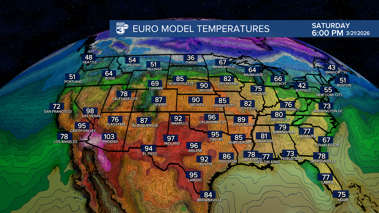
Meanwhile, elsewhere across the U.S., by this weekend 90° plus temperatures (and some early record 100s in the Southwest) will stretch well into the High Plains.
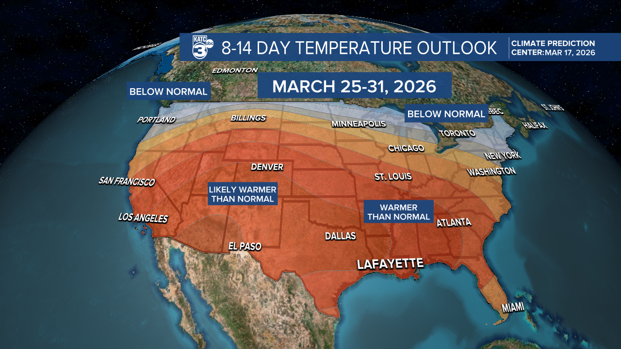
The latest Climate Prediction Center's 8-14 Day outlooks pretty much carry above normal temperatures for much of the U.S. (and Louisiana) essentially through through the rest of the month.
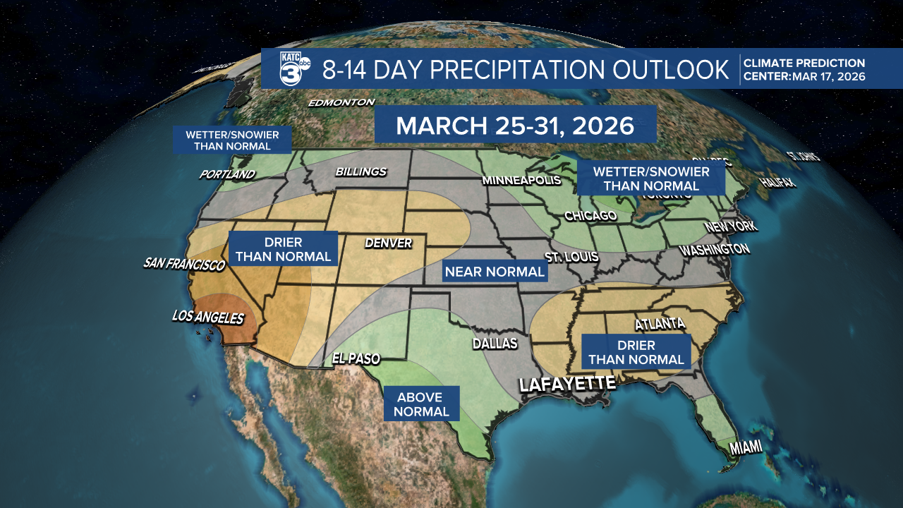
And the pattern looks dry for our part of the world (Acadiana) at least the next 10-12 days...
