


Acadiana is on track for increasing rain chances as we near the end of the week with a decent soaking possible arriving Friday into Friday night.
In the near term, look for another mild and humid night for the area with lows in the low-mid 70s...normal for June, not April.

Tomorrow will bring another partly to at times mostly cloudy, warm and humid day to the area, but there could be a few showers and/or thunderstorms that may pop-up during the afternoon and/or into the early evening.
The Storm Prediction Center (SPC) continues to have most of Louisiana and Acadiana hatched in for a marginal risk of a few isolated severe storms Wednesday, with best bet for any severe weather likely for the northern and central part of the state...for Acadiana, it remains to be seen as whether we see any storms.

Models like the HRRR and GRAF continue to struggle with the ongoing weather pattern.

As an upper ridge of high pressure in Mexico begins to retreat, the atmosphere will become a little more friendly for scattered showers and a few thunderstorms in the days ahead.

Temperatures Wednesday will top out in the mid-80s.
Thursday should bring a better chance of scattered showers and a few thunderstorms with temperatures holding closer to the lower 80s as a weak frontal boundary pushes through the area.
Currently the SPC does not have a severe weather outlook for the area for Thursday.
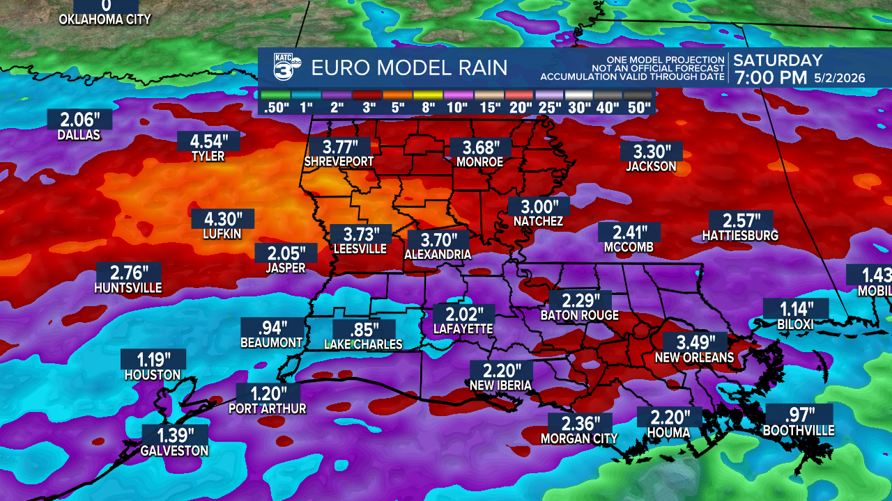
Acadiana's best bet for rain and some embedded thunderstorms should arrive Friday into Friday night with the potential of 1-2" of rain area wide per the Weather Prediction Center.

The Euro model backs up the same with higher totals to the north...and like every wet weather system, isolated spots could receive up to double the amounts shown.
We are not expecting an overt threat of severe weather with any embedded storms Friday into Friday night as the area should be on the cooler side of a frontal boundary limiting atmospheric instability closer to the surface.
Thereafter, it's breezy and cooler as skies clear by Saturday afternoon with chilly temperatures likely dropping into the upper 40s to lower 50s Sunday morning.
Several nice and cool days will follow Sunday into early next week before temperatures moderate mid-week.
See the KATC 10 Day Forecast and the Power Doppler 3 page for the latest.
