


Another day with sunshine and hot temperatures, although a few late afternoon storms could pop up like Tuesday. A deep southerly flow will keep the dew points up, so with higher humidity combined with temperatures in the low to mid 90s, heat index values will climb to near 105 again. We managed to hit 95 degrees for a high on Tuesday prior to the scattered storms moving in. A ridge of high pressure aloft will limit some of the storminess, but a normal 30% coverage is expected.

The ridge of high pressure will begin breaking down toward the latter part of the week. Therefore, showers and storms will be able to form more easily, and perhaps earlier in the day. Rain chances will be climbing as we head into the weekend, and a wetter pattern is expected most of next week. Unfortunately, temperatures and heat index values will still remain in 90s and low 100s respectively.

#6 finally got the bump to Tropical Storm Fred late Tuesday. Winds are now 40mph. The storm is drifting close to the western side of Puerto Rico and will impact the Dominican Republic and Haiti today with gusty winds and heavy rainfall. The forecast brings it near south Florida toward the weekend. It's expected to track more toward the northwest over the weekend, with a possible landfall as a strong tropical storm along the Florida Panhandle.
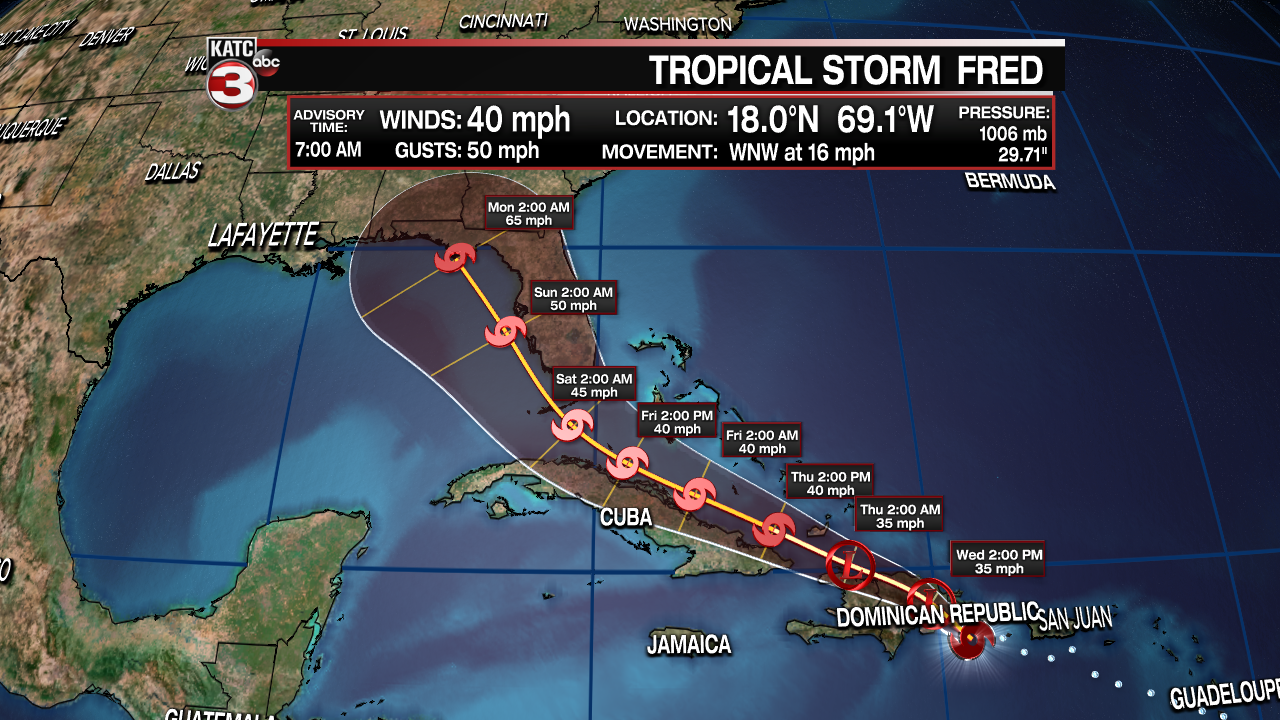
Models are pretty consistent with the track of the storm. Intensity models are still dealing with whether or not Fred will encounter land, so most models are keeping Fred as a moderate tropical storm into the eastern Gulf of Mexico. A few models point toward a weak hurricane, and a few even rip it apart as an open tropical wave with just showers and breezes. The official National Hurricane Center forecast is a blend of these, keeping Fred as a tropical storm until landfall with winds of 65mph.
