


Acadiana's 4th of July Friday will be hot and humid, but with plenty of clouds and some scattered showers, high temperatures will be closer to 90°.
Weak high pressure aloft has been drifting to the southwest which is expected to open the door for a few more scattered, primarily afternoon showers and storms for our Friday and Saturday, with rain chances near the 20-30% range.

The weakness in the atmosphere will be taken up by a weak upper low (currently in Mississippi) that will drop into the Northern Central Gulf Sunday, and then drift westward early next week, which should in turn, should allow for a better chance of scattered, pop-up showers and thunderstorms.

High temperatures should be near 90-91° for Friday and then push a little hotter, between 92-94° this weekend.

Heat indices are expected to reach the lower 100s but the area should stay below "heat advisory" criteria.

Overall, the current weather pattern over the next week to 10 days looks relatively normal with hot and humid conditions continuing, along with the requisite scattered afternoon storms.
See the KATC 10 Day Forecast for the latest.
Meanwhile, the tropics are getting a little busier by Florida and eventually off the Southeast U.S. Coast.
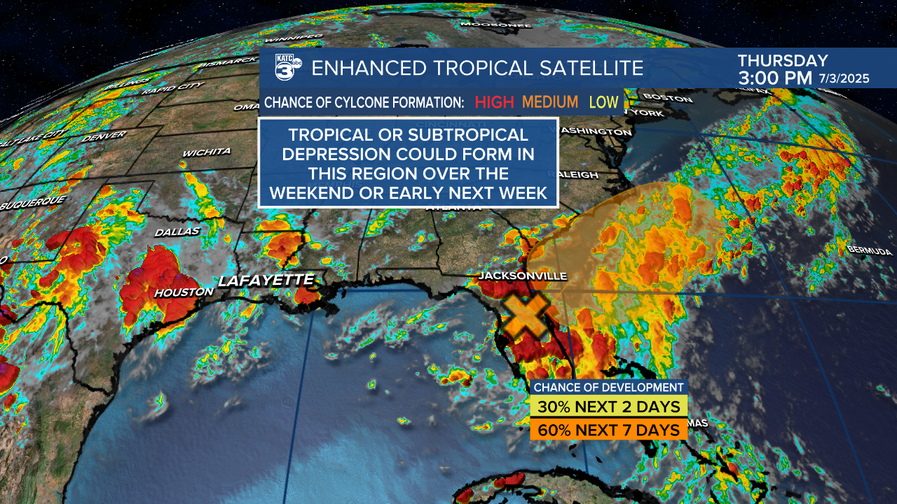
See the tropical update below:
