
Among many of the flood and wind damage reports in Acadiana following Wednesday night’s into Thursday morning’s severe weather event, the National Weather Service performed a preliminary survey of the damage in Krotz Springs and determined it to be an EF1 tornado with 107 mph winds.
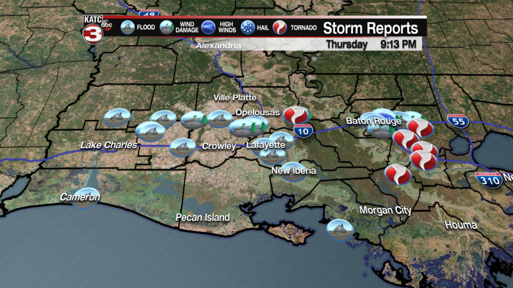
The tornado traveled roughly 1 miles damaging trees and power lines with a tree falling on a vehicle along LA 3174 with occupant having to be rescued.
Fortunately there were no injuries.
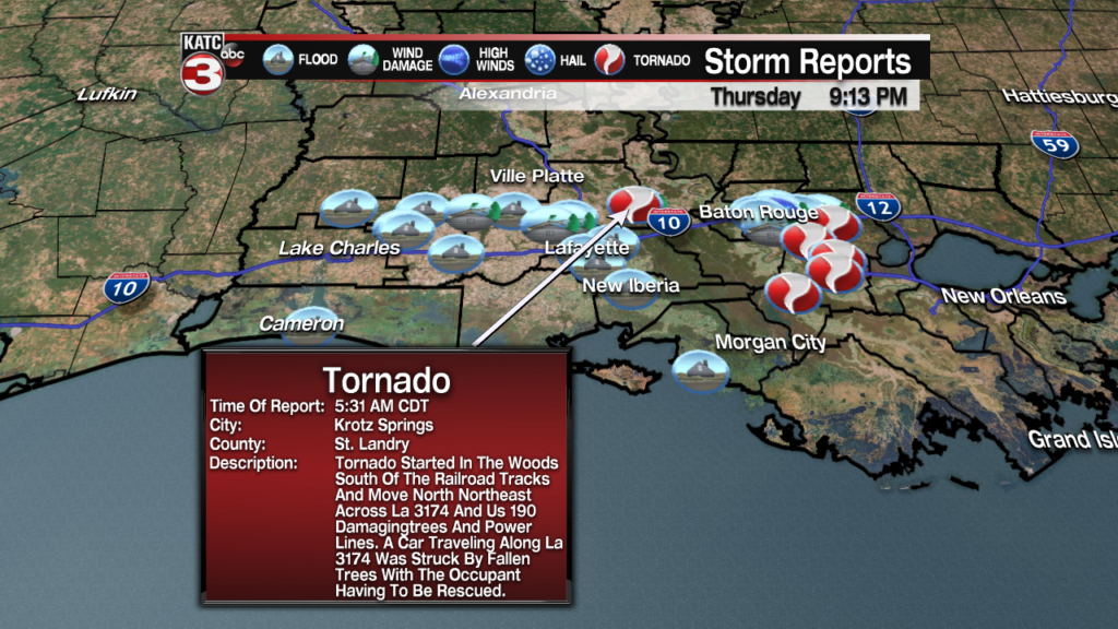
Here’s their preliminary report:
Public Information Statement
National Weather Service Lake Charles LA
807 PM CDT Thu Jun 6 2019


...NWS Damage Survey for 06/06/19 Tornado Event

|
.Krotz Springs Tornado...

Rating:                   EF-1
Estimated Peak Wind:      107 MPH
Path length /Statute/:    1.0| Miles
Path width /Maximum/:     419 Yards
Fatalities:               0
Injuries:                 0

Start date:               June 6 2019
Start time:               5:31 am CDT
Start location:           1 WSW Krotz Springs
Start Lat/Lon:            30.5332 / -91.7699

End date:                 June 6 2019
End time:                 5:35 am CDT
End location:             1 NW Krotz Springs
End_lat/lon:              30.5471 / -91.7653

Survey Summary: Tornado started in the woods south of the railroad
tracks and move north northeast across LA 3174 and US 190 damaging
trees and power lines. A car traveling along LA 3174 was struck by
fallen trees with the occupant having to be rescued. The path may
change based on additional data not yet available. Other wind
damage was noted east of the path of the tornado in Krotz Springs.

EF Scale:  The Enhanced Fujita Scale Classifies Tornadoes into
the following categories.

EF0...Weak......65 to 85 MPH
EF1...Weak......86 to 110 MPH
EF2...Strong....111 to 135 MPH
EF3...Strong....136 to 165 MPH
EF4...Violent...166 To 200 MPH
EF5...Violent...>200 MPH

Note:
The information in this statement is preliminary and subject to
change pending final review of the event and publication in NWS
Storm Data.

Additional storm surveys are ongoing, however flooding hindered
data collection to complete reports at this time.
