
A favorably dry and pleasant weather pattern will continue for Acadiana over the next couple of days before changes arrive into the weekend.
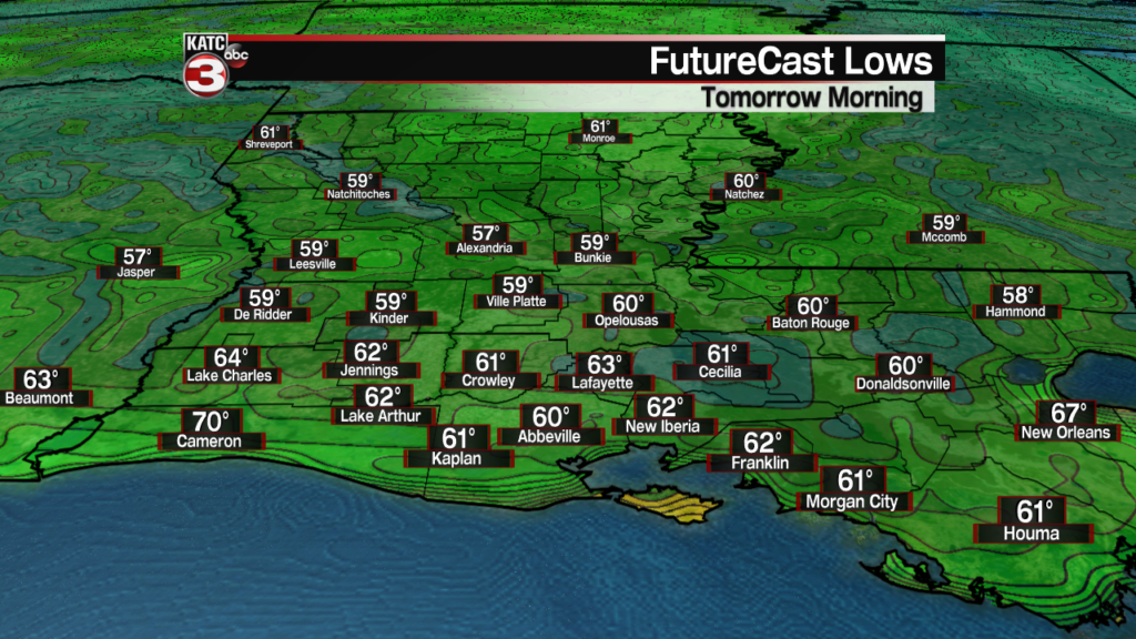
Look for another pleasant night/early morning across the area with low temperatures dropping into the lower 60s, with a few readings possibly getting into the upper 50s across northern portions of Acadiana.
High pressure stays in charge Wednesday with another mostly sunny and warm day.
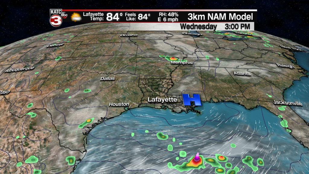
Temperatures will top out in the mid-80s Wednesday.

Little change is expected Thursday, other than morning lows will be a few degrees milder.

Highs Thursday will be in the mid-80s in most areas.

Friday will be similar, with fair to partly cloudy skies accompanied by a subtle increase in humidity.
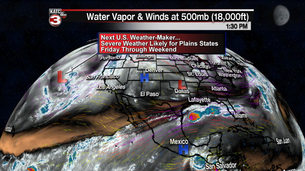
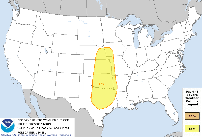
Our next potential weather system, currently in the Eastern Pacific, will be a big severe weather maker from Texas northward through much of Plains States this Friday into this weekend, and likely into early next week.
Locally, relatively minor impacts are expected for Acadiana Saturday with an increase in breezy southerly winds anticipated along with higher humidity and warmer overnight lows.
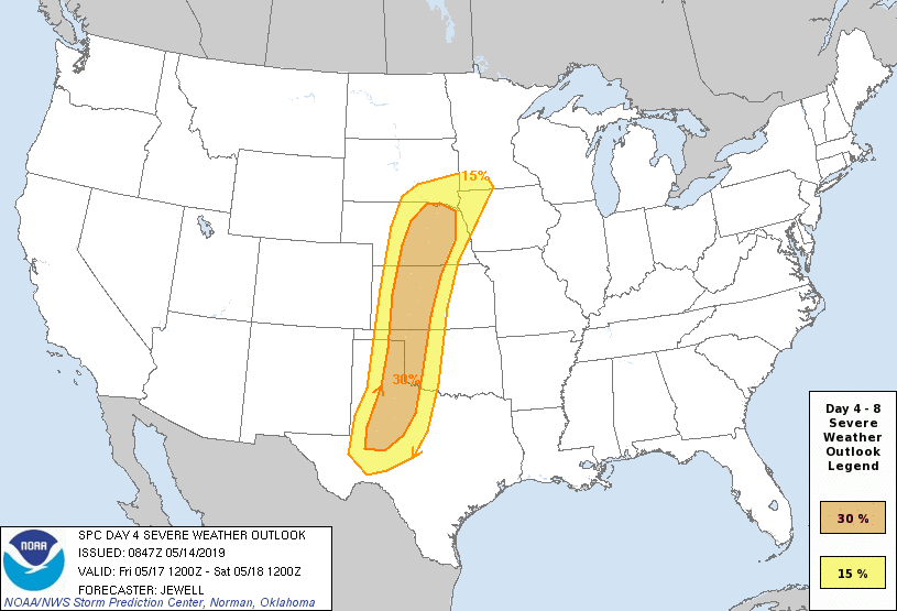
Strong to severe thunderstorms will become a daily threat to our west and north for several days starting Friday, with the Storm Prediction Center already hatching in some areas for enhanced storms, well in advance of this storm system.
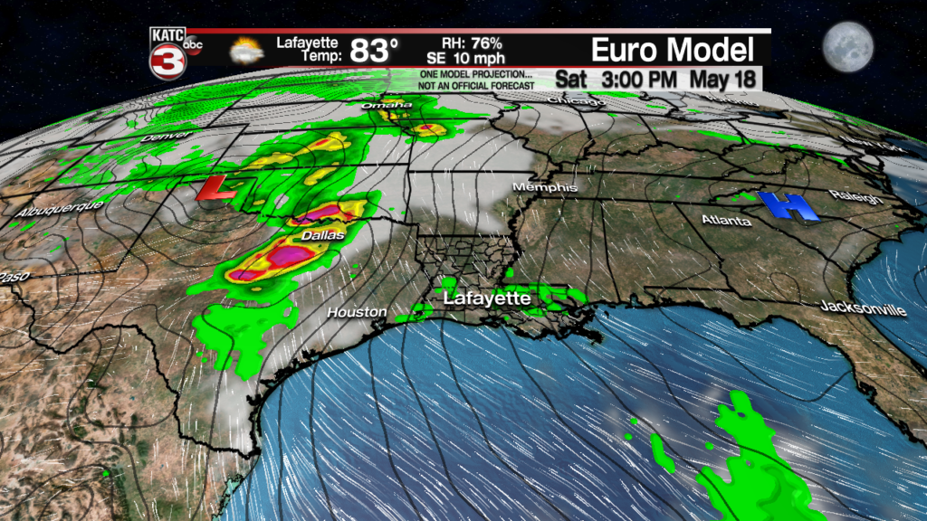
A few isolated daytime showers and/or a thunderstorm is possible locally Saturday, but rain chances should be no higher than 20-30%.
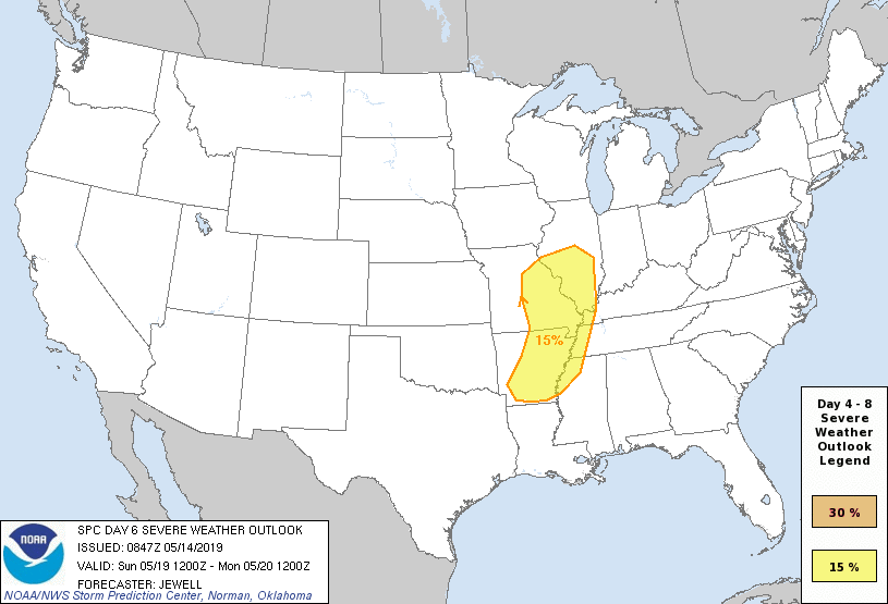
Moving into Sunday, the tail end of a frontal boundary should be the focus for scattered showers and some thunderstorms across Acadiana, but the model trend over the last couple of days has been for less dynamics and consequently, fewer storms.
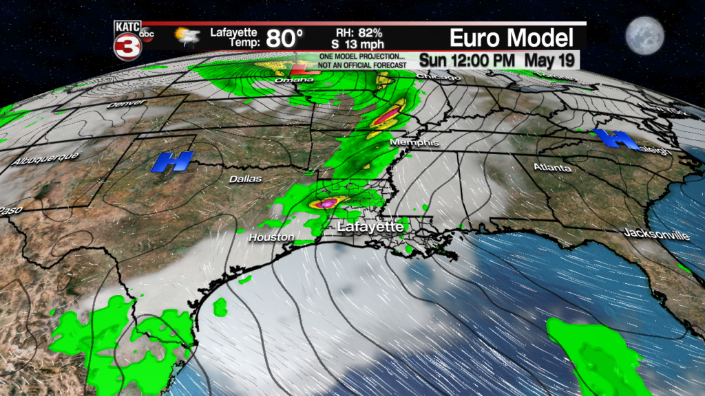
For now, we’ll go with a 50% chance of storms Sunday, with any severe weather threat confined closer to the northern part of the state.
The long range outlook into next week is starting to look quite summer-like with partly cloudy skies, and daytime highs approaching 90, accompanied by the ubiquitous summer-like humidity.
Overnight lows next week, will be closer to the mid-70s…so get the a/c units ready for more continuous use in the very near future!
See the 10 Day Forecast for the latest.
