
A taste of early summer will continue for Acadiana over the next several days with partly to mostly cloudy skies, breezy, warm and humid conditions to finish out the week.
Gusty southeasterly winds will continue during the day Wednesday feeding more strong to severe storms that will continue to pound portions of Texas, Oklahoma, Arkansas and Missouri.
Latest local wind forecast:
 Acadiana 1 Hour Wind Forecast


As of late Tuesday afternoon, the Storm Prediction Center upgraded a large portions of Eastern Oklahoma to a moderate (level 4 out of 5) of severe storms into Tuesday evening, citing “numerous tornadic supercells across northwest OK, southwest MO, and northwest AR…to warrant the upgrade”.
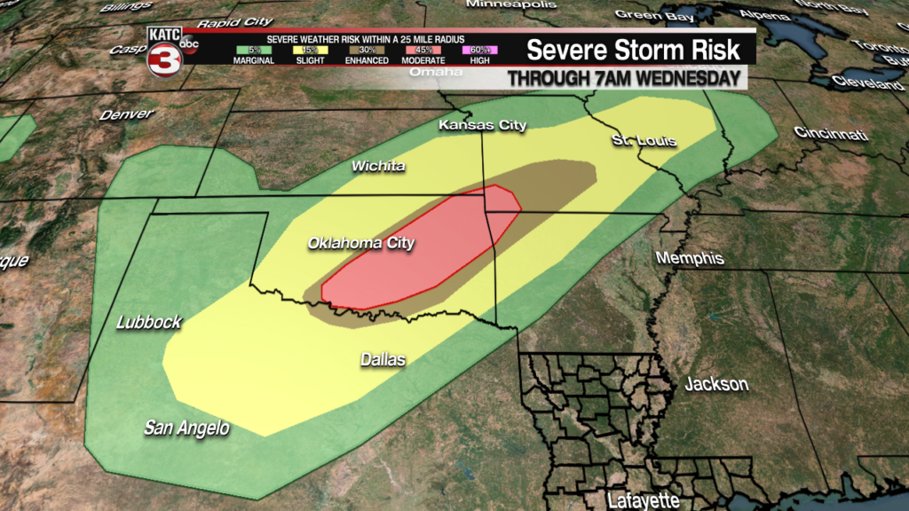
More severe storms will be likely generally in the same areas, but also a little farther southward for Wednesday.
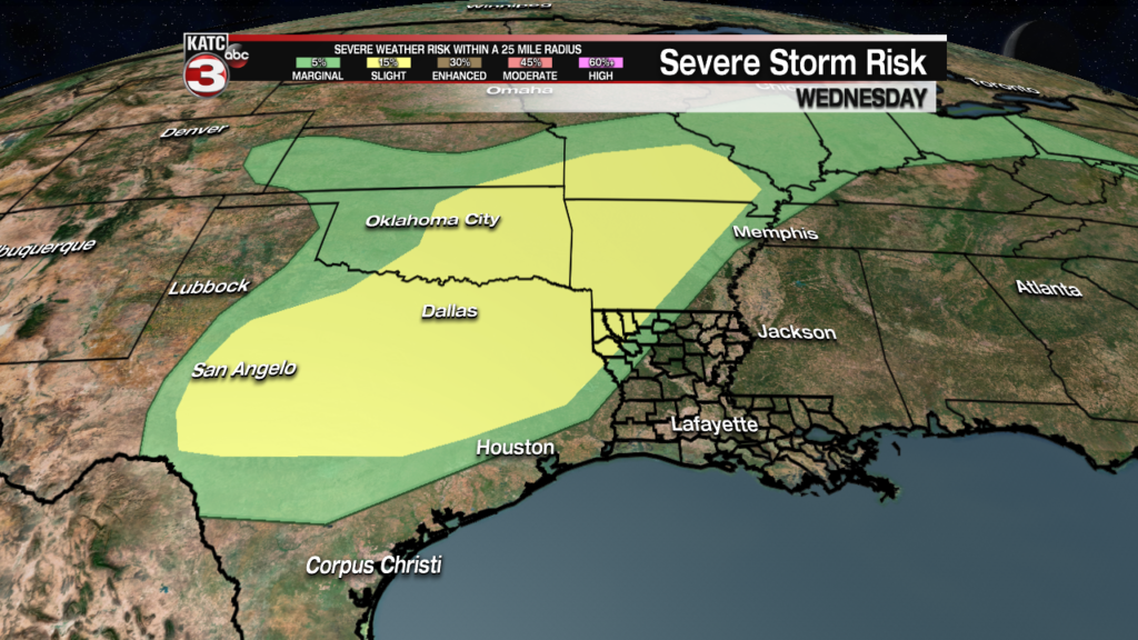
Meanwhile, Acadiana should stay out of the storm mix with mostly cloudy mornings yielding to some afternoon sun for both Wednesday and Thursday.

Look for daytime highs to continue in the mid-80s, (86-87F), with afternoon heat indices approaching 90F.
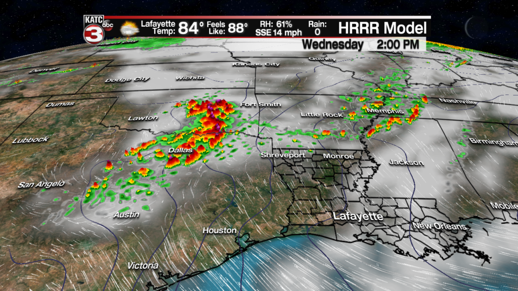
Rain chances will stay low Wednesday, near 10%, but could rise closer to 20% late Thursday into Friday…and we’ll likely see more clouds, especially Friday with more storms dropping a little closer to the region.

Moving into the weekend, it continues to appear that the Acadiana region will get under a more favorable pattern aloft with a disturbance likely to spark a good chance of showers and storms Saturday.
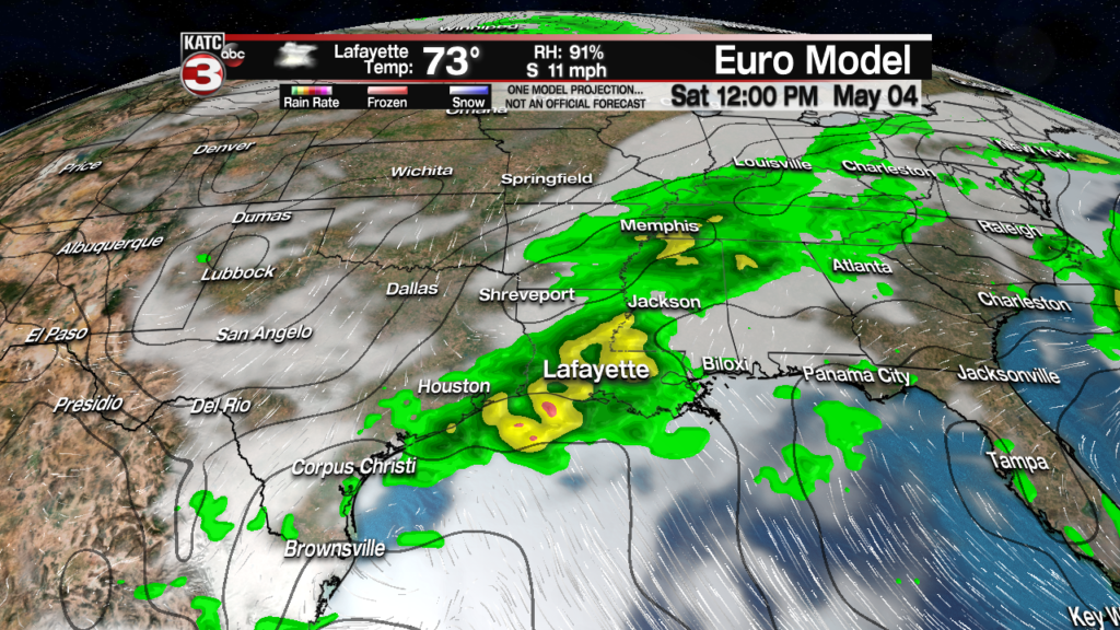
It remains too early to call as to whether Saturday’s storms will be tilted more toward the morning or the afternoon, with today’s models favoring mid-morning to mid-afternoon but that could certainly change.
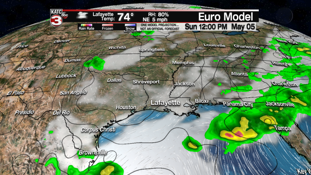
The local forecast thereafter is a little up in the air, pun intended. But for now our 10 Forecast is favoring the Euro model with a partly sunny and drier, but warm Sunday.
Warm temperatures are anticipated to continue much of next week along with eventually slight rain chances returning to the forecast mid-next week…but the models have been changing daily, so stay tuned!
