
After six days of temperatures topping out in the spring-like mid to upper 70s, a strong cold front moving through the area this Thursday evening will temporarily “shock” Acadiana back to more of a winter pattern for a couple of days.
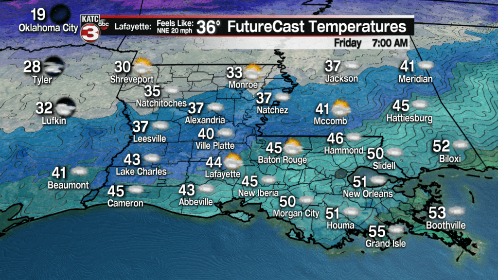
Showers with the front will lead to a temperature drop of roughly 15 degrees in an hour’s time through this evening, with readings dropping into the 40s after 1-2 am and low to mid 40s by morning.
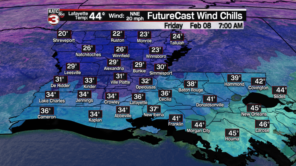
And with strong northerly winds behind the front, wind chills will likely drop into the 30-35 degree range by morning.

Latest Forecast Winds:
 Acadiana 1 Hour Wind Forecast


And offshore, Gale Warnings are posted, and with strong northerly winds Friday, tides will likely drop 1-1.5ft below normal.
Offshore Wind Forecasts:
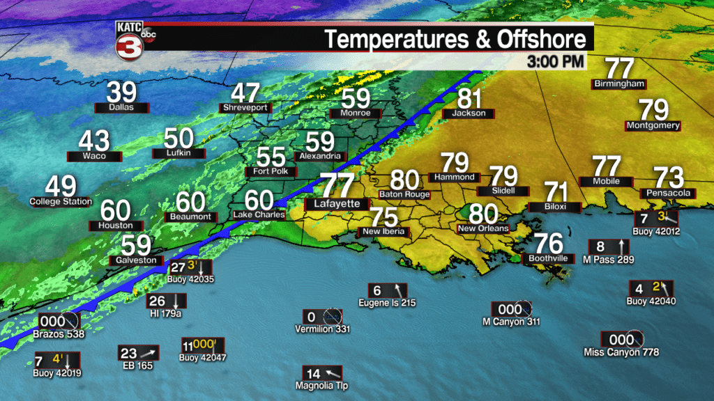
 Current Offshore Observations and Wave Heights


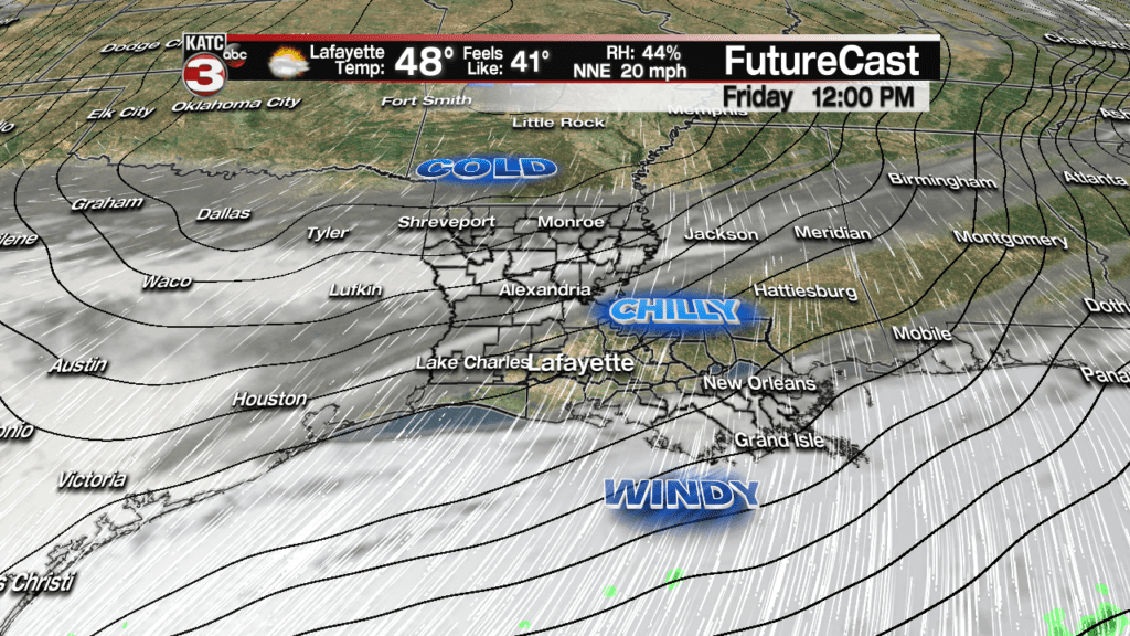
Friday will be a cloudy, windy and cold day with temperatures struggling to reach the upper 40s, while wind chills stay roughly 10 degrees colder.
The coldest night over the next 10 days or more will come Saturday night, but we should all stay well above the freezing mark as clouds and a northerly breeze persists.
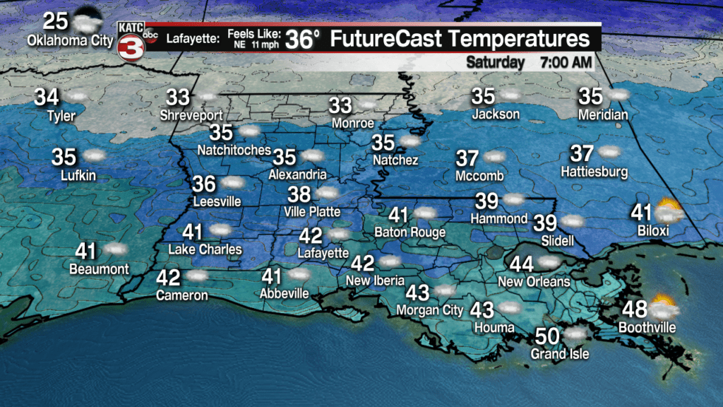
Lows Saturday morning will be near 40 in Lafayette but range from the mid-30s for northern portions of Acadiana and low to mid 40s to the south, but morning wind chills will again be in the low-mid 30s for most of us.
The winds should abate later Saturday along with the possibility of clouds thinning enough for partly sunny skies for the afternoon.
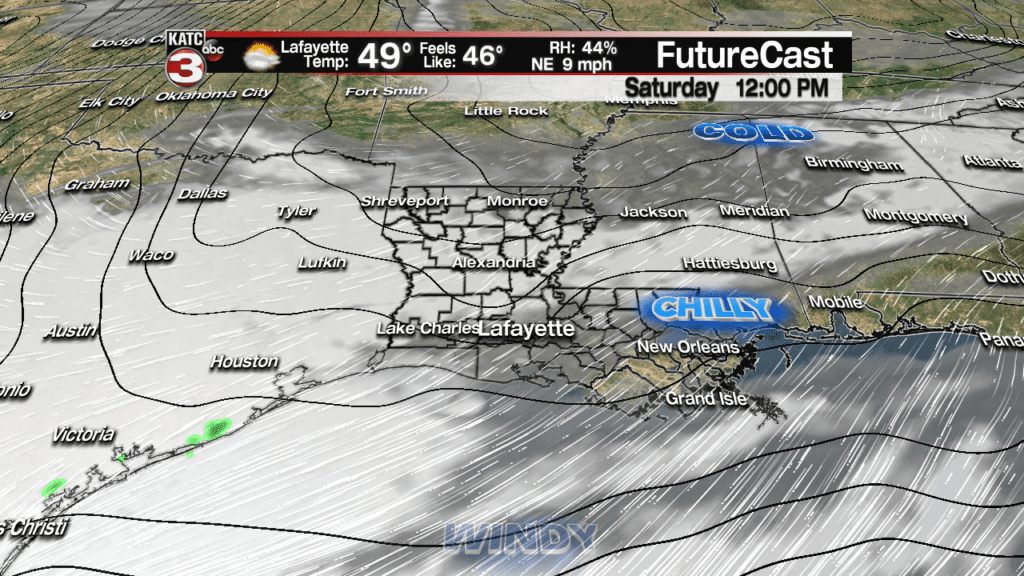
Highs Saturday should reach the mid 50s.
A warm front should return milder temperatures to Acadiana Sunday with highs getting back into the lower 70s after a morning start in the mid-40s.
It appears that spring-like weather with highs in the mid-70s will be with us early next week with a few showers possible Monday and a better chance of showers and storms developing Tuesday (and perhaps the best soaking we’ve seen in weeks) ahead of our next front.
Latest long range models:
 European Model Forecast Day 1


Next week’s front however will be Pacific in nature, so temperatures will cool to more seasonable levels for a couple of days mid-next week, before warmer, spring-like weather possibly returns by the end of the week and into the following weekend.
See the exclusive KATC 10 Day Forecast for the latest!
