The forecast in the short term looks to remain quiet.
Clouds will slide over Acadiana tonight helping to trap some of this afternoon’s heat at the surface so lows Sunday morning will not be as cold holding in the upper 30s and lower 40s.
Here is a look at the latest hour by hour temperatures across Acadiana.
Sunday afternoon should be another fantastic day with mostly sunny skies and near average temperatures in the low to mid 60s.
The warming trend continues Monday with highs in the mid to upper 60s as winds flip out of the SW at 10-15 mph.
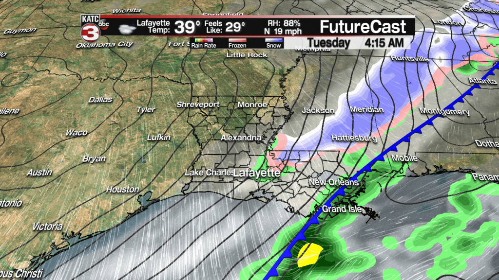
Overnight Monday into Tuesday morning is when the forecast gets interesting as our next strong cold front swings through the region.
Most models agree that the front will arrive after midnight initially producing light scattered showers.
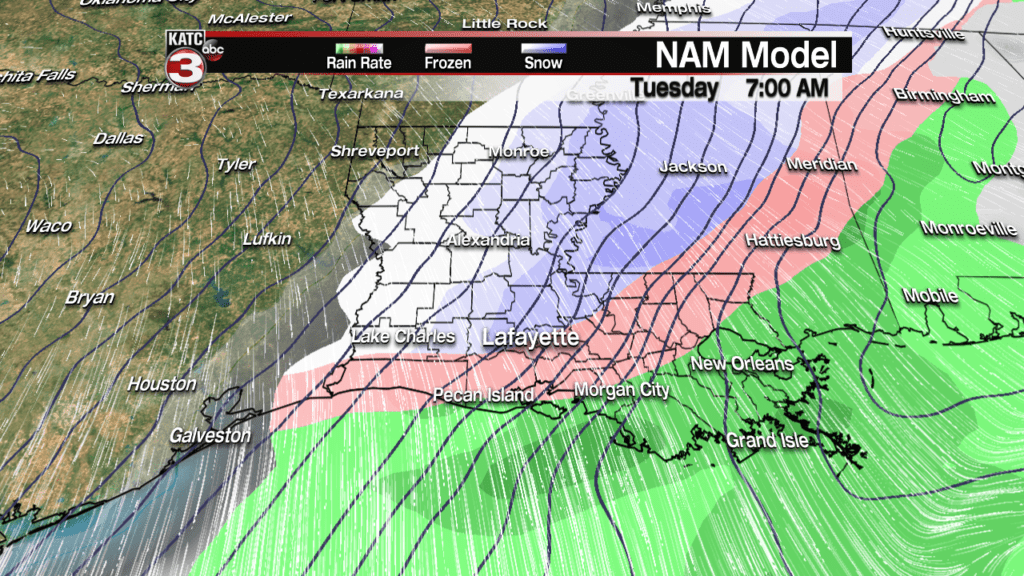
Between 4AM & 8AM is when the NAM and GFS models indicate that some of the rain could begin to change over to sleet/snow as very cold air invades Acadiana behind the front dropping temperatures to near freezing.


However, the RPM and European models, which are the more reliable models, are backing off and have very little, if any, of the rain change over to wintry precipitation for Acadiana.


Thus, I am going to lean more towards the RPM and European models and say that most of Acadiana just sees a cold rain early Tuesday morning, but for those that live to the north of highway 190 I would not rule out the possibility that you might see a wintry mix for a little bit but nothing that will cause any problems on the roads.
And with sunny skies and warm temperatures the next couple days the ground is going to warm up so it will be very hard for any wintry precipitation that we might get to stick.
Also, Tuesday afternoon the sun should come back out and with winds breezy out of the north at 10-18 mph most of the water on the roads should dry up fairly quick.
That sad late Tuesday night into Wednesday morning temperatures will drop into the mid to upper 20s, so any moisture still on the roads will freeze and could become black ice, especially on bridges and overpasses.
So, just take it easy Tuesday when you are driving just in case any wet roads are slippery.
You will also need to protect your pipes, plants and pets Tuesday night/Wednesday morning as temperatures will be below freezing for several hours which could cause exposed pipes to freeze and burst.
After the frigid start Wednesday morning we stay on the cool side as highs struggle to reach 50 as high clouds linger over Acadiana for most of the day.
To end out the work week skies will remain mostly cloudy along with the slight chance for a few isolated showers Thursday and Friday afternoon with temperatures a tad warmer in the 50s.


