It was nice to finally have a dry day with even a little sunshine this morning to help dry things out across Acadiana before more showers arrive Wednesday.
And the rain could return as early as the overnight hours as a few scattered showers are forecast to move onshore off the Gulf.
Here is a look at the latest predictive radar to see when these showers could arrive in Acadiana.
Scattered showers will then continue on and off throughout the day as a warm front slides closer to the region creating overrunning rains.
Now the models are indicating that the majority of the showers on Wednesday could stay just to our north and west but we will still have to watch for hit or miss showers in Acadiana.
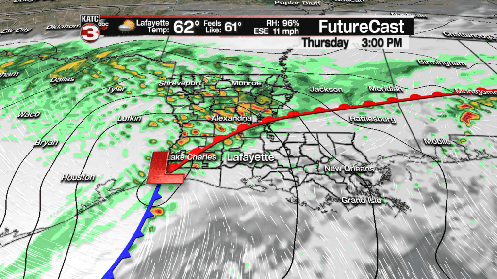
Here is a look at the latest futurecast model to see just where the showers are projected to develop.
Moving into Thursday a Gulf low and associated cold front will then swing through Louisiana producing more widespread showers.

Models are having a little trouble figuring out where the heaviest showers will set up the next couple days.
The latest RPM model has most of Acadiana only picking up about a half inch of rain, which would be the best scenario since the ground is still really wet.
But for portions of western Acadiana up to Alexandria the model is projected anywhere from 2-6 inches of rain, which could lead to flooding concerns.

A Flash Flood Watch has been issued for western and northern portions of Acadiana due to this threat of heavy rains the next couple days.

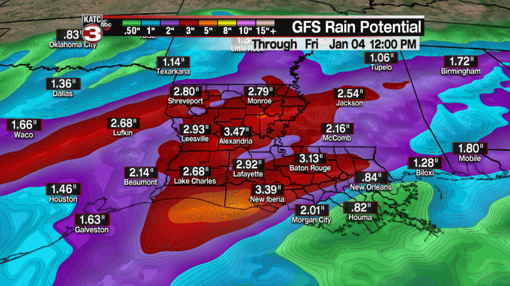
However, the GFS and European models are more aggressive with there rainfall amounts for Acadiana with totals in the 2-4 inch range, which would bring the flooding threat to our region as well.

We will just have to watch the trends of the models over the next 48 hours but I am going to go in the middle and say that Acadiana gets about 1-3 inches of rain which could cause minor flooding and ponding in the typical spots.
Also, we will have to watch for flooding along rivers in Acadiana as the Vermilion is still pretty high from last weeks rain.

The good news this system should move out of the area late Thursday into Friday and we will then get a stretch of dry weather.
But behind this system it will get cool again with temperatures dropping into the upper 30 and lower 40s Friday morning.
Then with high clouds lingering over Acadiana on Friday highs will only top out in the mid 50s.
Sunshine will finally come back out again just in the weekend with temperatures near average in the low to mid 60s.


