
Breezy and cool conditions will continue to follow Thursday rains with skies clearing and full sunshine expected for Acadiana Friday.
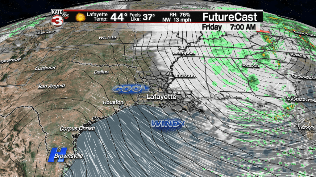
Gusty northwest winds near 15-25 mph will continue through the overnight and daytime hours Friday with occasional gusts near 30-35 mph during the night-time hours.
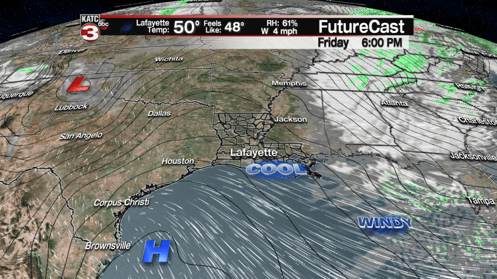
Winds stay breezy in the 15-22 mph with occasional gusts to 25-28 mph early Friday, but should diminish nicely by late afternoon into the evening hours.
Latest FutureCast Winds:
 Acadiana 1 Hour Wind Forecast


Offshore winds had gusted to near 50 mph as of Thursday afternoon with Gale Warnings continuing through Friday morning. And because of the strong northwesterly winds, a Low Water Advisory is in effect for tides running 1-2 feet below predicted levels.
Latest Offshore Winds and Forecast:
 Current Offshore Observations and Wave Heights


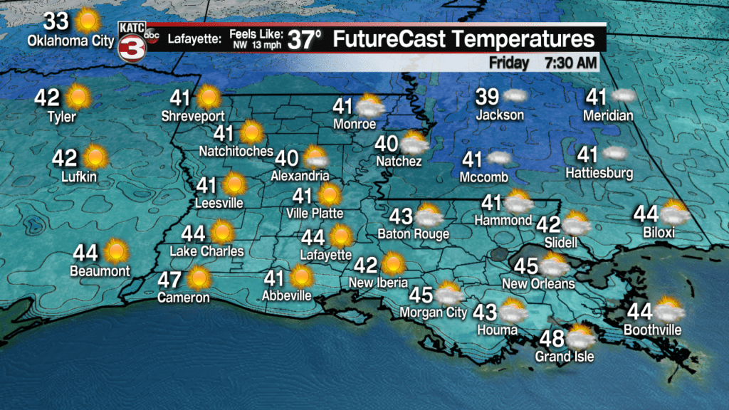
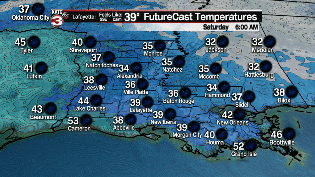
Inland across Acadiana, temperatures will drop into the low to mid 40s Friday morning with wind chills likely in the mid-upper 30s so bundle up!
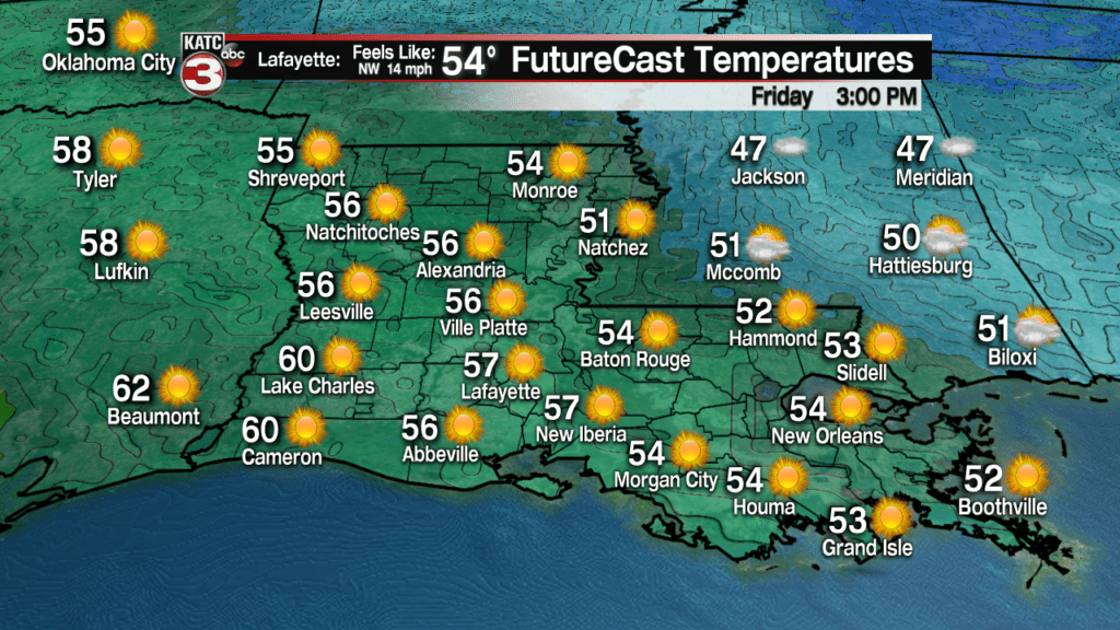
Lots of sunshine is anticipated for the area Friday with temperatures likely topping out in the upper 50s, but it will feel cooler, thanks to the gusty northwest winds.
As winds diminish Friday night into Saturday morning temperatures will likely drop into the mid-upper 30s which could lead to some patchy frost, especially in the northern Acadiana parishes.
Mostly sunny skies and a return of southerly winds Saturday will translate to a nice warm-up with temperatures reaching the upper 60s for the afternoon.

It will be even milder Sunday with afternoon readings reaching the 700 degree mark, but a fizzling front may also produce a few isolated showers by late in the day.

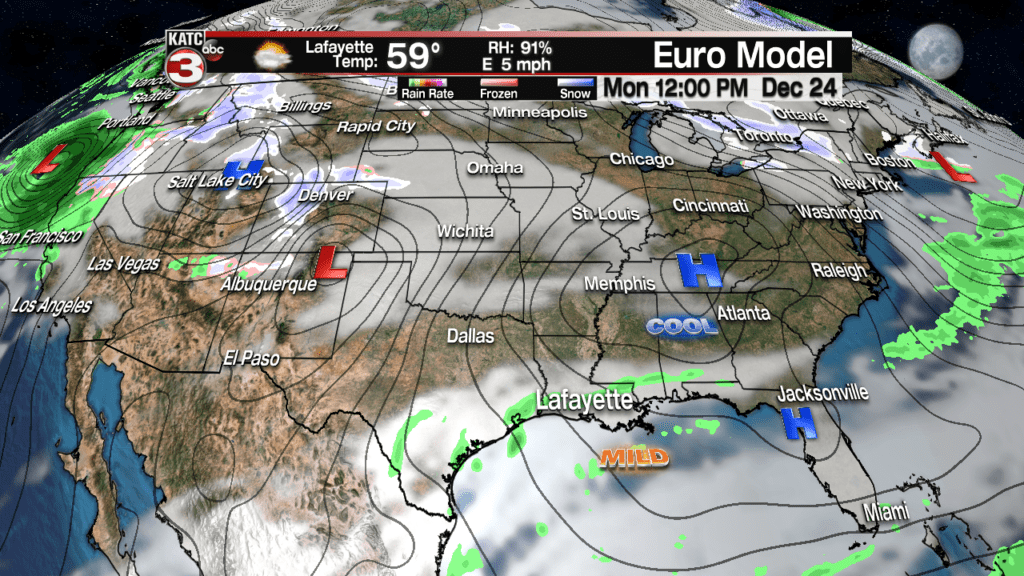
The same front will likely wash back to the north Monday allowing for the continued slight chance of a few showers.
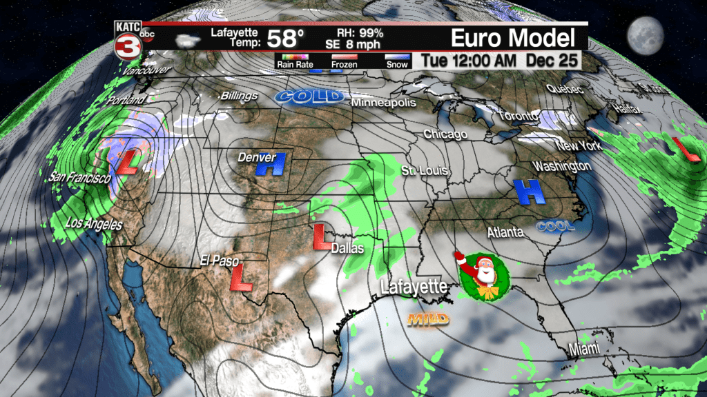
Christmas Day should be partly to mostly cloudy and mild with temperatures pushing into the lower 70s.

Rain chances should be minimal Tuesday, but will increase slightly Wednesday ahead of a series of storms systems carried in the sub-tropical jet stream that will likely make for an unsettled and wet latter part of Christmas Week.
A good chance of showers and storms will return to the area Thursday, with lingering showers likely Friday.
More rain is possible into the following weekend as temperatures gradually get cooler from Friday through Sunday.
Latest Long Range Computer Models:
 European Model Forecast Day 1


