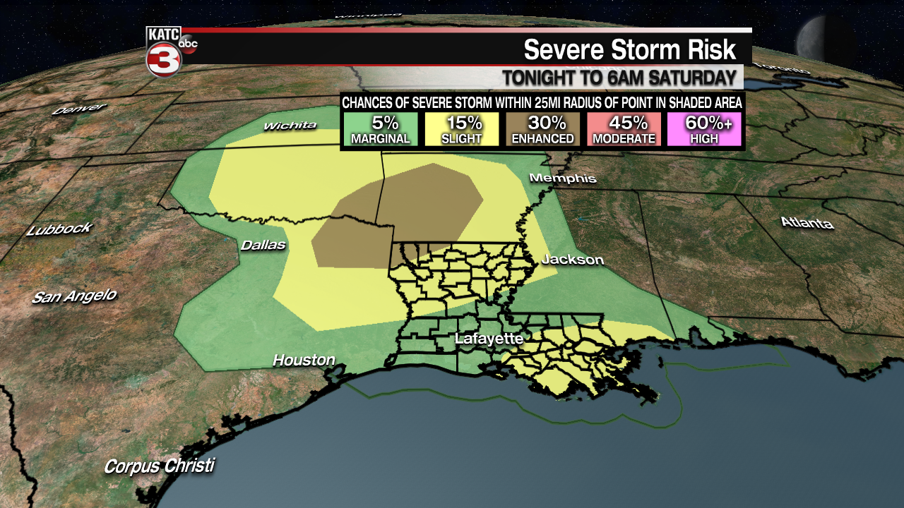
Per the Storm Prediction Center (SPC), most of Acadiana is hatched in for a “Marginal Risk” of severe storms into the overnight hours with a “Slight Risk” for Iberia and St Mary Parishes, especially closer to daybreak.
Most of Acadiana is in a marginal risk primarily because most of the severe weather parameters meteorologists examine are not in sync with when the best chance of storms may occur across the area.
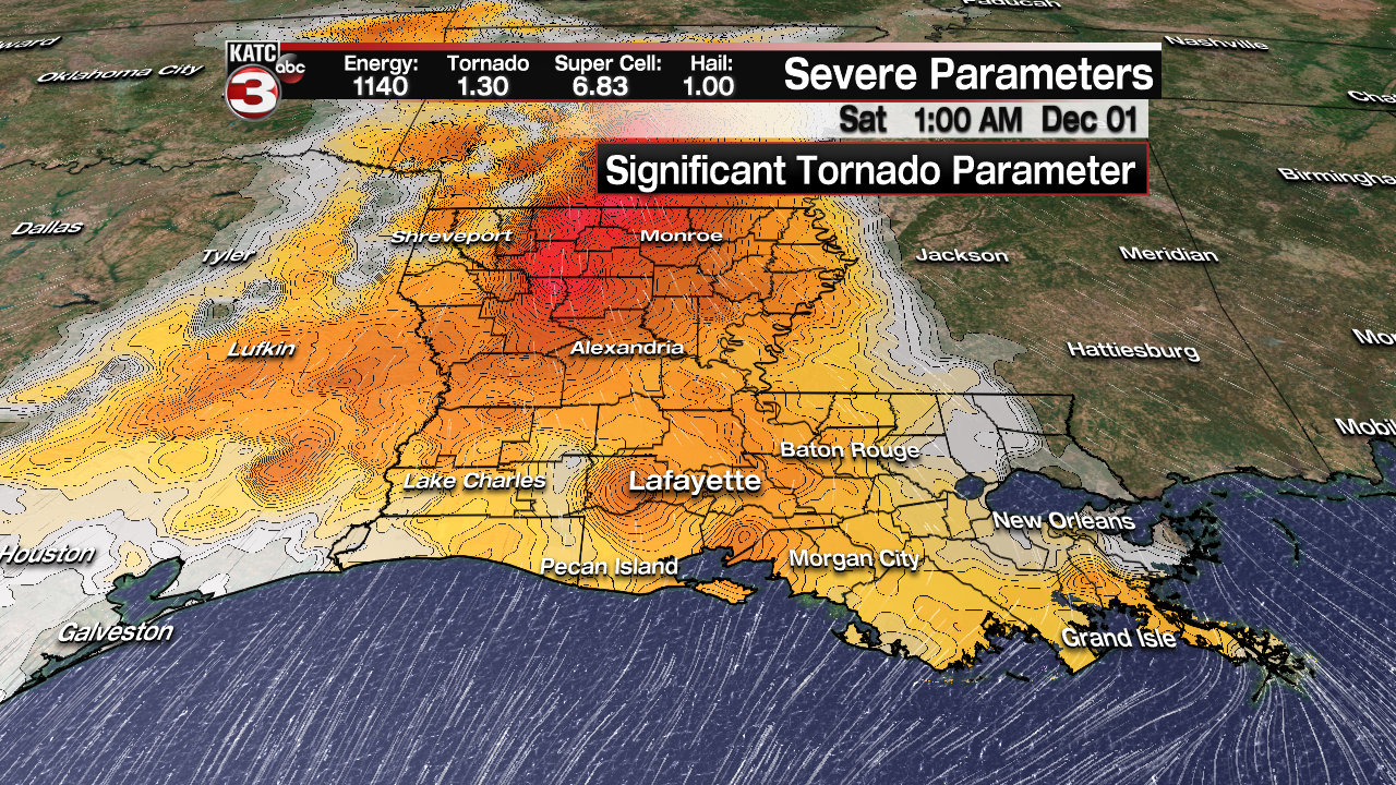
It appears that the best severe weather dynamics will be in the Acadiana region from 10 pm through about 5 am, but Predictive Radar indicates our best chance of storms will be mainly early this evening, and then perhaps closer to daybreak when severe storm dynamics will weaken for most.

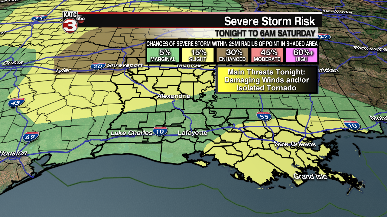
Any thunderstorm cells that develop overnight however, will be closely watched for signs of rotation.
Wind damage and isolated tornadoes will be the primary mode of severe storms should they develop in the Acadiana area.
Stay weather aware through tonight and follow KATC, katc.com and social media platforms for the latest.
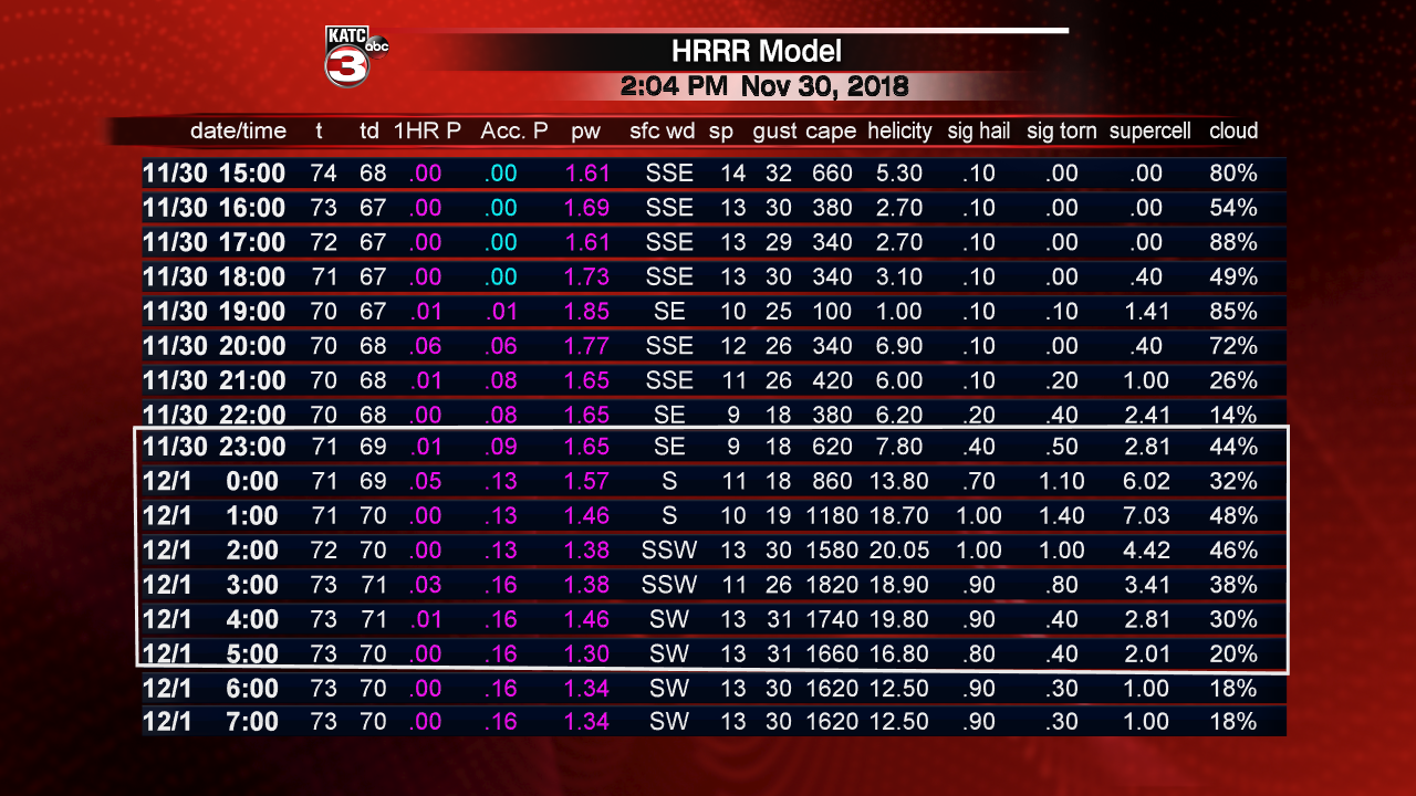
Latest Predictive Radar:
 Predictive Radar (HRRR Model) 1 Hour Forecast


Latest Radar:
 Power Doppler HD Acadiana View


Meanwhile, the greatest risk of severe weather this evening and tonight will be from Northeast Texas, Southeast Oklahoma, much of Arkansas and Northwest Louisiana where storms containing large hail, damaging winds and isolated tornadoes may develop.