
In the wake of Friday evening’s shower system, expect foggy conditions to develop overnight and into and for the start of Acadiana’s Saturday.
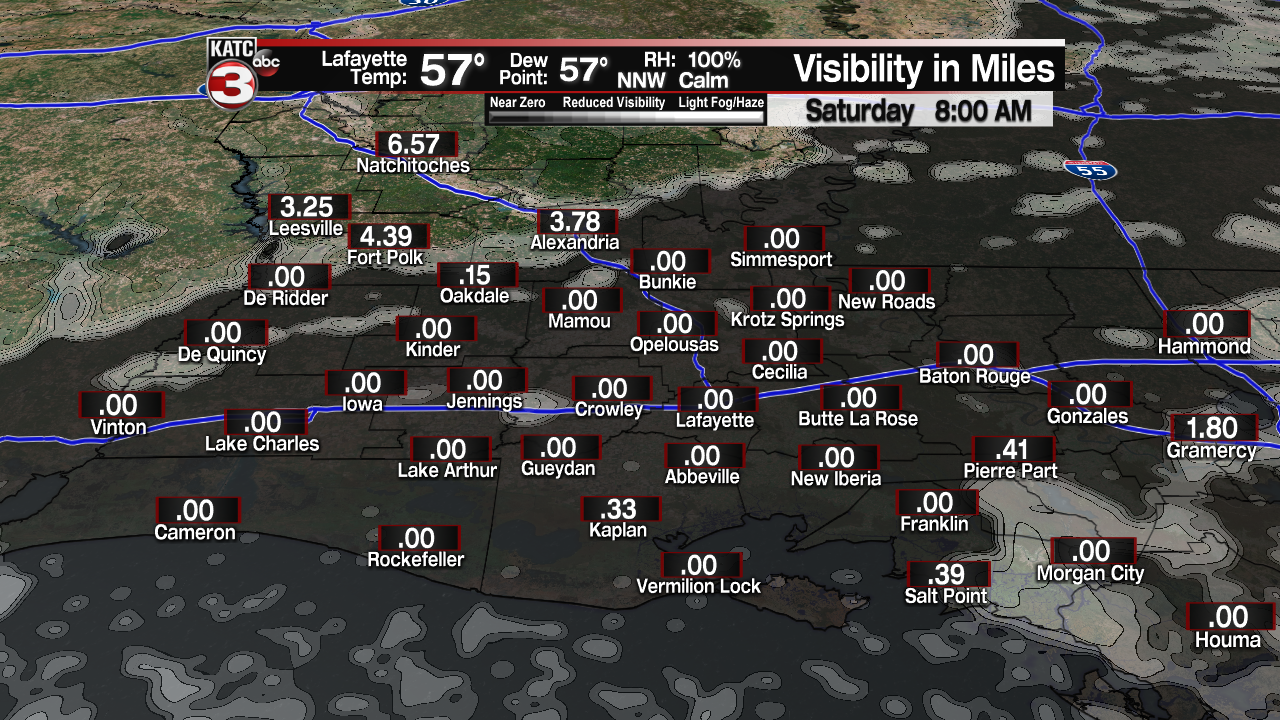
The fog will likely set in after midnight, with lowest visibilities developing toward daybreak and lasting up until 8:00 to 9:00 am.
The FutureCast Fog Model has been consistently forecasting visibility to drop down to near zero in many locations by morning, signalling the threat of the very thick, “pea-soup” style fog.
Latest Current Visibility and Fog Forecast:
 Current Visibility


So please allow extra time to get where you are going for early morning travel plans, slow down, and keep the low beam headlights on until you reach your destination. Remember, even if you can see, you want to be seen by others.
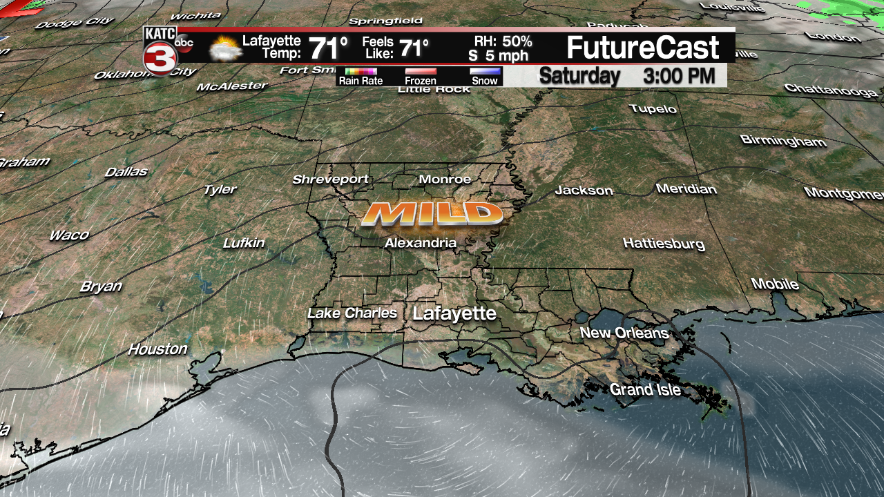
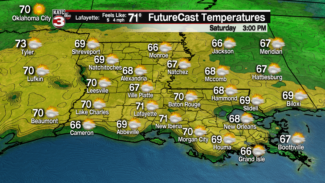
The fog and associated clouds will begin to lift and break-up mid-morning Saturday, with mostly sunny skies and temperatures warming from the mid-50s in the morning to the lower 70s for the afternoon.
Quiet weather will continue into Saturday night/Sunday morning with the chance of another round of fog, but it may not be as widespread, nor as thick, as what is expected for Saturday morning.
Sunday will be partly to at times mostly cloudy and warmer with temperatures reaching the mid to perhaps upper 70s.

But a vigorous cool front will be on the way late Sunday, possibly sparking off a few scattered showers or even a thunderstorm into Sunday afternoon/evening…no severe weather is anticipated at this time.
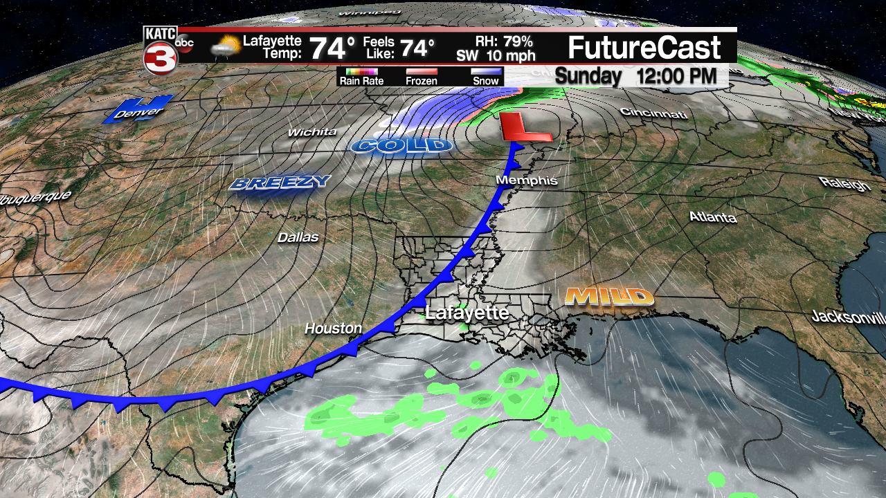
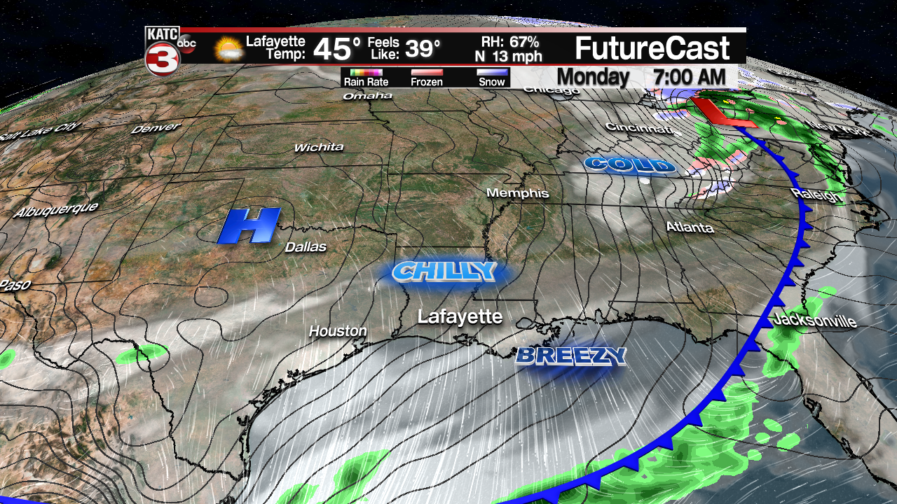
After a balmy day in the mid-upper 70s Sunday, temperatures will plummet overnight into Monday morning with readings dropping into the mid-40s. And gusty northerly winds could bring wind chills back into the 30s too!
Breezy and cool weather will be the hallmark of Acadiana’s Monday, and in spite of mostly sunny skies, temperatures will barely reach the mid-50s for an afternoon high.
The weather stays fair (with in and out high cirrus clouds) and seasonably cold through Wednesday, with lows dropping into the mid-upper 30s for both Tuesday and Wednesday mornings…there could be frosty conditions on either of those mornings, so keep that in mind for your tender vegetation.
Thereafter, milder temperatures should return toward the end of next week and into the weekend, but the models are starting to point to the possibility of a more significant weather system to bring rain (some possibly heavy) and perhaps the risk of strong storms next Saturday.
Lately, the extended forecast beyond 5-6 days has been “flip-flopping” with regularity (as it can often do into the winter months), so we’ll see if this will be a trend, or we have something different for you tomorrow.
Here’s the most recent run of the European Model:
 European Model Forecast Day 1


