Portions of Acadiana have seen a light passing shower this afternoon but the heavier rains and storms will arrive closer to midnight and continue on and off on Monday as we have 2 systems heading for the region.
The first system is a warm front lifting north off the Gulf producing rounds of heavy showers and a few thunderstorms this evening mainly south of the interstate.
Here is a look at the Predictive Radar showing the latest timing on the showers and storms arriving early Monday morning.
It is with this front that we will have to watch any storms that do develop as there could be enough warm air and instability to create some large hail.
Then late Monday morning we might get a break before a strong cold front sweeps across Acadiana producing another round of scattered showers and storms.
Here is the latest Futurecast to showing the timing of this cold front.
With this front one or two storms that develop out ahead of the system could produce damaging wind gusts up to 60 mph.
Thus, for these reasons the Storm Prediction Center has Acadiana under a marginal risk(5%) for severe weather on Monday.

The good news is with the latest few model runs the rainfall amounts are coming down a little bit as most of Acadiana will receive a good soaking of 1-2 inches of rain but there is a chance we could see showers train over the same spots which could produce up to 3-5 inches of rain and lead to the possibility of minor flash flooding in the usual locations.

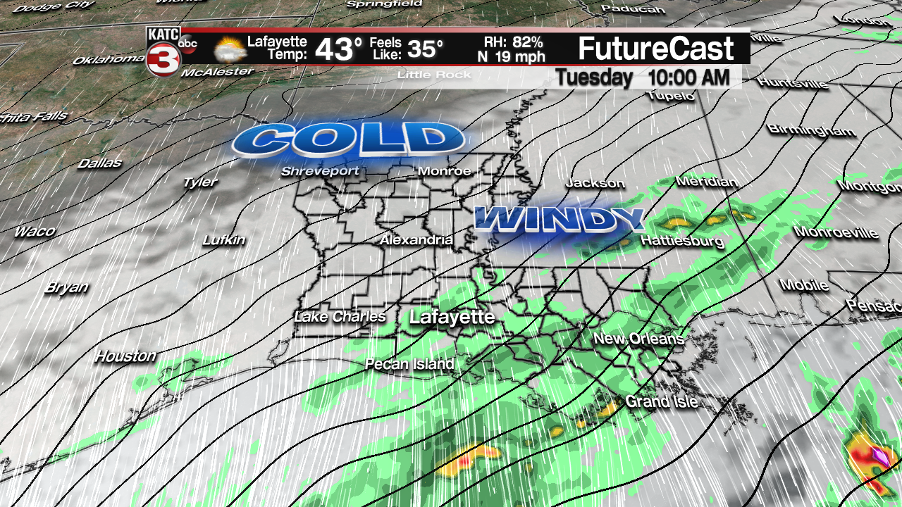
The cold front should push off to the east Monday evening but we could still have some scattered light showers overrun the front and linger into the Tuesday morning.

Once the rain does end it is still going to be a cloudy, windy and cold day on Tuesday with highs only in the mid 40s with wind chills most of the day in the mid to upper 30s so make sure you have the heavy jackets and maybe even hats and gloves.
Wednesday morning lows still look to bottom out in the low to mid 30s meaning our first frost/freeze looks like a good possibility.
Sensitive vegetation will need to be protected and pets brought inside Tuesday night but this will not be a pipe bursting cold.
Wednesday afternoon we will finally begin to see a few peeks of sun through the high clouds but it will still be another cold days with highs in the upper 40s.
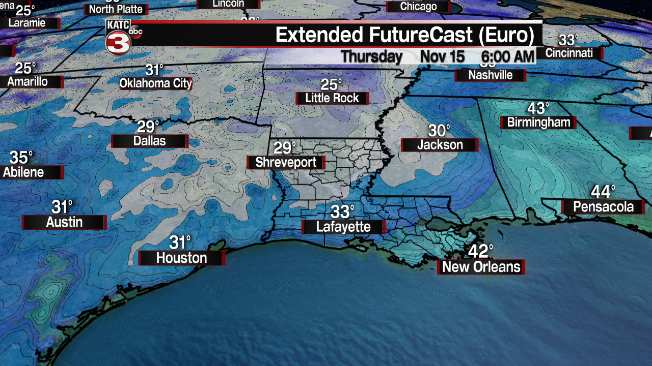
Lows will dip down near the freezing mark Thursday morning but not a pipe bursting cold.

Thursday with plenty of sunshine highs will warm back into the mid 50s and lows Friday morning will stay above freezing for most of Acadiana but another frost is likely with lows in the mid to upper 30s.
Friday into next weekend we should have some beautiful fall-like weather in Acadiana with bright sunny skies and highs in the low to mid 60s and lows in the low to mid 40s.


