
(Note to limited time for our election coverage, the WeatherCast above was cut from the 6pm newscast…but graphics are updated below-Rob)
After another round of fog with temperatures in the lower 70s for Acadiana Wednesday morning, look for another warm and humid day with a pretty good chance of scattered showers and thunderstorms.
 Current Visibility


Best rain chances Wednesday, near 70%, will be from mid-morning into the afternoon hours.


Temperatures will once again broach the lower 80s Wednesday, but a cool front will slide southward through the area by Wednesday evening.
Expect rainfall totals through Wednesday evening to be in the 1/2″ range for most folks, but up to an inch or two may be possible in spots.

While temperatures could be 5-10 degrees cooler into Thursday, there will still be the chance of scattered showers (at 40%) and perhaps a slight chance of a thunderstorm.
 Futurecast 3 Hour


A stronger cold front will arrive in the area by Friday morning, but an active upper jet stream and over-running southwesterly winds aloft, will lead to an excellent chance of periods of rain…another inch of rain will be possible.
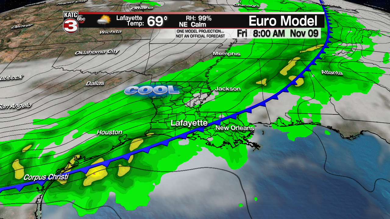
Rain shower activity should be going Friday morning into the afternoon but should begin to diminish Friday evening.
Here’s the kicker…temperatures should cool into the 50s Friday morning and that’s where they may likely stay all day long!
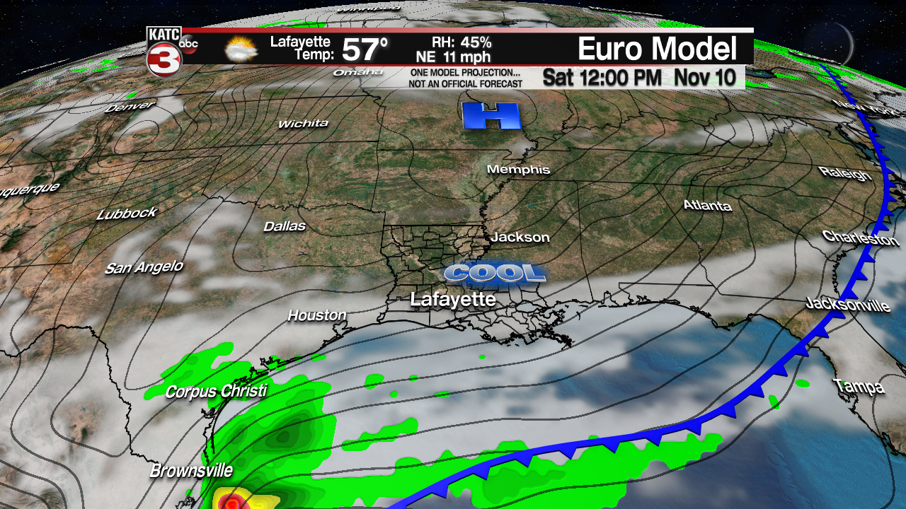
It’s going to be a cool weekend with clouds clearing out only briefly Saturday, but they will likely rebuild into the region by late in the day as a disturbance, riding along the frontal boundary in the Gulf likely induces low pressure development and casting a shield of rain, perhaps a few storm Sunday.
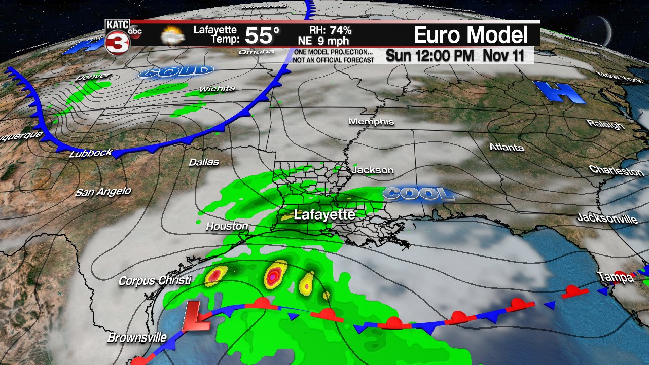
Temperatures this weekend will be cool with highs in the upper 50s to lower 60s Saturday, dropping into the mid-40s Friday and Saturday nights, and may stay in the 50s again Sunday with clouds and rain locked in the area.
But wait, there’s even colder air on the way!
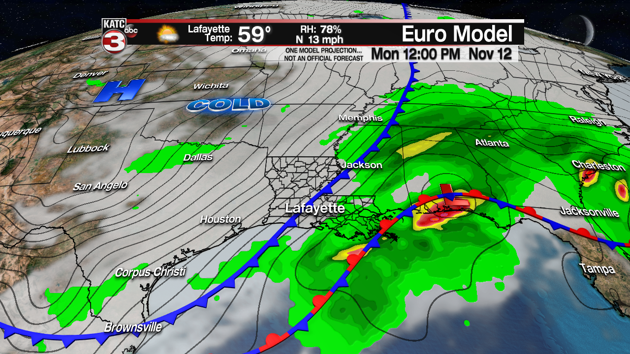
A Canadian ridge of high pressure will advance toward the Gulf Coast pushing Sunday’s system off to the east with progressively colder air spilling into the region through mid-week.
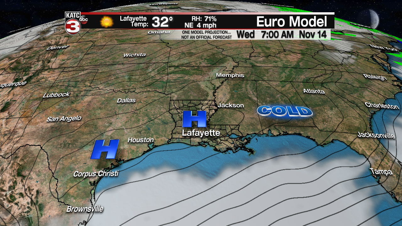
While it’s still a week away, it’s interesting to note that both GFS and Euro Models give Acadiana the chance of our first frost, perhaps light freeze, by Wednesday and/or Thursday mornings…we’ll see as the models can “give-ith and take-ith” away from day to day, but the consistency in their outputs today gives us some confidence in the forecast.
