
The weekend will start off on a sunny and cool note for Acadiana, but it will likely finish a little more unsettled Sunday, with a pretty good chance of scattered showers and a few thunderstorms.
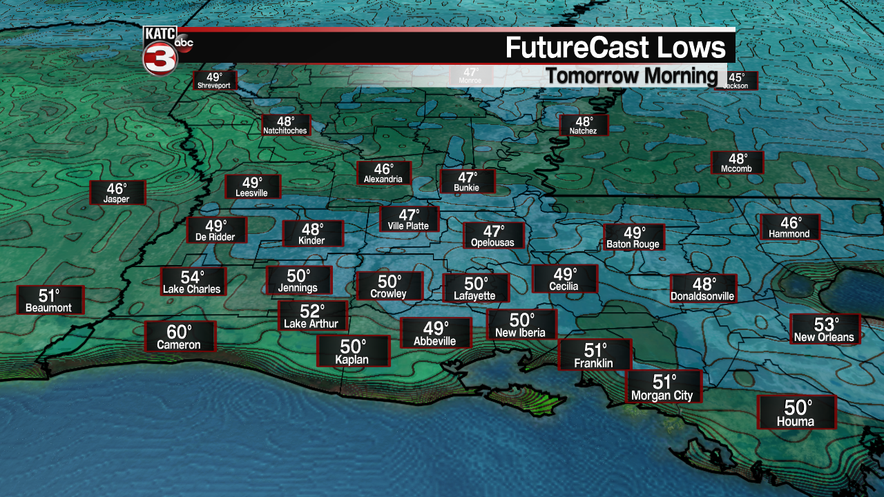
Early morning temperatures Saturday will range from the mid-upper 40s northern sections of the area closer to near 50 along the I-10 parishes, and lower 50s along the coast.
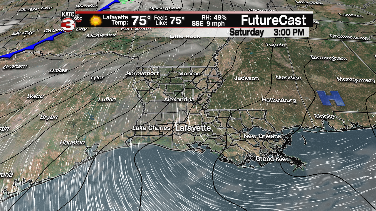
Look for lots of sunshine and milder temperatures Saturday with breezy S/SE winds near 8-16 mph during the afternoon.
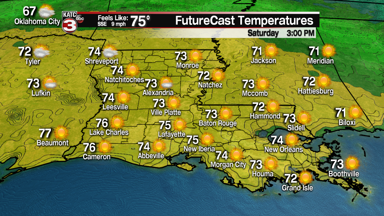
The gulf breezes will likely usher in some clouds during the afternoon, but overall it will be a beautiful day with highs topping out in the mid-upper 70s.
A fizzling frontal trough will be advancing southeastward toward the area Sunday, but it should have enough dynamics to generate scattered showers and a few thunderstorms, with Friday’s FutureCast Model favoring the morning into the early afternoon for the highest rain chances…near 60%.

If storms do develop Sunday, severe weather is not expected.
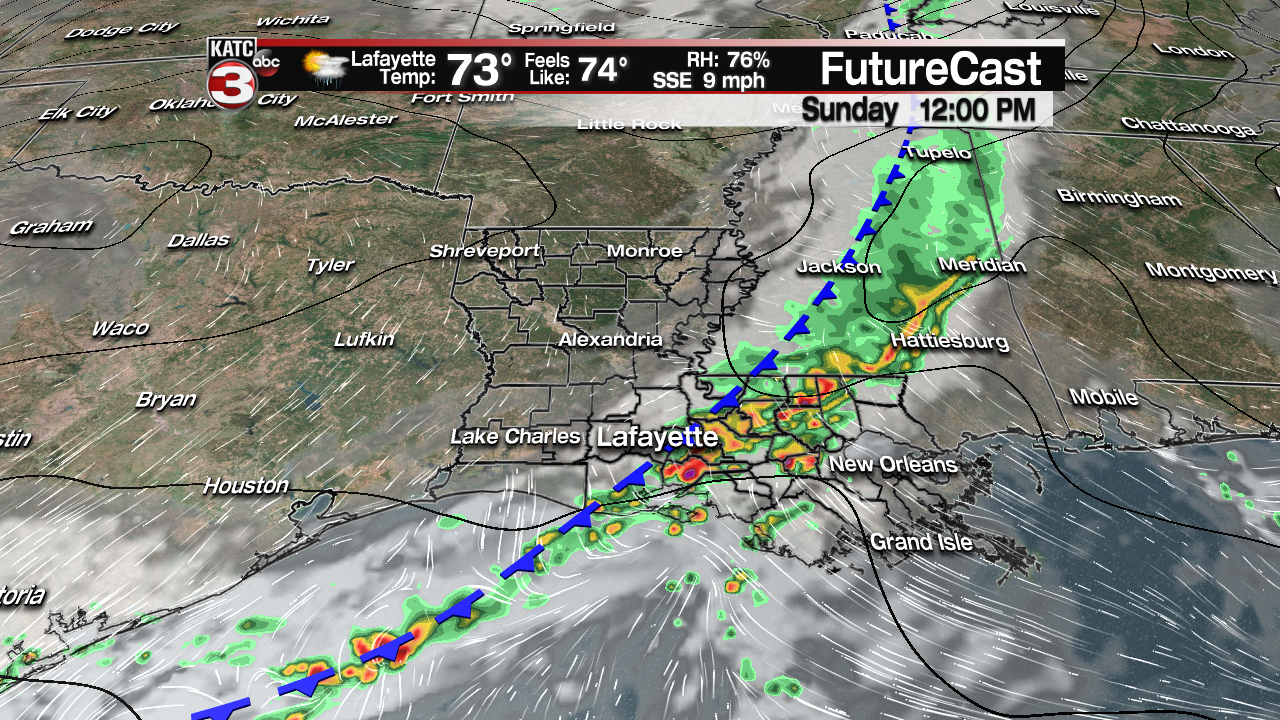
The timing of the rains Sunday could change, so follow the latest model runs here:
 Futurecast 3 Hour


Next week the pattern remains quite unsettled with slight rain chances on any given day through mid-week, but perhaps there could be another round of potentially hefty storms as soon as the overnight hours Monday.

Although not as strong and dynamic locally as Louisiana’s weather system this past week, there could be the risk of a few severe storms late Monday night, per the Storm Prediction Center.
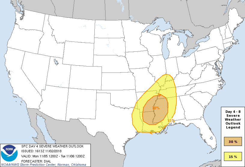
The best dynamics for severe storms this time around should be just north of our area…but we’ll see…if moisture return before Monday night’s system is more robust than currently anticipated, a more significant severe weather threat could materialize.
After a period of unsettled weather through mid-week, the forecast looks to get definitively more interesting toward the end of next week with a fairly strong front arriving and generating more shower and perhaps thunderstorm activity, Thursday.
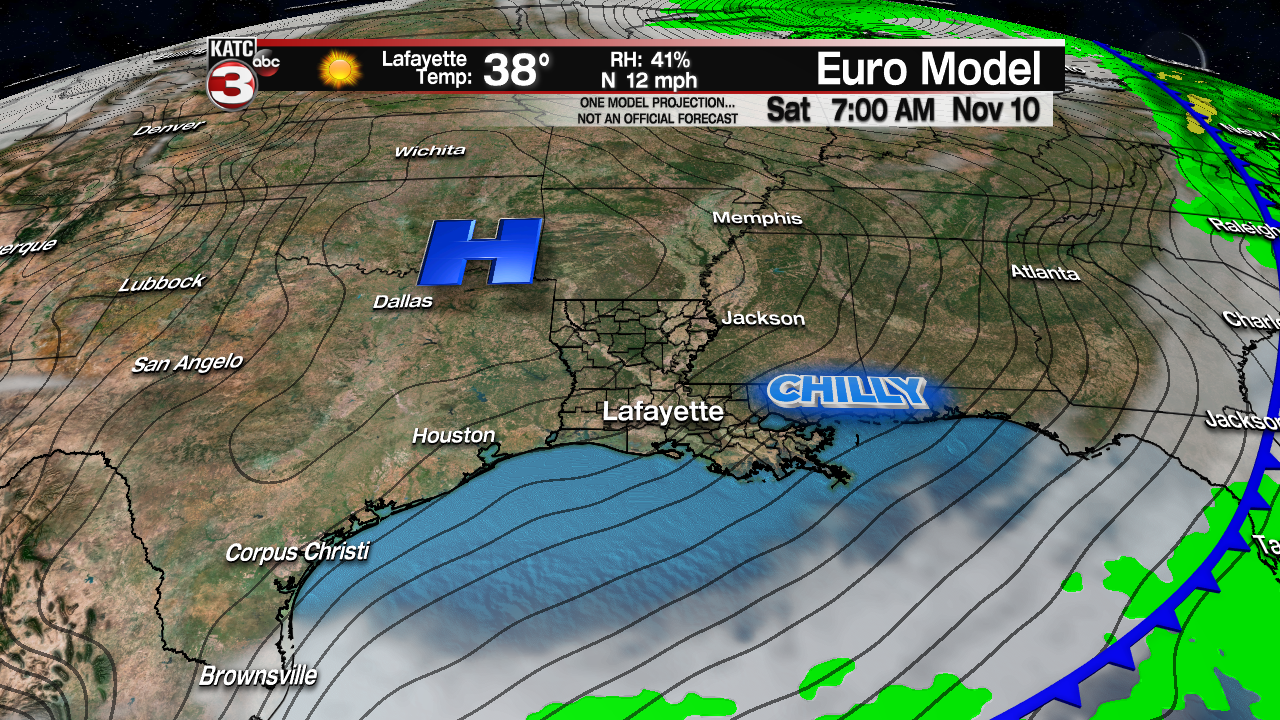
The high pressure system that will follow will be of Canadian origin and it could deliver the chilliest temperatures of the fall season to date.
Models remain at odds at how cold it may get into next weekend…but morning readings in the upper 30s would not be unusual for this time of year, nor would it be surprising.
As always in the fall (and winter, and spring) across Louisiana, there can be wild forecast and temperature swings, so stay tuned for more changes to both to come!
Latest European Model:
 European Model Forecast Day 1


Have a great weekend!
