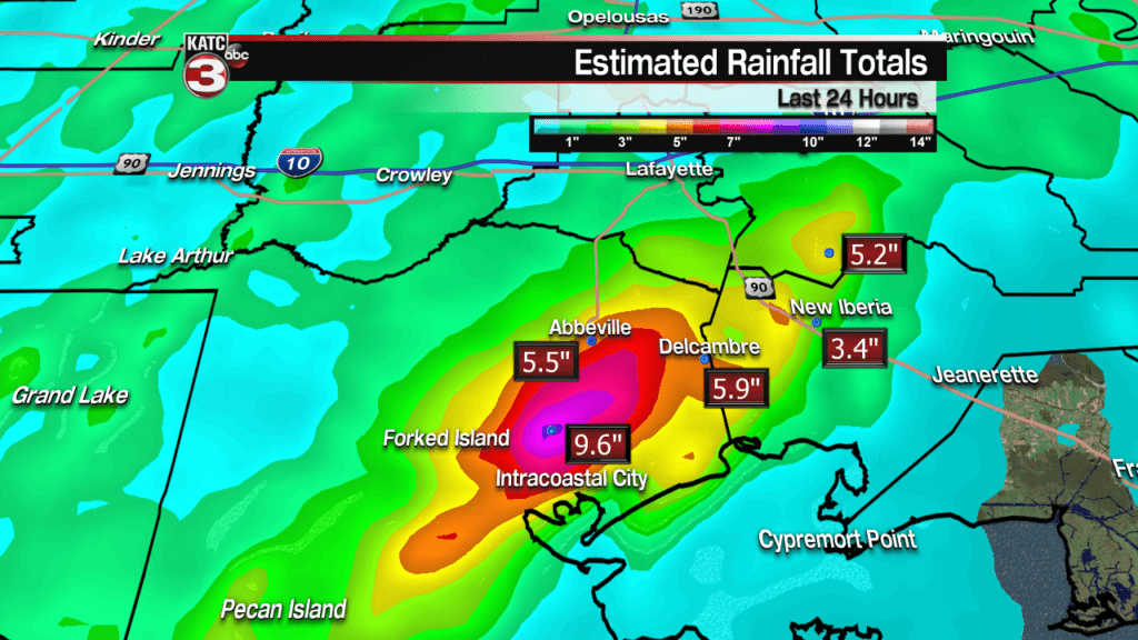
Thankfully most of the rain has stopped and many places are drying out after this morning’s heavy rain event across Iberia, Lafayette, St. Martin and Vermilion Parishes caused widespread flooding as 6-12 inches of rain fell.

Outside a stray shower/sprinkle most of Acadiana should stay dry tonight with lots of clouds and cool temperatures as lows will bottom out in the upper 50s and lower 60s.

Wednesday morning the cool/stationary front could still be located along the coast so an isolated shower will be possible, especially for those areas closest to the Gulf.
Good news is winds should pick up out of the north at 10-15 mph Wednesday afternoon sending the front way out into the Gulf ending the rain chances but those winds will add an extra chill to the air with highs struggling to reach the lower 70s.
Futurecast Winds
Thursday we should finally get rid of the clouds and allow for sunshine to return across Acadiana warming highs into the mid to upper 70s but it will still be breezy with winds out of the north at 10-15 mph.
The warm weather will continue Friday as temperatures will get back into the low to mid 80s under partly sunny skies.
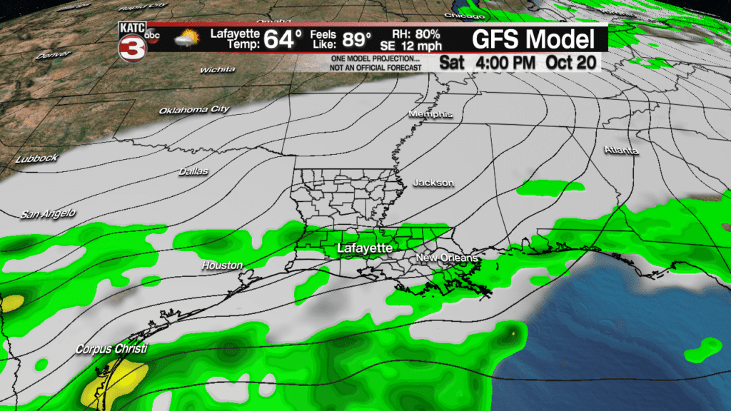
However, Friday afternoon with the warm and humid conditions that could spark off about a 30-40% chance for scattered showers and a few storms in advance of our next cool front.
That front will then slide through Acadiana on Saturday creating the chance for scattered showers and a few storms but it will not be a wash out.

But the front will bring another shoot of fall like temperatures as highs on Saturday will fall into the mid 70s thanks to the clouds and chance for rain.
Then behind the front lows Sunday morning could dip into the mid 50s.
After the cool start highs will only push the lower 70s Sunday afternoon under partly cloudy skies.
Our next real weather maker looks to arrive the following Wednesday into Thursday as a strong low pressure and associated cold front could swing through Louisiana producing heavy rains and the possibility of severe weather.
European Long Range Model


