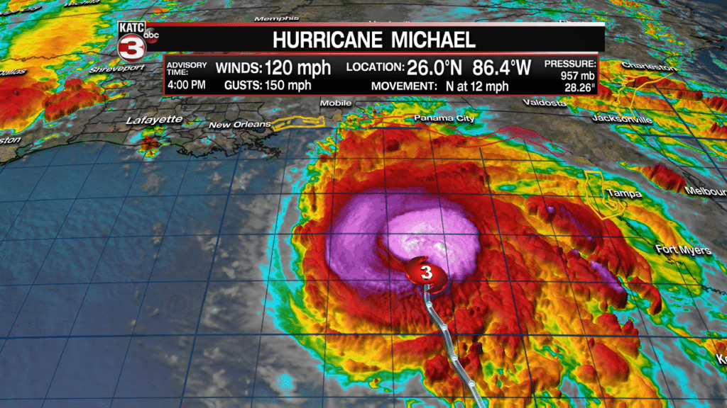
7PM update: Hurricane Michael is getting better organized with a tight eye forming around strong convection storms. Winds are holding at 120 mph but pressure has fallen drop to 953 mb.

- – – – – – – – – – – – – – – – – – – – – – – – – – – –
With the 4PM update Michael has strengthen to a major category 3 hurricane with 120 mph winds and gusts up to 150 mph.

The new track forecast has Michael making landfall as a major hurricane with 125 mph winds near Panama City Beach, Florida Wednesday afternoon.

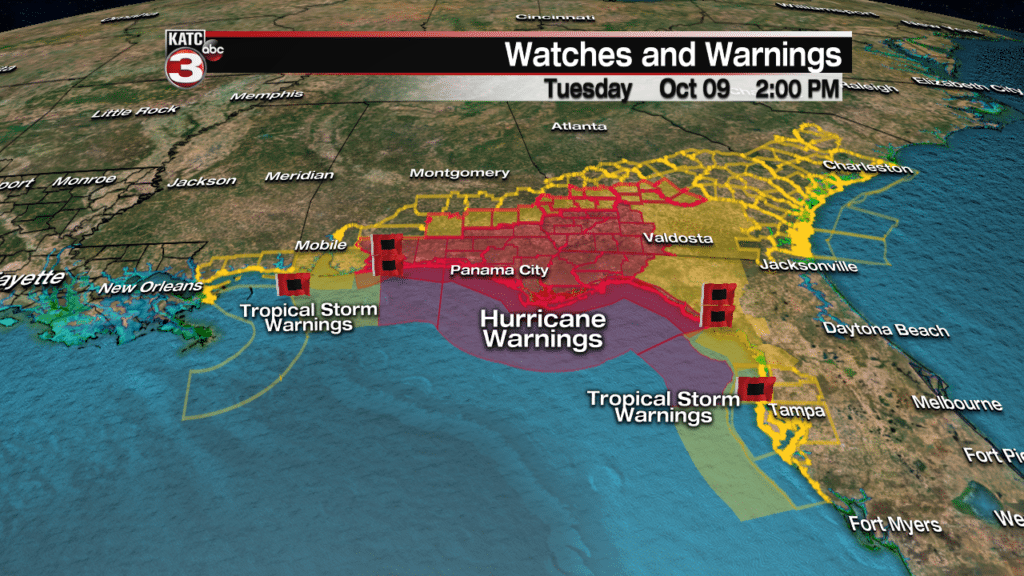
Hurricane warnings have been issued from the AL-FL border to the lower Big Bend region of Florida and up into the southwest region while tropical storm warnings are up for portions of Alabama, Georgia, Mississippi and even up into South Carolina.

This is shaping up to be a very dangerous situation for many on the East Coast with many forms of potential impacts.
The main impact with be the winds which will be as high as 125-130 mph near the eye as it makes landfall with a large area along the entire Florida panhandle over to Mobile and halfway up into Georgia expected to experience tropical storm force winds of 40 mph or greater.
These powerful winds are likely to cause widespread power outages for many along the Florida coast and up into Georgia and possibility the Carolinas.
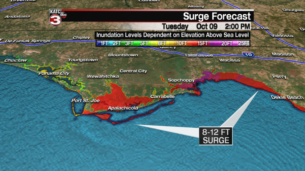
To go along with the powerful winds storm surge is going to be a major issue for areas from Panama City Beach to the east through the Big Bend region with the possibility for some areas to see a surge as high as 8-12 feet.

This portion of Florida has now seen a potential storm surge like this in decades so this wall of water could cause massive damage to the shoreline and buildings that have been built right along the water.
On top of the water from storm surge Michael is going to bring heavy rains to a large area of the east coast with portions of Florida, Georgia and up into North and South Carolina having the possibility of seeing 5-8 inches of rain, which will likely cause flash flooding.

And if all that was not bad enough as Michael makes landfall Wednesday afternoon it will also bring with it the threat for severe storms in the outer bands which could produce tornadoes for central portions of Florida and up into Georgia.

