Expect another round of scattered tropical showers and a few thunderstorms for Acadiana Tuesday, but drier and eventually cooler weather is on the way!
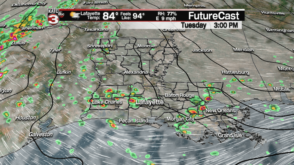
Plenty of tropical moisture will be pooling well to the northwest of Hurricane Michael and ahead a frontal trough that will be pushing toward the area by Wednesday.
This trough will steer what will be a very dangerous Category 3 Hurricane Michael toward the Florida Panhandle.
Expect near a 60% chance of shower activity locally Tuesday with brief, locally very heavy downpours and lightning possible, and perhaps a few tropical funnels when activity starts up during the mid-morning/early afternoon.
Activity will taper into the evening hours Tuesday, with drier, but still quite warm conditions anticipated Wednesday.
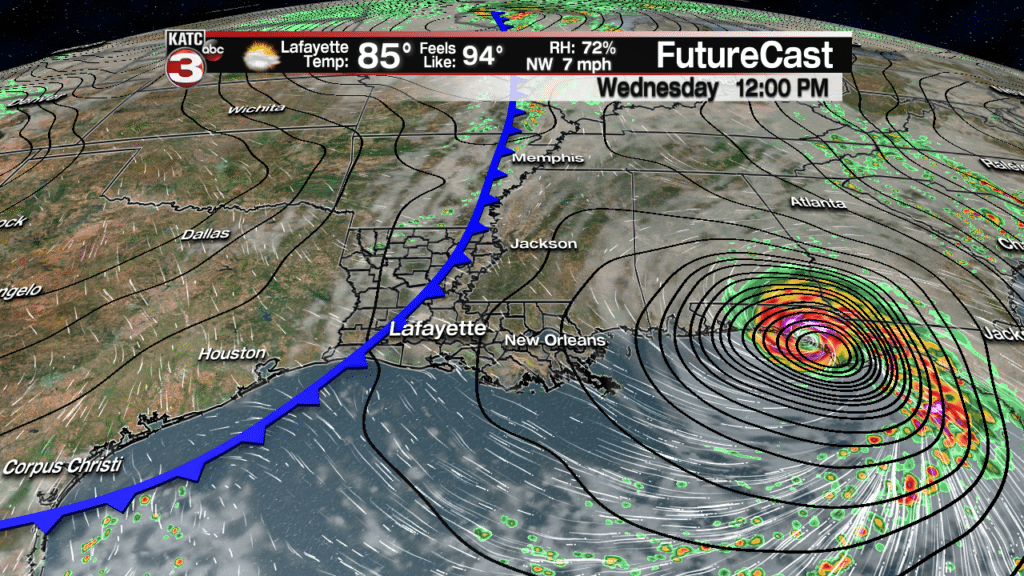
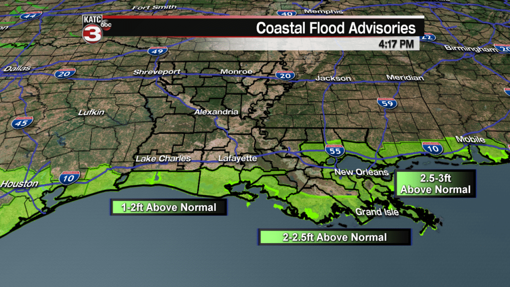
Breezy easterly winds Tuesday will turn northeasterly Wednesday, but the combination of easterly winds and big swells emanating away from Michael in the Gulf of Mexico will push local tides a couple of feet above normal.
Offshore Wind Observations and Forecasts:
Tides will decrease with the onset of northeasterly winds Wednesday and after Michael makes landfall.
Flood Advisories have been issued for the entire Louisiana Coastline in response to these conditions.
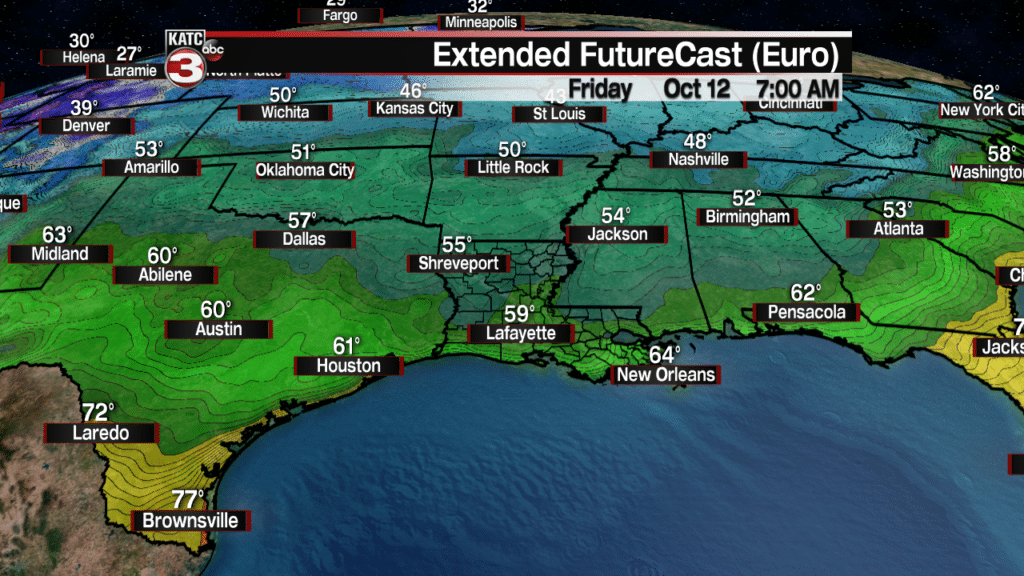
Cooler air will follow a Wednesday cool front, especially into the latter part of the week into the weekend with low temperatures likely heading for the mid-upper 50s by Friday and Saturday mornings!
High temperatures Thursday through Saturday will be in the upper 70s to lower 80s with mostly sunny skies accompanied by comfortable humidity.
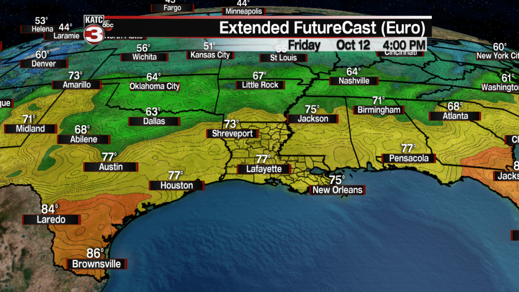
A return flow by Sunday could bring clouds and a few showers back by Sunday afternoon.
Meanwhile in the tropics, it is all about Hurricane Michael.
Michael is expected to become a major, Category 3 storm with landfall expected as a major storm in the Western Florida Panhandle by Wednesday afternoon.
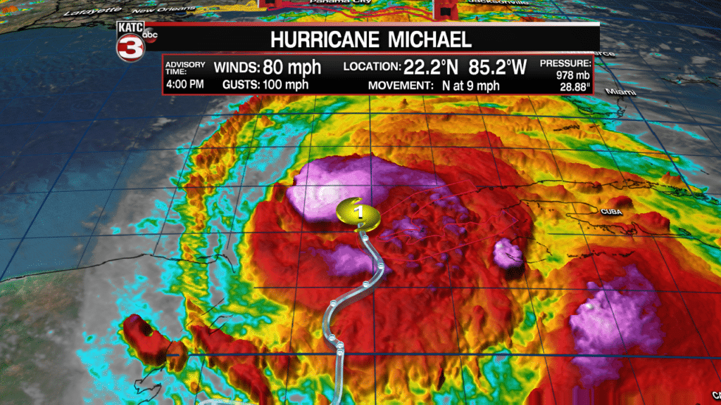
In addition to a wind-damaging storm, storm surge could be as high as 8-12 feet near and within 100 miles east of where the center makes landfall.
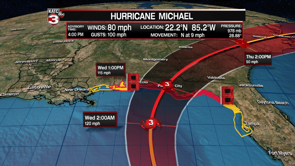
Per the National Hurricane Center (NHC), as of late Tuesday afternoon, Hurricane Warnings were issued for the Gulf Coast of Florida from Alabama/Florida border eastward to Suwannee River while Hurricane Watches were issued from Alabama/Florida border westward to the Mississippi/Alabama border.


