The pleasant weather of the past couple days is over as high pressure slides off to the east creating a return flow off the Gulf.
This is causing humidity levels to creep back up to sticky and oppressive levels again as feel like temperatures Sunday afternoon will top out the triple digits.
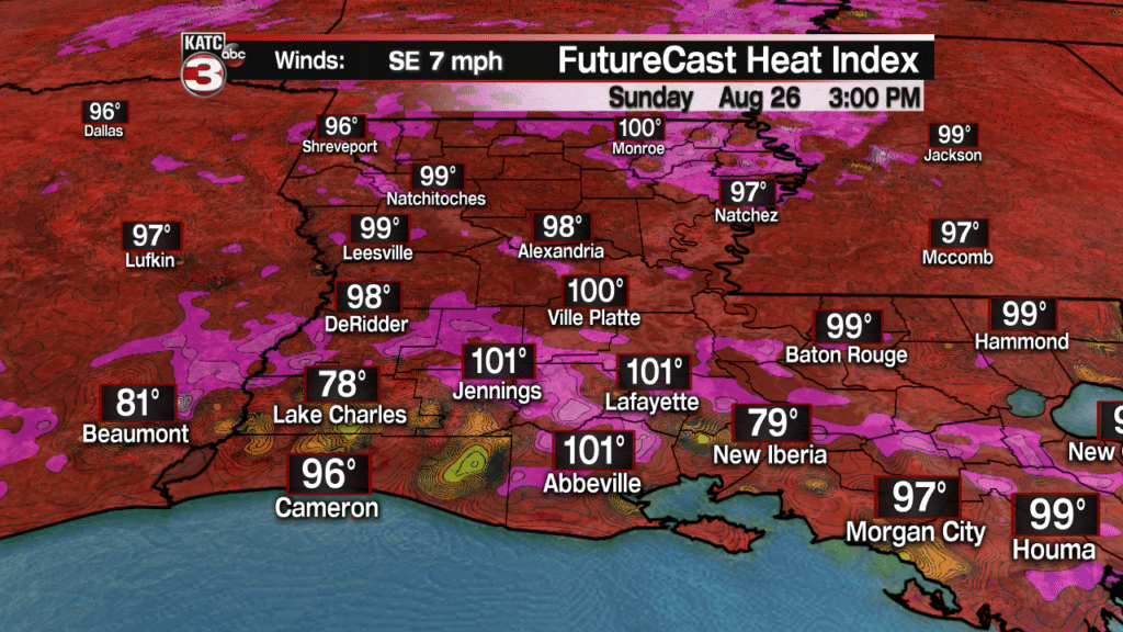
Also, with this extra moisture in the atmosphere that will allow for the daily pop-up showers and storms to return during the afternoon on Sunday.

This summertime pattern looks to continue into the first half of the upcoming work week meaning we will have more hot and humid days with a 30-40% chance for scattered showers each afternoon Monday through Wednesday.


For the second half of the work week an upper level high will be tracking to the west through the southwest sending us a bit more stability in the air dropping rain chances to just 20% each afternoon but it will still be on the hot side with highs in the lower 90s.
Early look at your Labor Day weekend forecast reveals a typical summer-like forecast with hot temperatures in the 90s and the chance for a few isolated to scattered showers and storms during the afternoon but I would not cancel any outdoor activities just make sure you have a place to seek shelter if one of these showers does fires up over your event.
