The much anticipated “cool” front has pushed out into the Gulf and is ushering in drier air over Acadiana.
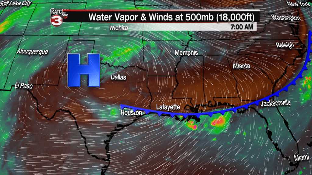
Now this drier air has caused lots of evaporation this morning leading to a layer of low clouds to start the day.
These clouds will eventually burn off giving way to plenty of sunshine this afternoon heating temperatures into the mid 90s.
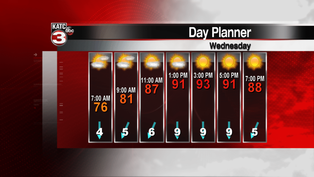
Although it will still be hot it will feel more comfortable today as heat indices will only be a couple degrees higher than the actual temperatures so we are getting a break from the triple digits.
The best thing about this front and drier air is that temperatures will cool off nicely at night as lows Thursday and Friday morning will be in the upper 60s and upper 70s.

Thursday and Friday will then be a carbon copy of today with lots of sun and highs in the mid 90s.
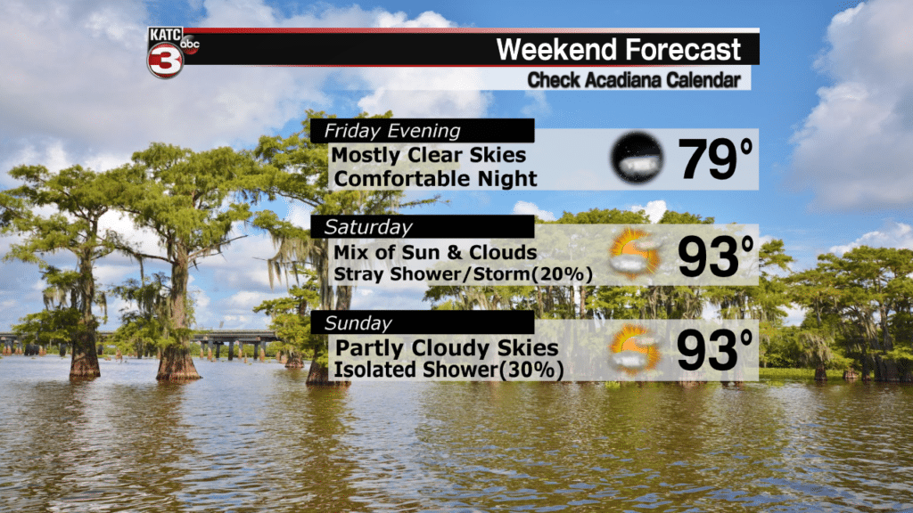
Looking ahead to the weekend the forecast looks good but winds will begin to turn out of the ESE gradually pushing Gulf moisture back over Acadiana making it feel a bit more humid and producing more clouds to bubble up during the afternoon and maybe a slight chance(20-30%) for a few showers.