Forecasting can be tricky, we got a taste of that this week when we missed out on the rain, forecasters are deal with systems that span the country to barely covering a neighborhood all of which impacting each other and impacting the forecast.
This can get particularly tricky when dealing with the boundaries of systems because minor moves can drastically impact the forecast, and this week we are dealing with one such boundary.
The front that moved across Acadiana on Tuesday has stalled on the other side of the Atchafalaya Basin giving us just enough clearance to get that dry air to filter in, seriously we barely made the cut.
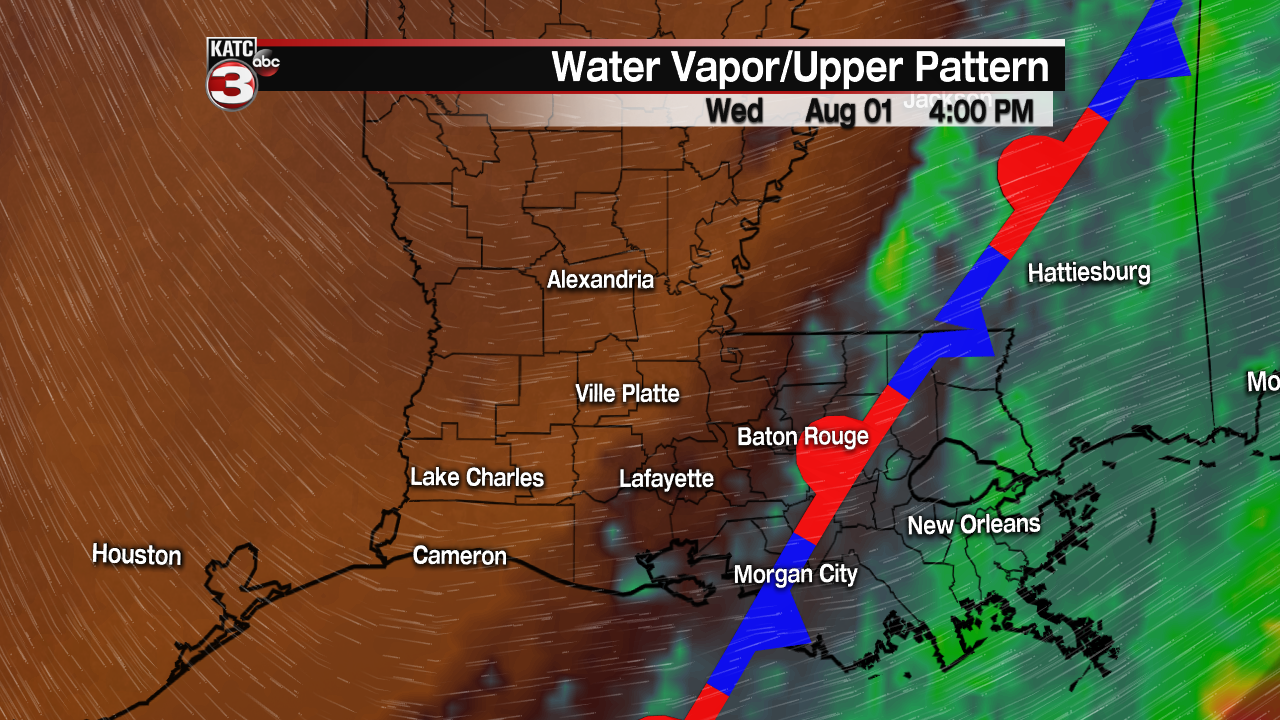
Some of that moisture can even be found in east Iberia Parish and St. Mary Parish which will likely be a little warmer overnight Wednesday into Thursday morning.
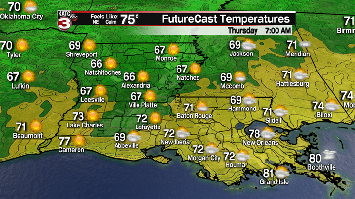
The rest of Acadiana, especially west and north Acadiana, will get a "comfortable" morning Thursday (this is August comfortable and shouldn’t be compared to the comfortable of the fall months).
Look for Wednesday lows to sit around the 70 degree mark in and around Lafayette and areas to the south, while north of I-10 and west of I-49 we may even end up with a few upper 60s.
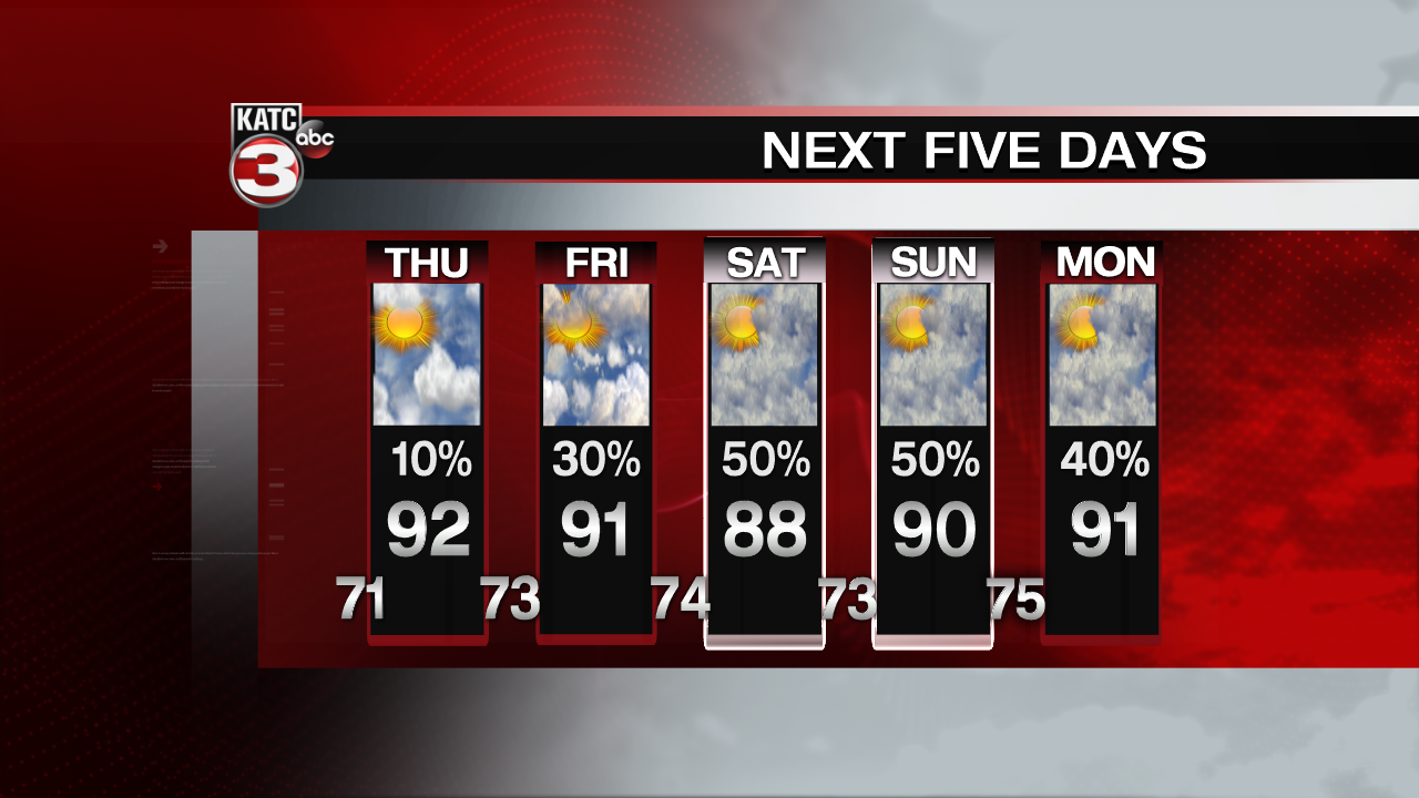
Skies will remain mostly clear Thursday and even if a few showers try and develop dry air aloft will choke them off and won’t give them a whole lot of breathing room, so will leave a 10% in the forecast.
Even if you find yourself in the 10% rest assured it won’t last long and will be moving along almost as quickly as it pops up, which is to say it won’t have much of an impact.
The front will start to back up though on Friday pushing that moisture back in place and keeping the door open for daily afternoon showers to pop up through the weekend and into next week.