Plenty of sunshine to get our Thursday started helping to quickly warm temperatures up as highs will get back into the lower 90s this afternoon with heat indices topping out in the mid to upper 90s.
This afternoon I am watching an upper level low that is heading our way from the East which will spark off scattered showers and storms across Acadiana.

We will have to watch these storms closely as a couple could be on the strong to severe side as the Storm Prediction Center has placed all of South Louisiana under a marginal risk(5%) for severe weather with gusty winds up to 60 mph, heavy downpours and lots of lightning as the main threats.

The showers that do fire up today will fade later this evening once the sun goes down and it should be a quiet night with lows in the mid 70s.
Friday looks to be more of the same with morning sunshine followed by a 50% chance for hit or miss showers and storms during the afternoon.

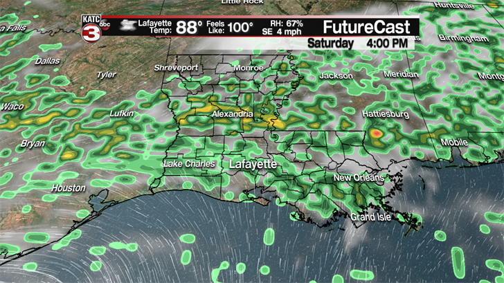
The unsettled weather pattern will continue this weekend as a weak frontal boundary will try to swing down from the north helping to spark off more scattered showers and storms Saturday afternoon.
Sunday a weak low and tough will try to develop over the region producing another round of on and off showers and storms throughout the day.
It is summertime so any of these passing showers and storms can produce some heavy downpours but they will not last long so flooding should not be an issue as we are still really behind on rainfall for the year so these showers are much needed.

Looking ahead to next week we return back to the typical summer pattern with hot and humid conditions as highs each day will be in the low 90s with feel like temperatures getting close to triple digits and a 30-40% chance for pop up showers and storms during the afternoon.
——————————————————————————————————————————————–
In the tropics things are finally starting to get a little active in the Atlantic as the National Hurricane center is now watching a couple disturbances.
The first disturbance is a cluster of showers and storms near Bermuda.
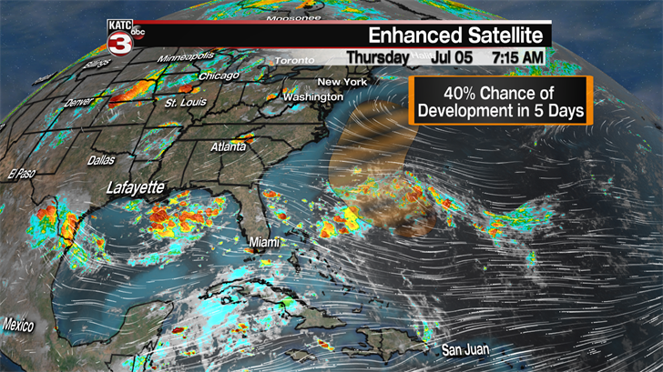
Right now the disturbance is not that organized and only has about a 40% chance of developing into a tropical system in the next 5 days.
The other disturbance is the one the hurricane center is watching closely as they have now given it a 70% chance of developing into a tropical system in the next 48 hours.
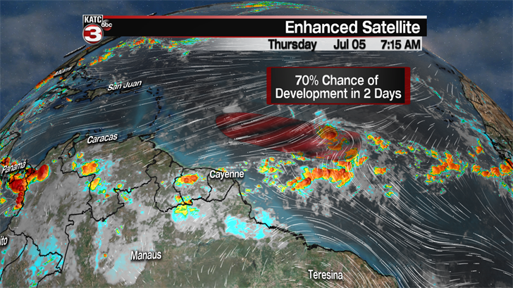
The showers and storms are already beginning to form a closed circulation.
If it would develop into a tropical system it would get the name Beryl.
The good news for us is the tropical wave is expected to run into a lot of shear as it gets closer to the Caribbean Islands which should tear apart the system well before it evens gets close to the Gulf of Mexico.
