Like Sunday we should have another dry but warm day in Acadiana for Memorial Day with a mix of sun and clouds and temperatures in the lower 90s.

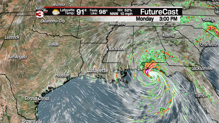
Now, we still might have a couple stray showers work there way into the region as Alberto makes landfall Monday afternoon along the Florida panhandle.
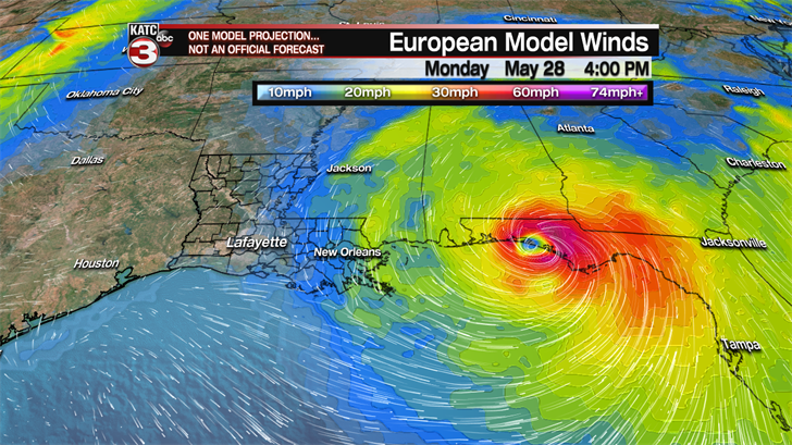
On Tuesday what’s left of Alberto will move into the Tennessee Valley taking most of the rain with it as an upper level high will begin to build over the Gulf Coast setting up a sunny and warm work week.
Highs Tuesday through Friday will be between 92-94 each afternoon with heat indices pushing the upper 90s.

As we move back into this summertime pattern one or two pop-up showers/storms can not be ruled out each afternoon but rain chances will only be around 10-20% all week.
Looking ahead to next weekend it is really going to feel like summer with highs rising into the mid to even upper 90s and heat indices climbing into the triple digits.
The extreme heat is forecasted to continue into the first half of the following week but we might get some relief as our next surface front could swing into the region producing a 30-40% chance for scattered showers Tuesday and Wednesday to help cool things off.
—————————————————————————————————————————————————
Here is the latest on Subtropical Storm Alberto as of 4PM Sunday
The storm is fighting some dry air being wrapped around the eastern side of the storm which is causing the maximum sustained winds to hold at 50 mph.

It is currently located about 120 miles south of Apalachicola, Florida and is now turning slightly to the NNW as it is moving in that direction at 12 mph.
The latest track from the National Hurricane Center has Alberto making landfall near Panama City Beach, Florida sometime Monday afternoon with tropical storm force winds of 50 mph.
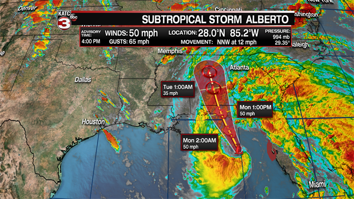
The good news with Alberto is that it is a very small storm mainly focused right near the center and slightly to the east of the storm so the worst impacts are going to be around where it makes landfall.
Minor storm surge of maybe 3-6 feet with be possible along the Florida panhandle from Destin to Apalachicola Florida.
The biggest concern with Alberto will still be the rain threat as areas along the Florida panhandle and up into Alabama could get 3-5 inches of rain with some isolated spots maybe picking up 5-8 inches, leading to widespread flash flooding.

The heavy rains from Alberto will then continue into Tennessee on Tuesday before pushing into the Ohio Valley on Wednesday,
