While Acadiana’s weather pattern will remain essentially unchanged over the next couple of days, odds are favoring development of a tropical system in the Gulf of Mexico over the next few days into the holiday weekend.
The National Hurricane Center (NHC) upped the odds of a tropical or sub-tropical depression developing associated with an area of low pressure that has been situated over the eastern Yucatan Peninsula over the last few days.
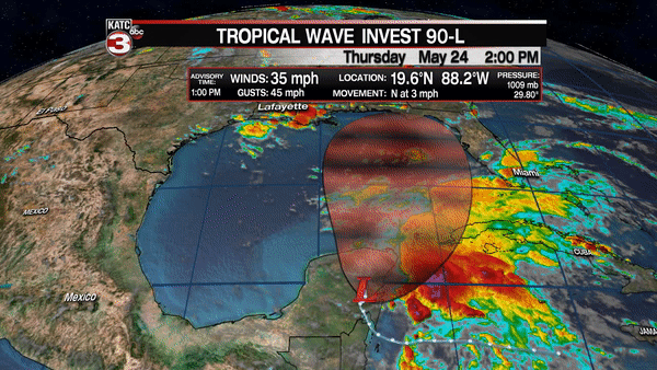
As of Thursday afternoon the chance of development had increased to an "almost done deal" of 90%.
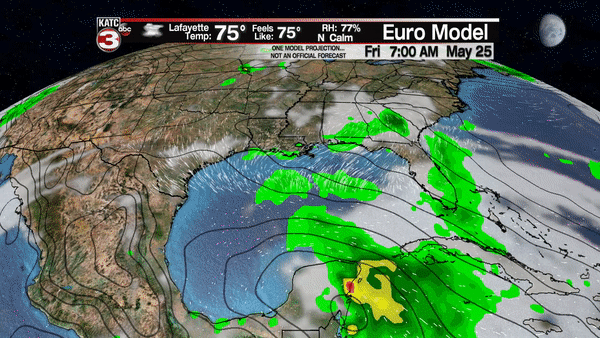
Tropical and global models along with NHC guidance has this system generally moving northward over the next few days, threatening the Northern Gulf Coast as a tropical storm, perhaps a strong one. While the risk of a hurricane is possible, its not zero, but is still low at this point.
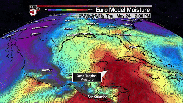
Any storm system that will be over the open Gulf waters for several days has potential for development, and it should be noted that the water temperatures in the Northern Gulf of Mexico are warmer than normal.
The current thinking is that the system will approach anywhere from extreme Southeastern Louisiana to the Mississippi, Alabama and/or Florida Panhandle late Sunday into Monday.
Obviously there will be changes, but the European and GFS models are fairly consistent in their forecasts at this time, but there remains some doubt as to whether the system will meander or drift once inland, or get picked up by a mid-latitude upper atmospheric trough and get pushed farther to the east.
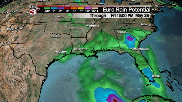
Heaviest rainfall, per the Weather Prediction Center, and in agreement with the latest European Model, yields the greatest risk of flooding rainfall east of Acadiana from extreme Eastern Louisiana, to most likely Mississippi, Alabama and portions of the Western Florida Panhandle where to to 10" of rain, or more in isolated spots will be possible.
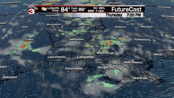
Meanwhile, locally in Acadiana, we’ll continue to plan for a good chance of typical, scattered afternoon thunderstorms through Saturday.
If the track of the tropical system stays east of the region per Thursday’s guidance, the risk of anything more than scattered afternoon storms will stay low for the area…in fact, we may very well be on the dry side of the system, where we may not see much, or any rain, especially if the system intensifies to tropical storm status or stronger and concentrates it’s weather near the core and to its east.
So far now, while Acadiana is not out of the woods yet, the system will require monitoring this system into this weekend for any changes…small changes could result in drastic changes to the local forecast, which is now much more optimistic as compared with just a few days ago.
Meanwhile, offshore and marine interests should be preparing for the possibility of tropical storm winds beginning as early as late Sunday, but more likely Monday, especially across the Southeastern Louisiana offshore blocks on eastward.
Farther west and south of Acadiana in the Gulf, fresh northerly winds and lower than normal tides may develop by Memorial Day.
Stay with KATC, katc.com and social media for the latest on this potential early season tropical system.
