A few clouds will be moving in as we roll through our midweek. A cold front will advance through the area this evening and push offshore overnight. Ahead of the front temperatures will be rather warm, with highs in the lower 80s. Humidity levels will be increasing, so the comfort levels will drop somewhat, but it won’t be enough moisture to bring any significant precipitation.
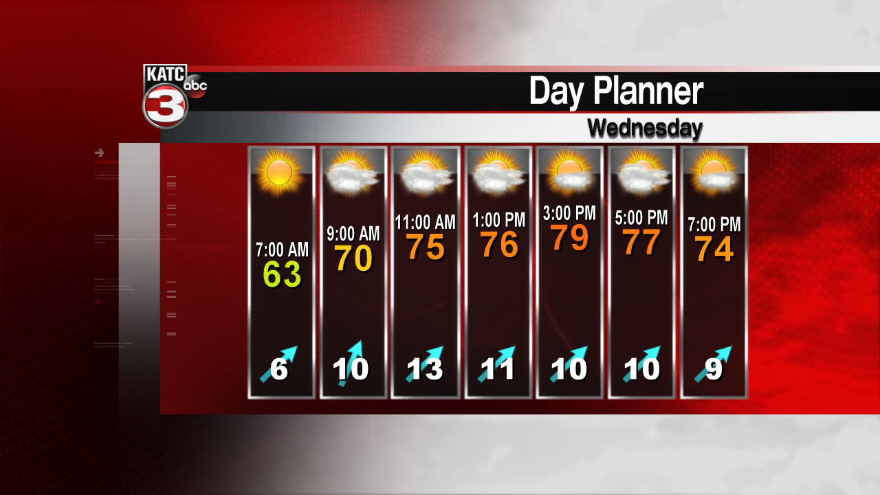

Expect sunny skies for the early part of the day, with clouds moving in by this afternoon. Winds will be out of the south and southwest near 10 mph. Afternoon high temperatures will be slightly above normal for this time of year. The front will pass through with a few widely scattered showers this evening. Most areas will remain dry, heaviest rain totals should be less than 1/10 of an inch. After the front passes through, northerly breezes and dry air will clear any cloudiness. Overnight temperatures should drop to near 60 degrees.
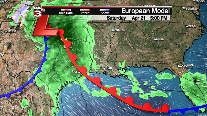

Pleasant days are expected for Thursday and Friday, even Saturday looks decent. Cooler temperatures with highs in the lower 70s are expected for the end of the week. Friday and Saturday mornings will be quite cool with lows in the upper 40s and lower 50s. Clouds will return for Saturday as another system approaches the area. Temperatures will rise to near 80 degrees Saturday afternoon. It looks like rains will hold off until overnight Saturday night into Sunday. Showers and thunderstorms will be likely, with a marginal chance for severe weather. Any strong storms will be isolated, and not as widespread as last weekend’s severe weather event. Rainfall totals will probably stay below one inch.

Next week looks pleasant with clouds leaving the area late Monday. Great weather is expected for the opening of Festival International!
