A strong cold front will swing through Acadiana late tonight into Sunday morning producing a line of scattered showers and thunderstorms.
Some showers could begin as early as midnight for portions of western Acadiana but the main line of storms will move through Acadiana between 5am and 11am.

The good news is the better dynamics for the storms look to stay to our northwest towards the Ark-La-Tex where the main area of low pressure will be centered causing them to be under a marginal risk(5%) for severe weather.
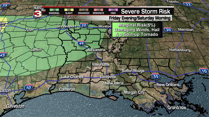
Although Acadiana is no longer hatched in a marginal risk by the Storm Prediction Center we will still need to watch this line of showers and storms closely as one of two could be on the strong to severe side with damaging wind gusts up to 60 mph as the main threat but a spin up tornado can not be ruled out as well.
As for rainfall this system looks to be a narrow line of showers and storms so most of the region will only pick up about a quarter to a half inch.

Behind this front skies will clear leading to times of sunshine Sunday afternoon warming temperatures into the mid 70s.
It will also get a little breezy Sunday afternoon with winds out of the WNW at 10-20 mph.

The work week looks really nice with pleasant, spring temperatures as highs will be in the mid to upper 70s and lows in the mid 50s.
Late Wednesday into Thursday morning a weak cool front could slide down through Acadiana producing a few stray showers but most of us will stay dry.
Another weak cool front could push through the region late Friday night/early Saturday morning creating a slight chance for a couple isolated showers.
The good news is this front should clear things out for the weekend setting up a fantastic forecast for Festival International as we should have a mix of sun and clouds both days with highs in the upper 70s.
