After a chilly start, Acadiana will get to enjoy lots of sunshine Wednesday with temperatures warming into the mid-upper 70s for the afternoon.
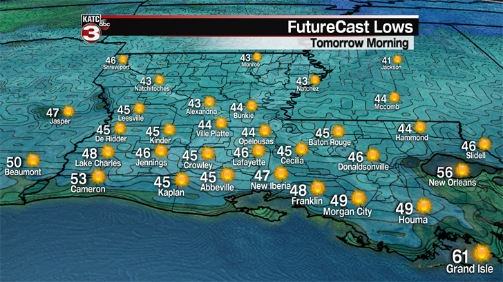
Wednesday morning readings will be in the low-mid 40s across the area, but afternoon readings should be a few degrees warmer than Tuesday, rising into the mid-upper 70s.

More sunshine is in the mix Thursday with temperatures nearing 80 for the afternoon.
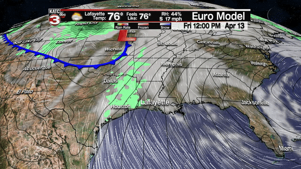
Changes will begin Friday as strong southerly winds kick in ahead of a storm system that will sweep through the nation’s mid-section (and yes with snow on the northern side of the storm) into this weekend.
Gusty southerly winds, up to 30-35 mph, with a few afternoon storms, will be possible Friday. If storms erupt Friday, there could be the marginal risk of a few severe storms…but the big action though, will arrive Saturday.
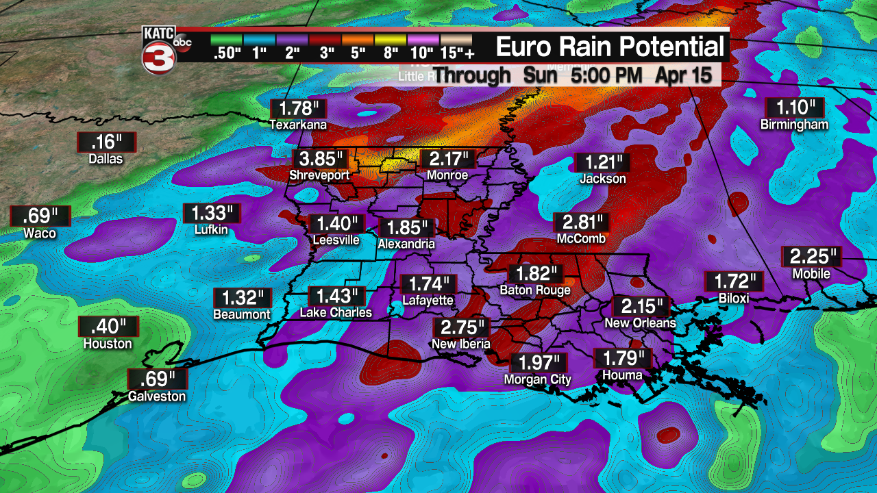
Rain chances Friday afternoon should be in the 30-40% range.
Another strong cold front will arrive in Louisiana beginning very late Friday night, with a line of showers and storms likely beginning to edge into portions of Acadiana during the early morning hours Saturday.
Showers and storms will remain likely (90%) through midday Saturday, with activity slow to taper in the afternoon.
While still early in the game, there could be a "marginal" to "slight" severe storm threat Saturday depending on how the dynamics evolve, and the time of the day the storms arrive…stay tuned.
In addition, there will be a good chance of at least a couple of inches of rain, although a flood event is not anticipated at this time.
And once again, behind the front, it will turn sharply cooler with a morning start Sunday in the low-mid 40s and an afternoon high only in the mid-60s in spite of full sunshine anticipated.
The weather pattern into next week tentatively appears nice and quiet.
