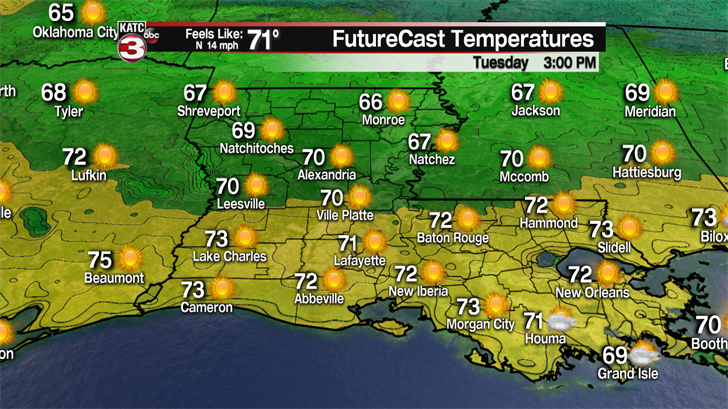
Monday night into Tuesday morning a cool front will slide through Acadiana, maybe producing a few sprinkles, but more importantly it will clearing out the clouds allowing for sunshine to return Tuesday afternoon.
Even with lots of sunshine Tuesday temperatures will still be a little cool for early April as highs will only get into the lower 70s but with a steady breeze out of the north at 10-18 mph it will feel more like the mid 60s.

Under clear skies Tuesday night lows will get quite chilly again dropping into the mid 40s by Wednesday morning.

With abundant sunshine Wednesday afternoon temperatures will climb into the mid 70s.
Thursday a southerly flow will return warming highs into the upper 70s under mostly sunny skies.
Clouds start to move back over the region Friday in advance of our next cold front which will bring widespread showers and thunderstorms.
This front also has the possibility to produce a few strong to severe thunderstorms.

Even 5 days out the Storm Prediction Center already has an area just to our northwest under a slight risk(15%) for the possibility of severe weather.
However, there is still some uncertainty of when this front will arrive.
Right now, the GFS model has the front swinging through Acadiana Friday night around midnight.
While the European model is several hours slower with the front pushing through Acadiana about 9-10 in the morning on Saturday.
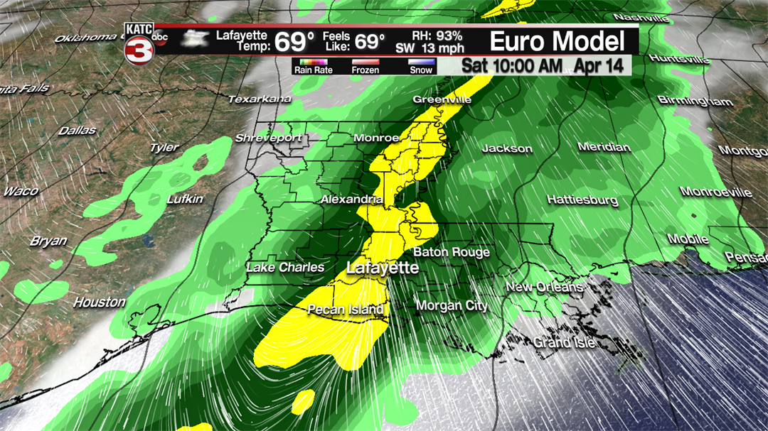
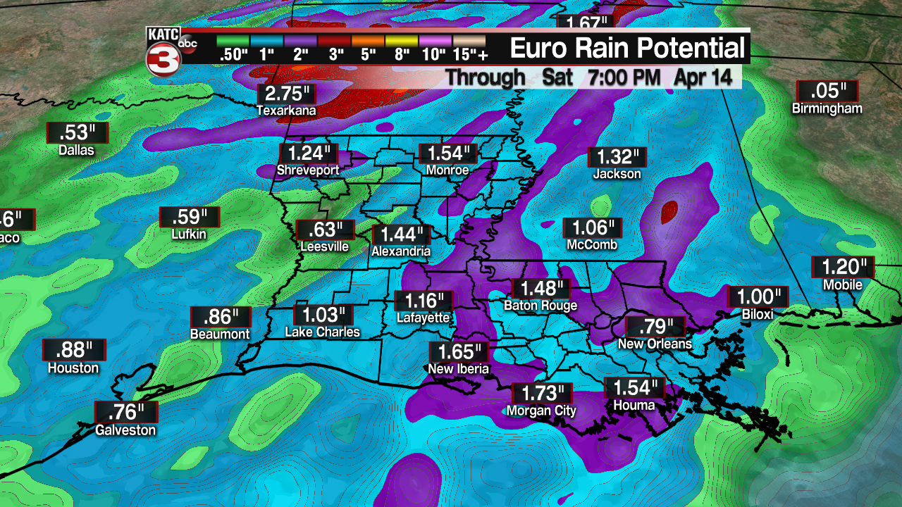
Just like the past couple storm systems this one should move through fairly quickly so flooding should not be an issue but most areas could pick up an inch of rain.
Then behind this front we will get another round of cool temperatures as lows Sunday morning will fall into the mid 40s and afternoon highs will struggle to reach the mid 60s.
Also, it will be quite windy Sunday afternoon out of the NNW at 15-25 mph with gusts up to 35 mph making it feel pretty chilly to be outside.
Monday morning will be the coldest night as lows fall into the lower 40s with the possibility for our northern communities to drop into the upper 30s.
The good news is with sunny skies Monday through Wednesday temperatures will quickly warm back up through the week.
