Monday we should finally see some sunshine again helping to push highs back into the lower 70s.

Monday evening into Tuesday morning a cool front will swing down through Acadiana maybe squeezing out a couple light showers but for the most part this will be a dry front.
Behind this front high pressure will move down over the southeast leading to plenty of sunshine Tuesday afternoon and comfortable temperatures in the mid 70s.
Wednesday morning will be another chill one as lows drop down into the mid 40s under clear skies but with lots of sunshine temperatures will warm into the mid 70s for beautiful day.
Thursday high pressure starts to slide off to the east flipping winds back off the Gulf warming highs into the upper 70s under mostly sunny skies.
The southerly flow will pick up Friday pushing more humid air back over Acadiana causing clouds to build throughout the region and a few isolated showers.

Late Friday into Saturday morning a cold front will push through Louisiana producing a line of showers and thunderstorms.
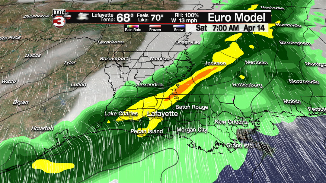
We will have to watch this front as it could have a marginal to slight risk for a few thunderstorms to become severe as the Storm Prediction Center has a slight risk area for Day 6 just outside Acadiana.
The good news is it should clear out behind this front leading to tons of sunshine for the weekend but it will get a little cool again as temperatures will drop into the upper 60s for highs and lows in the mid 40s for Saturday and Sunday.
The pleasant weather looks to continue for the first half of the following week with more sunshine and temperatures warming into the mid to upper 70s.
