This afternoon’s scattered showers/storms will fall a part once the sun goes down and all the rain should be done by 9-10pm.
Thanks to a southerly flow temperatures will remain mild tonight as lows will only drop into the upper 50s to lower 60s, 10-15° warming than we were Thursday morning.
Friday is shaping up to be a warm, humid and breezy day with highs in the upper 70s and winds out of the south at 10-20 mph.

Due to the extra moisture in the air we will have a 40-50% chance for hit or miss showers/storms to fire up during the afternoon with the daytime heating.
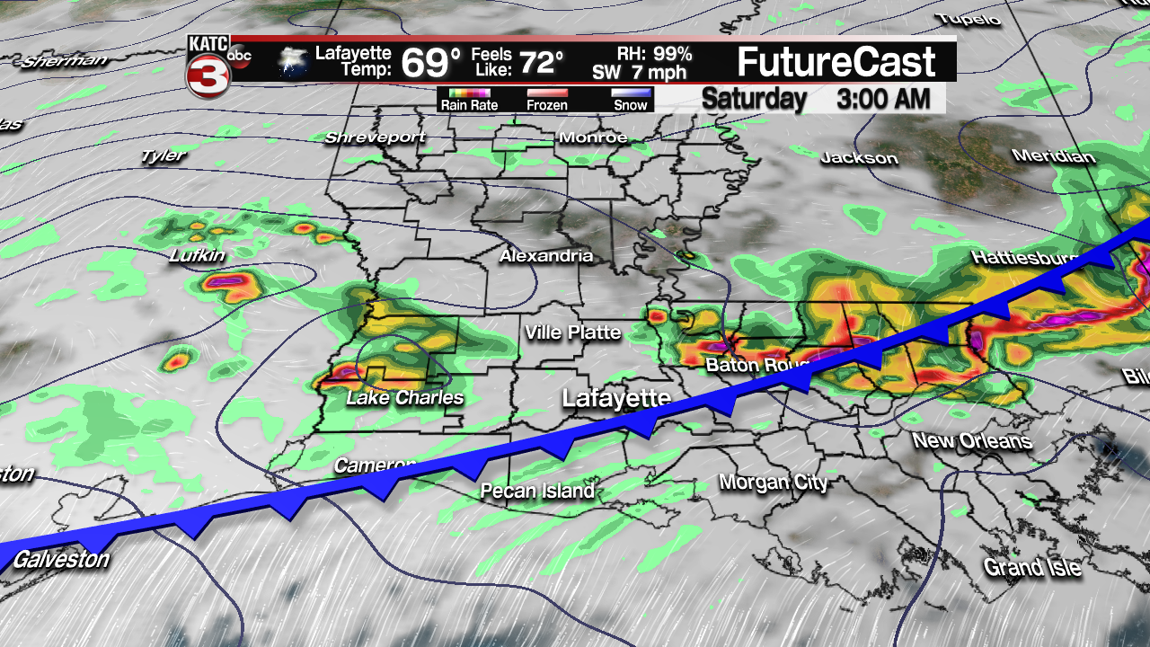
Friday night into Saturday morning is still the best chance for everyone to see widespread rain as a strong cold front dives south into Acadiana.
This front has the possibility to produce a line of strong to severe storms similar to what we saw Tuesday night.
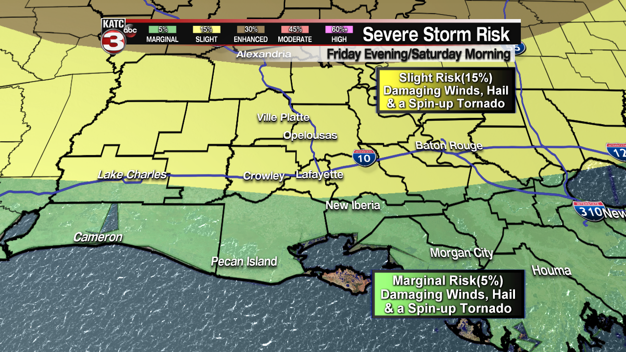
The Storm Prediction Center has the northern half of the state under an enhanced risk(30%) to experience severe storms with damaging wind gusts up to 60 mph, large hail and even a few tornadoes.

As for Acadiana, areas north of the interstate are in a slight risk(15%) while communities closer to the coast are under a marginal risk(5%) for the line of storms to produce damaging wind gusts up to 60 mph, large hail and maybe even a quick spin up tornado.
This line of storms should push through Acadiana between midnight and 8am Saturday morning.
The good news is this system should be a relatively thin line of showers and storms so flooding will not be a concern as most of Acadiana will get about a half to an inch of rain.

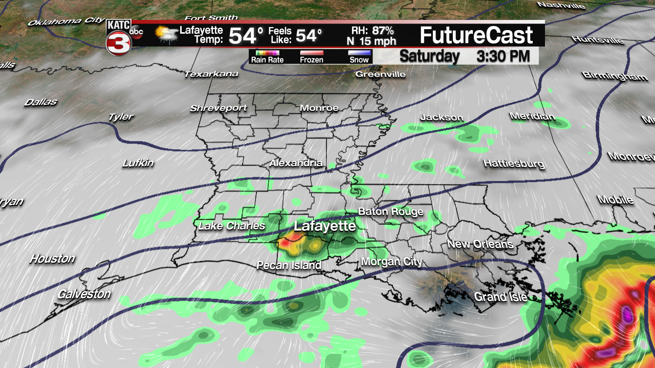
Behind this front temperatures are going to drop throughout the day on Saturday falling into the mid 50s during the afternoon.

It is also going to get breezy out of the NNE at 10-20 mph making it feel rather cool to be outside at the Po-Boy or Boudin festivals.
Also, even once the main line of storms moves through we could still have the chance for overrunning showers Saturday afternoon.
Sunday should be a slightly better day but it will be a cool start with lows in the mid 40s before some peeks of sunshine warm temperatures into the upper 60s.
Monday another cold front will sweep through Acadiana creating another wave of scattered showers.

We finally clear out Tuesday with comfortable temperatures in the mid 70s.
