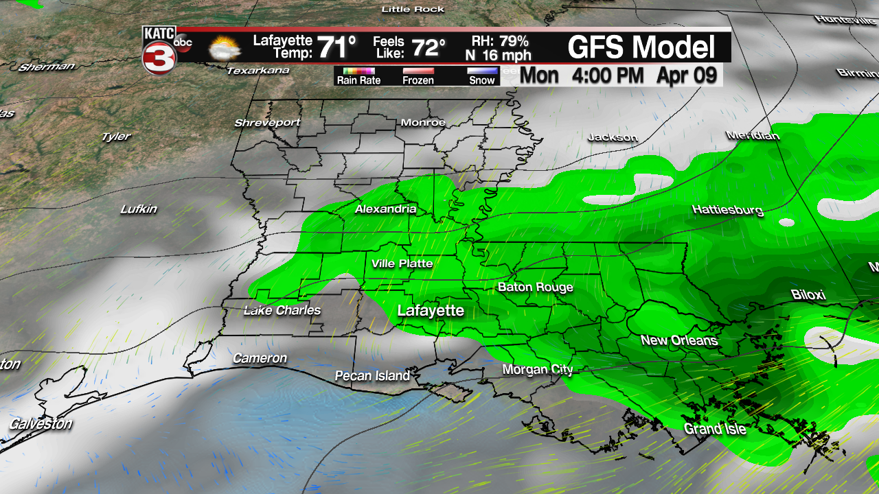
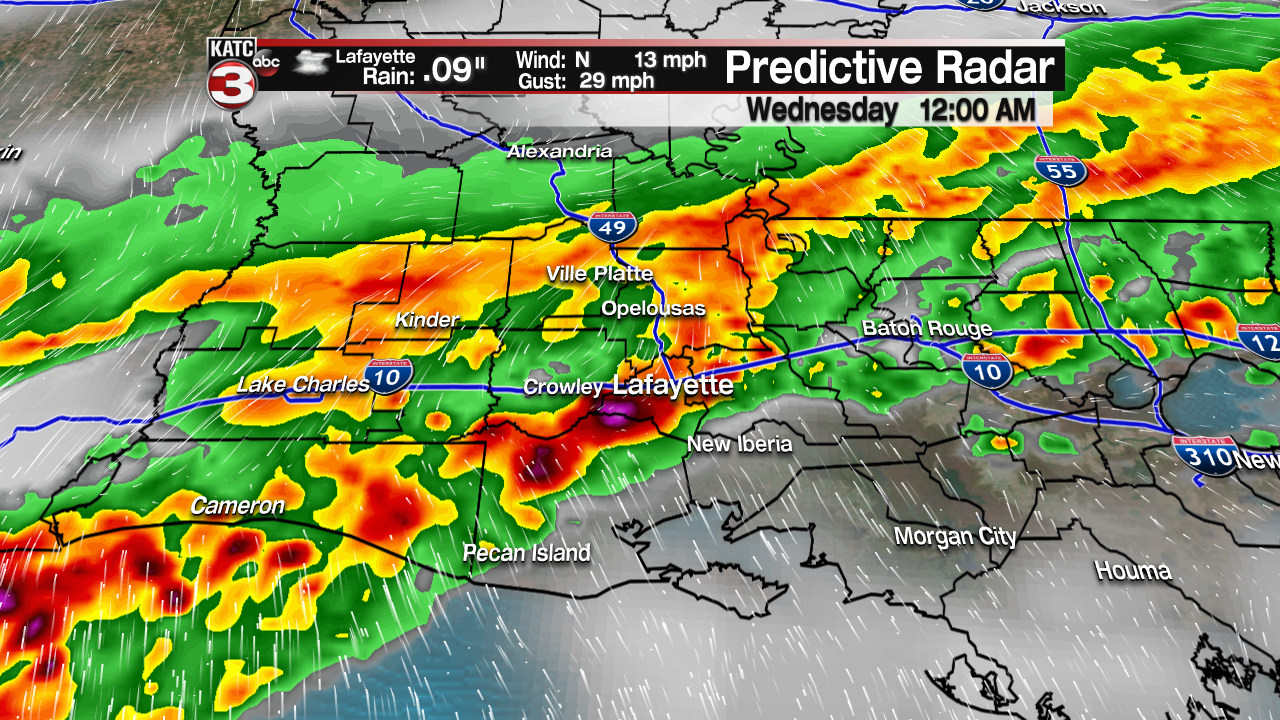
This evening between 8PM and 5AM a line of strong to severe thunderstorms will sweep across Acadiana producing rounds of heavy downpours and lots of thunder and lightning.
This line of storms also has a good chance to produce some damaging wind gusts up to 60-70 mph causing the Storm Prediction Center to place all of south Louisiana under a slight risk(15%) for these storms to reach severe levels.
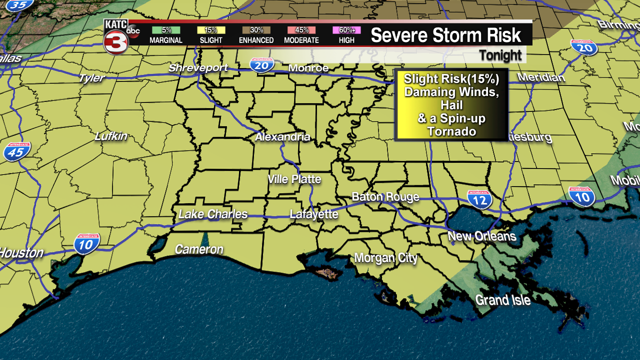
Finally, there is a much lower chance for a couple storms, especially to the west towards Lake Charles, to potentially drop some large hail and maybe even a quick spin-up tornado.

These storms will provide a good soaking for much of Acadiana as we will pick up about an inch of rain with a few isolated spots maybe getting up to 2 inches but I am not expecting any flooding concerns as the area is still relatively dry as of late but there could be some brief ponding of water on roads as the heavy rains are falling but that should quickly drain once the rain stops.

Wednesday as the cold front push out into the Gulf a wave of cooler air will dive down into Acadiana as highs will only top out in the mid to upper 60s.

Besides the cooler temperatures it will also be rather breezy Wednesday afternoon out of the north at 15-25 mph with some gusts up to 30 mph making it feel even cooler for much of the day.

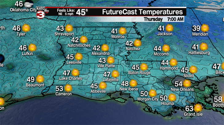
The coldest temperatures will be Thursday morning as lows will bottom out in the low to mid 40s so you might need to dig out the heavier jacket one more time.
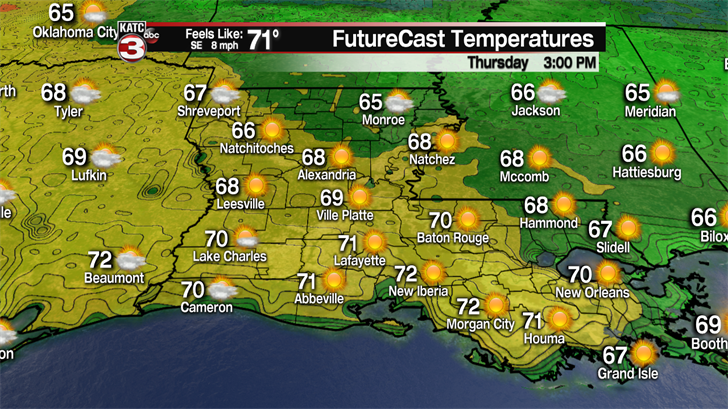
The good news is temperatures will quickly warm up Thursday afternoon as winds start to turn back out of the south pushing highs into the low to mid 70s.
Friday clouds will build back over the region out of head of a few scattered showers and thunderstorms during the afternoon and evening.
Widespread showers and storms are likely Saturday as our next cold front slides down into Acadiana.

Right now this front does not look to be as strong as the front moving through tonight but it could still produce a couple strong to possibility severe storms.
Sunday clouds will linger with maybe a stray shower as temperatures hold in the low 70s.
Then we could get a few more scattered showers and thunderstorms Monday afternoon/evening as a third front works across the region.