


Winter forecasting in Louisiana is incredibly frustrating, and as we seem to get once a winter or so a very complicated forecast is shaping up for the end of the week.
South Louisiana will sit in the boundary between rain, ice, sleet and all will be possible based off what our exact temperatures, not just at the surface but through the atmosphere, will be at any particular point in time.
All of the winter weather will be the result of a front that will be moving across Acadiana late Wednesday night into early Thursday morning.
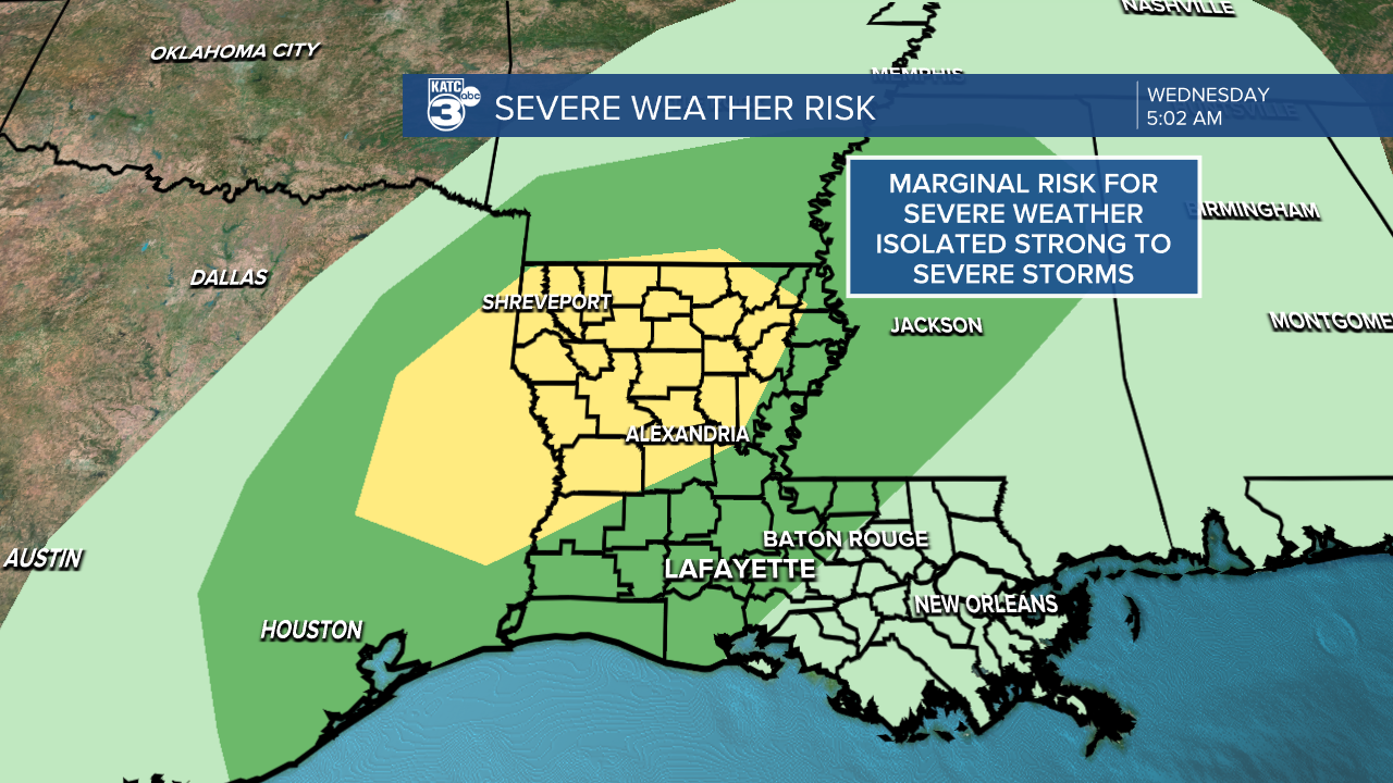
As the front moves through, we do need to be on the look out for a couple of strong storms with an isolated chance for a severe thunderstorm or two (although chances to our northwest will be slightly higher).
These storms likely don't arrive until the early morning hours of Thursday and will come to an end by the time folks start heading to work Thursday morning, which is when the winter weather will start to arrive.
Thursday is shaping up to be a bitterly cold day, with temperatures in the low to mid 40s in the morning and steadily dropping through the rest of the day.

As is typically the cast winds will really pick up coming out of the north around 20-25 mph and gusts that will be much higher, driving the wind chill into the 30s through most of the day.
Once we get into the evening temperatures will start to approach freezing, not quite freezing but close enough to start to cause some issues as it lines up with the arrival of another round of precipitation.
The front is going to stall just to our south, which will open the door for showers moving along the frontal boundary to interact with our cold temperatures late Thursday night into Friday morning.
Accumulating ice will be possible with the GRAF Model hinting at around a tenth of an inch by Friday morning, although the GFS and the EURO doesn't have any accumulating ice at all. (Quick side note the GFS up until early Wednesday morning was picking up on minimal accumulation but has since backed off entirely.)

And that's where this forecast gets incredibly tricky, absolutely no model agrees on what the eventual weather will do and that's because each model approaches the storm with small differences in temperatures and placement of the front.
If you change either of those things even slightly the forecast changes entirely because winter precipitation is so reliant on exact temperatures, and the precipitation will be reliant on the exact placement of the front.
In the event we see impactful weather that could cause interruptions to your normal routine it would likely play out the way the GRAF model is indicating with up to a tenth of an inch of ice as a result of freezing rain starting Thursday evening and lasting on and off into Friday morning.

The bottom line is that we should be prepared for slick roads on Friday morning, especially along bridges and overpasses, even if we never see the rain turn over into winter precipitation.
The least impactful scenario is the one that the GFS and EURO is presenting and that's the one we can hope to see, however, the scenario played out by the GRAF is just as likely and that should be the one we anticipate the most.
As it fairly obvious at this point, this forecast is changing rapidly and will constantly evolve through the next few days (even while writing this some sentences were amended as new data came in) so don't get hung up on one particular forecast.
------------------------------------------------------------
Stay in touch with us anytime, anywhere.
To reach the newsroom or report a typo/correction, click HERE.
Sign up for newsletters emailed to your inbox. Select from these options: Breaking News, Evening News Headlines, Latest COVID-19 Headlines, Morning News Headlines, Special Offers
