


The long talked about round of winter weather has arrived in Acadiana with snow, sleet, and freezing rain all coming down in various parts of Acadiana.
Wintry precipitation started Sunday night, and active precipitation will continue through the mid-morning before finally moving out of the region by the afternoon.

While it may not be actively coming down this afternoon the damage will already be done, with the ice accumulated on the roads already making travel dangerous for the next couple of days.
Acadiana may be on the hook for a quarter to a half inch of ice accumulation through the morning which is a pretty substantial amount of ice and could start to stress out our infrastructure.
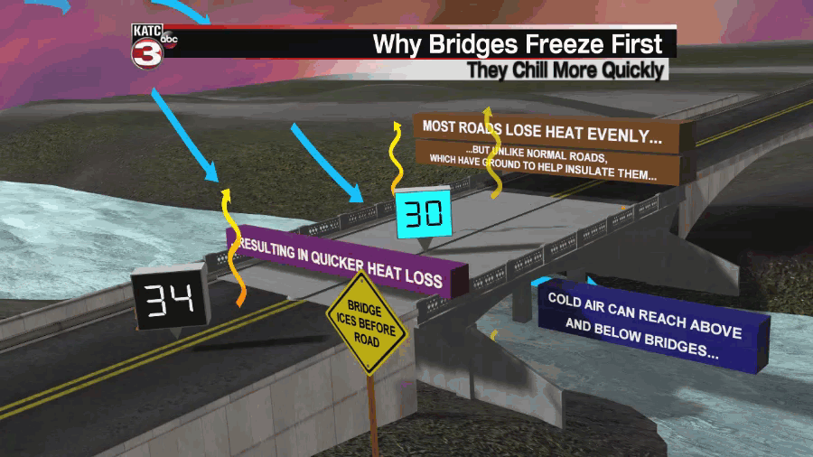
The roads will be the first things to go making travel dangerous, this is especially true on the overpasses and bridges which always ice over before the other roads as they don't have anything insulating them underneath.
The warm layer of air in the upper atmosphere, which would melt the snow into freezing rain, has been fairly shallow which has lead to a little more snow/sleet opposed to freezing rain.
This doesn't mean we won't get any accumulation of ice, there's still likely going to be about a quarter inch, but it could mean we don't see the more extreme end of the possible range we had been looking at this weekend.
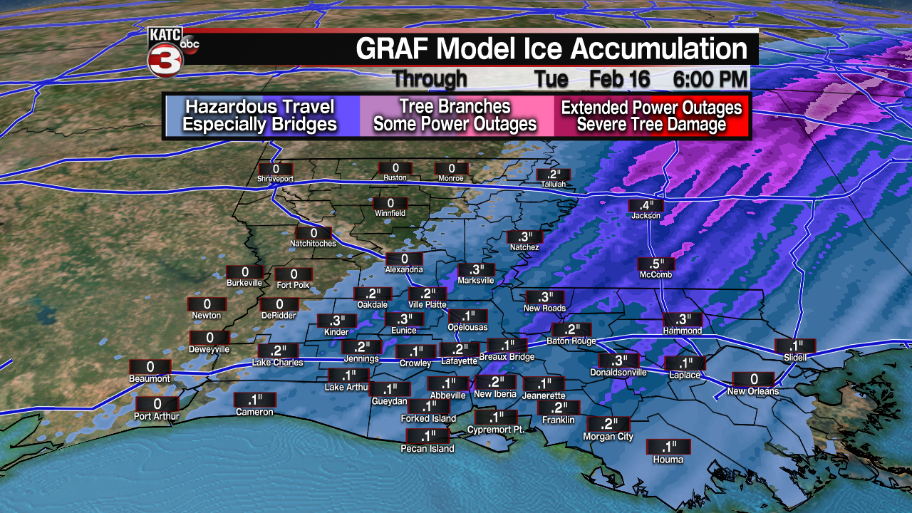
While the ice accumulation totals are going down the snow accumulation looks like it's trending up, which means models seem to be picking up on that colder air, and again the more snow means less ice.

Once the precipitation ends Monday morning the focus will then shift to dangerously cold temperatures for Monday night and Tuesday morning with lows down in the mid teen and wind chill values close to zero.
Since the temperatures aren't expected to get warmer than freezing the ice that builds is going to remain on the roads with out any kind of thawing expected, in fact it could make for more treacherous travel Tuesday morning.
All the moisture on the roads will freeze over into one solid chunk of ice by Tuesday morning which means roads will be dangerous likely through mid day on Wednesday.
------------------------------------------------------------
Stay in touch with us anytime, anywhere.
To reach the newsroom or report a typo/correction, click HERE.
Sign up for newsletters emailed to your inbox. Select from these options: Breaking News, Evening News Headlines, Latest COVID-19 Headlines, Morning News Headlines, Special Offers
