

This week has been a crash course for many in the delicate nature of producing a forecast, watching models swing from one direction to another and doing our best to peak through the tea leaves and figure out what kind of winter weather we're facing.
As promised though the closer the event has gotten the more confidence has been building in the forecast, and there's now a few things that I feel much more comfortable saying out loud.
That being said there's still some details that we don't know yet, although some of the finer details will start to emerge over the weekend.
So I'll outline what we know so far and what we're still working to figure out so we can wrap up the week with as much information as possible.

It continues to look likely that we will have a chance for winter precipitation on Monday with both major models continuing to signal for something other than rain as the front moves through Acadiana.
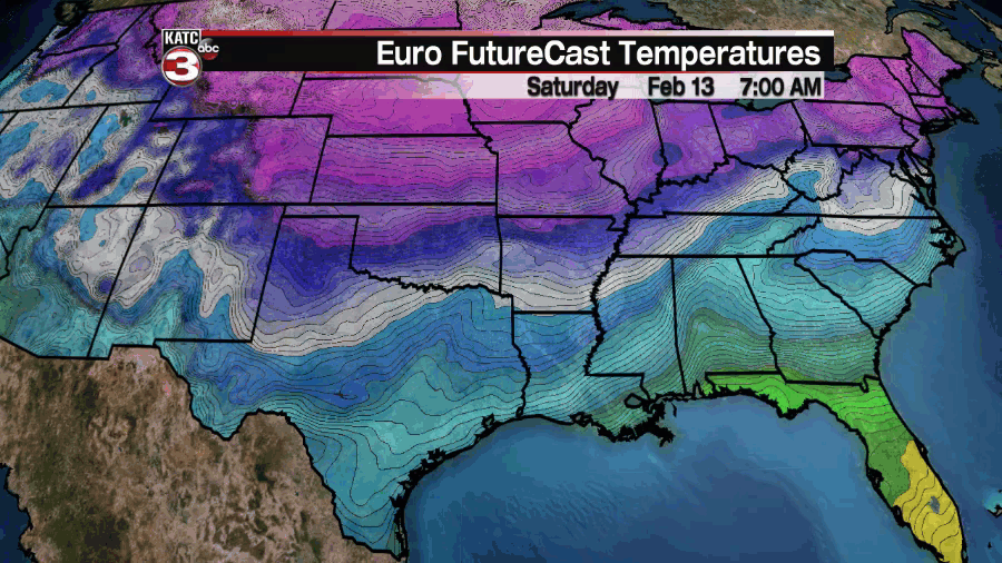
There's still a range in outcomes regarding the coverage, intensity, and type of winter precipitation, the EURO model has the faster moving and less intense round of freezing rain and gradually turns it into a light snow.
On the other hand the GFS is predicting a much more disruptive event that remains predominantly frozen rain, with no change over to snow, at a length that could lead to some serious ice accumulation.


There's still some significant discrepancies between the two major models, and those differences mean major implications for overall impacts, but it is note worthy that they still are hinting at frozen precipitation and both agree it will play out mostly on Monday.
The trend to watch the next couple of days is which way these models trend in regards to duration and arrival of the freezing rain, and timing of the event is going to start to become more clear over the weekend.
Confidence is also growing in an outbreak of extreme cold across Acadiana, although similar to the precipitation, the duration and the intensity of the cold remain a question mark even though we have narrowed the range a little.

The GFS remains significantly colder than the EURO and while it keeps the cold air longer it's notable that it isn't keeping it as long as some previous runs but instead "warms" us up by Thursday.
It looks like the range in temperatures for Tuesday morning is between the mid 20s and the teens, with the EURO projecting the higher end of that range and the GFS projecting the lower end.
Over the next couple of days look to see which model is moving more which will tell you which end of the range is more likely either the EURO will cool or the GFS will heat up, that'll be the temperature trend to monitor.
Regardless of the exact temperature the wind chill Tuesday morning will be flat out dangerous, ranging between the low teens to possible sub-zero, again this is the range hinted at by both the GFS and EURO.
There's still some finer details left to emerge regarding accumulation potential which will become more apparent as we get a better handle on timing and intensity, so while we've come along way in the process we still have a few questions we need to answer.
------------------------------------------------------------
Stay in touch with us anytime, anywhere.
To reach the newsroom or report a typo/correction, click HERE.
Sign up for newsletters emailed to your inbox. Select from these options: Breaking News, Evening News Headlines, Latest COVID-19 Headlines, Morning News Headlines, Special Offers
