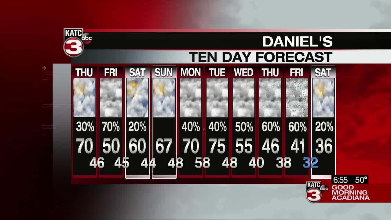


It's been hard to find any complaints with the forecast so far this week, it's been a little chilly, but ultimately it's been some really nice weather.
That all changes on Thursday.
Strong winds out of the south will start up by mid-morning which is going to drive in some warm, muggy air ahead of a cold front which will drop down overnight.
The temperatures will be the warmest of the week with highs in the low 70s despite progressively less sunshine through the afternoon.
A front is going to be moving through late Thursday night which will bring around the first round of rain, this front will then stall just offshore which sets the stage for a wet Friday.
Since the front will stall just to our south it means the cold air will be able to filter in to the area which is going to make for a very chilly Friday as temperatures will struggle to get to 50 degrees.
These clouds are going to have a hard time clearing on Saturday so while some patchy sunshine will be possible it looks like it'll be mostly cloudy skies that linger through the weekend.
The door for showers stays open through most of this week although confidence in next weeks forecast is low as it deals with a notoriously fickle stalled front.
------------------------------------------------------------
Stay in touch with us anytime, anywhere.
To reach the newsroom or report a typo/correction, click HERE.
Sign up for newsletters emailed to your inbox. Select from these options: Breaking News, Evening News Headlines, Latest COVID-19 Headlines, Morning News Headlines, Special Offers
