Here's the set-up and a little breakdown of the pattern we're looking at for the week ahead.
Lows tonight: upper 70s
Highs Monday: lower-middle 90s
DISCUSSION:
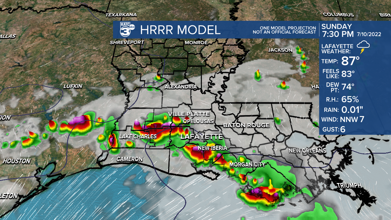
In the short-term (thru this evening): an impulse of energy will likely help generate a round of storms late this afternoon and evening.
Models are in fairly decent agreement of that occurring.


Some of the storms may contain gusty winds, lightning and heavy rainfall.
Thereafter (rest of week): A leftover frontal boundary will linger across the Gulf coast for several days.

As that interacts with deep tropical moisture, it'll lead to a healthy scattering of showers and storms from Louisiana over to Florida.
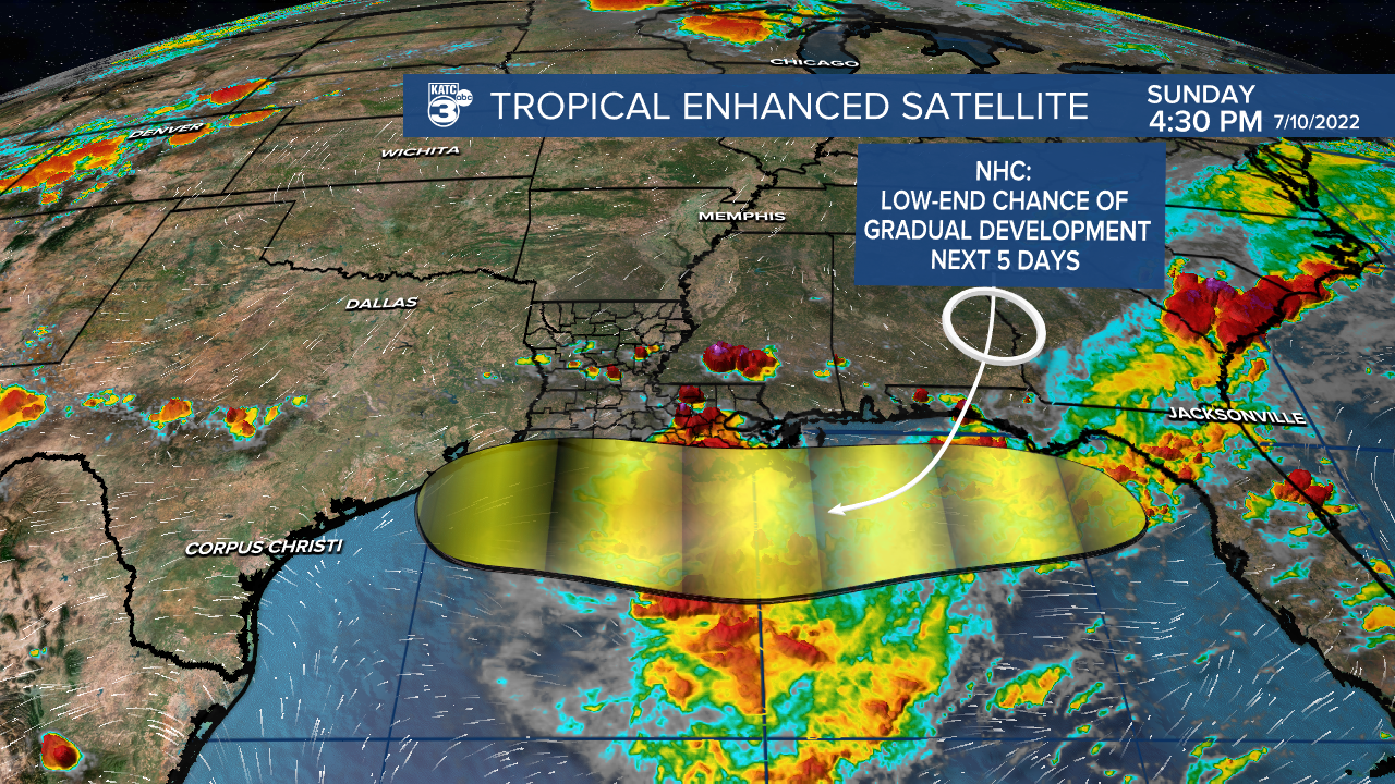
As we talked about yesterday, we always have to keep an eye on old frontal boundaries sneaking into the Gulf this time of year as a weak surface low could always try to quickly spin up.

Possible? Of course, and that's why the hurricane center is highlighting the northern Gulf for potential slow development (20%).
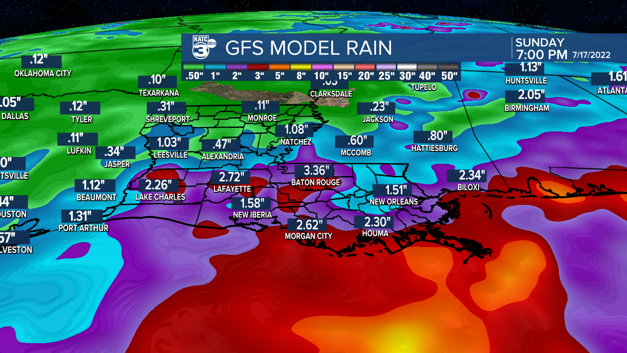
Regardless of any development, heavy rainfall is going to be the main concern from this feature.


Who sees the most is still up in the air at this point with the Euro continuing to show concerning amounts for areas off to our east.
Bottom line: The forecast remains quite complex as it continues to evolve. Stay with KATC for the very latest.
Have a great week!
TROPICS
Gulf disturbance was discussed above...
Rest of tropics quiet at this time.
------------------------------------------------------------
Stay in touch with us anytime, anywhere.
To reach the newsroom or report a typo/correction, click HERE.
Sign up for newsletters emailed to your inbox. Select from these options: Breaking News, Evening News Headlines, Latest COVID-19 Headlines, Morning News Headlines, Special Offers


