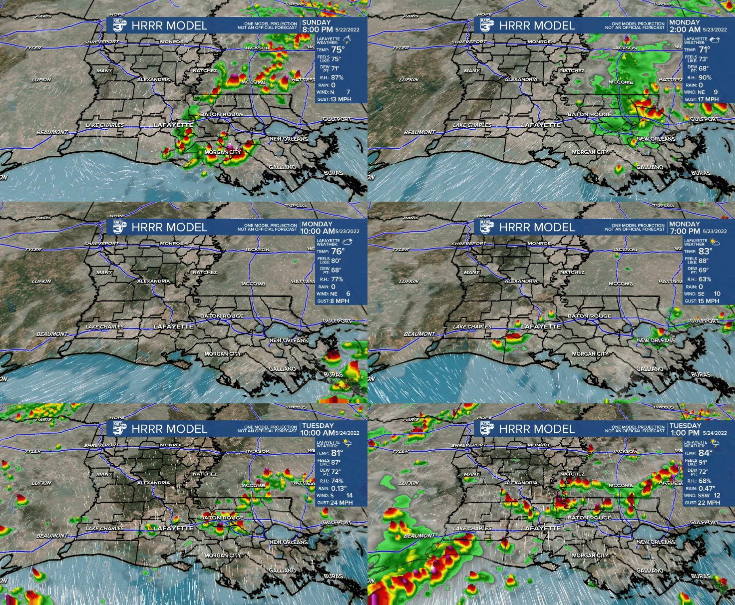
The threat of an early evening shower or storm sits at 20-30%.
Otherwise, it'll be a mild night ahead as lows drop into the upper 60s to lower 70s.
A little more in the way of drier air will move into the area Monday.
That, coupled with our first plume of Saharan dust, will help lower rain chances.
Partly to mostly cloudy skies expected as highs push the upper 80s.

An isolated late afternoon/evening storm can not be ruled out.
However, scattered showers and storms will be back Tuesday and Wednesday as impulses of upper-level energy combine with the moist Gulf atmosphere we'll have in place.
Locally heavy rains could be possible at times.
Activity will start to come to end Thursday morning with sunny skies returning by the afternoon.
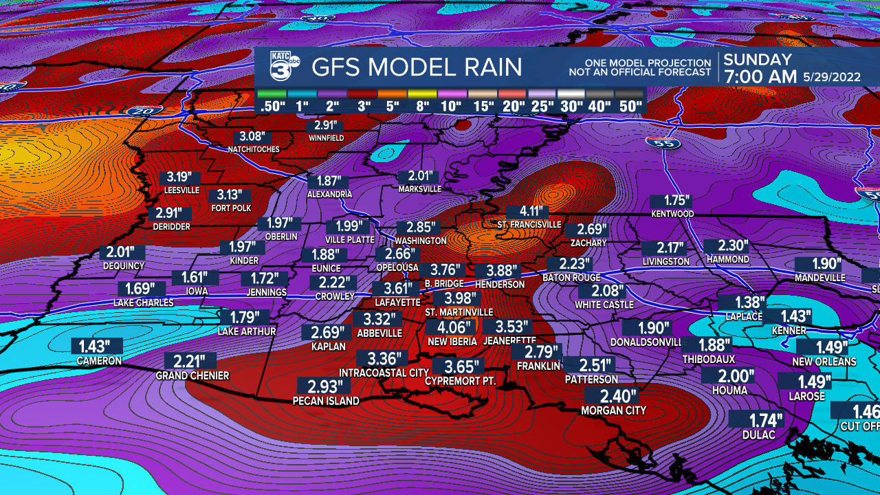
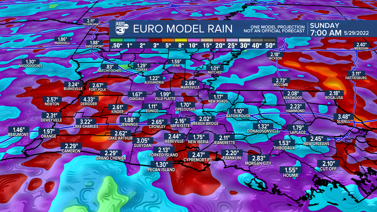
2-4" of rainfall possible through this time period.


Noticeably cooler Thursday night/Friday morning as lows drop into the lower 60s.
Plenty of sunshine and more comfortable humidity on Friday.
The Memorial Day weekend looks good with mostly sunny to partly cloudy skies.
Highs will push the upper 80s to lower 90s.
Have a great week!
In the Tropics:
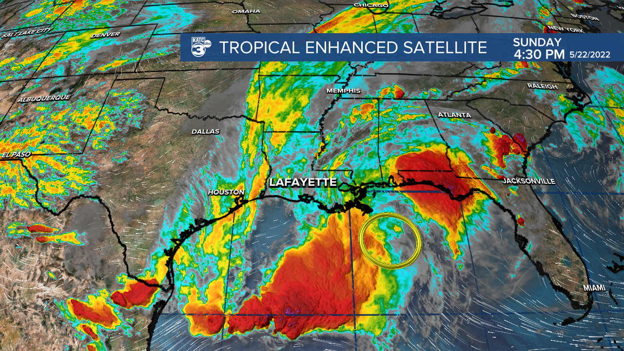
The NHC is monitoring one small area of disturbed weather in the northern Gulf.

Development is not likely, but it will bring tropical squalls to the southeast in the coming days.
Rest of the Atlantic is quiet at this time.
------------------------------------------------------------
Stay in touch with us anytime, anywhere.
To reach the newsroom or report a typo/correction, click HERE.
Sign up for newsletters emailed to your inbox. Select from these options: Breaking News, Evening News Headlines, Latest COVID-19 Headlines, Morning News Headlines, Special Offers


